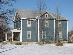
| [3] |
Name on the Register[4] |
Image |
Date listed[5] |
Location |
City or town |
Description |
|---|
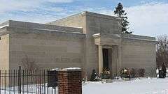
| 1 |
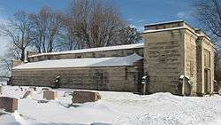
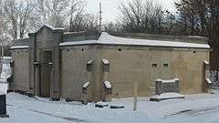
Auburn Community Mausoleum |
|
000000002014-03-24-0000March 24, 2014
(#14000069) |
1431 Center St.
41°21′24″N 85°02′58″W / 41.356528°N 85.049306°W / 41.356528; -85.049306 (Auburn Community Mausoleum) |
Auburn |
|
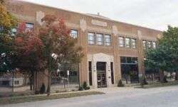
| 2 |
Auburn Cord Duesenberg Automobile Facility |
|
000000001978-09-21-0000September 21, 1978
(#78000029) |
1600 S. Wayne St.
41°21′21″N 85°03′26″W / 41.355833°N 85.057222°W / 41.355833; -85.057222 (Auburn Cord Duesenberg Automobile Facility) |
Auburn |
|
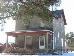
| 3 |
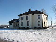
Samuel Bevier House |
|
000000001983-05-06-0000May 6, 1983
(#83000014) |
County Roads 11 and 52, south of Garrett
41°20′13″N 85°08′15″W / 41.336806°N 85.137500°W / 41.336806; -85.137500 (Samuel Bevier House) |
Keyser Township |
|
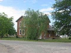
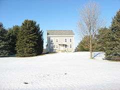
| 4 |
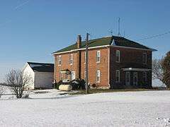
Joseph Bowman Farmhouse |
|
000000001983-05-06-0000May 6, 1983
(#83000013) |
County Roads 19 and 40, northeast of Garrett
41°22′52″N 85°05′55″W / 41.381111°N 85.098611°W / 41.381111; -85.098611 (Joseph Bowman Farmhouse) |
Keyser Township |
|
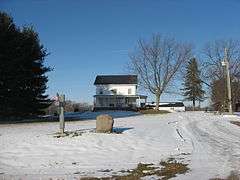
| 5 |
Breechbill-Davidson House |
|
000000001983-05-06-0000May 6, 1983
(#83000012) |
State Road 8 and County Road 7, northwest of Garrett
41°22′02″N 85°09′21″W / 41.367222°N 85.155833°W / 41.367222; -85.155833 (Breechbill-Davidson House) |
Keyser Township |
|
| 6 |
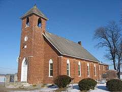
Brethren in Christ Church |
|
000000001983-05-06-0000May 6, 1983
(#83000011) |
County Road 7, northwest of Garrett
41°22′11″N 85°09′18″W / 41.369861°N 85.155000°W / 41.369861; -85.155000 (Brethren in Christ Church) |
Keyser Township |
|
| 7 |
Butler Community Mausoleum |
|
000000002014-03-25-0000March 25, 2014
(#14000070) |
County Road 28 E., east of Butler
41°25′49″N 84°50′59″W / 41.430278°N 84.849722°W / 41.430278; -84.849722 (Butler Community Mausoleum) |
Stafford Township |
|
| 8 |
Orin Clark House |
|
000000001983-05-06-0000May 6, 1983
(#83000010) |
County Roads 3 and 48, west of Garrett
41°21′03″N 85°10′34″W / 41.350833°N 85.176111°W / 41.350833; -85.176111 (Orin Clark House) |
Keyser Township |
|
| 9 |
William Cornell Homestead |
|
000000001973-08-14-0000August 14, 1973
(#73000015) |
Southwest of Auburn off State Road 427
41°16′44″N 85°05′28″W / 41.278889°N 85.091111°W / 41.278889; -85.091111 (William Cornell Homestead) |
Butler Township |
|
| 10 |
DeKalb County Home and Barn |
|
000000001983-05-06-0000May 6, 1983
(#83000015) |
County Road 40, northeast of Garrett
41°22′54″N 85°04′59″W / 41.381667°N 85.083056°W / 41.381667; -85.083056 (DeKalb County Home and Barn) |
Keyser Township |
|
| 11 |
Downtown Auburn Historic District |
|
000000001986-09-10-0000September 10, 1986
(#86002858) |
Roughly bounded by E. and W. 4th, N. and S. Cedar, E. 12th, and N. and S. Jackson Sts.
41°22′00″N 85°03′18″W / 41.366667°N 85.055000°W / 41.366667; -85.055000 (Downtown Auburn Historic District) |
Auburn |
|
| 12 |
Downtown Butler Historic District |
|
000000002001-12-07-0000December 7, 2001
(#01001347) |
Roughly the 100 and 200 blocks of S. Broadway
41°25′45″N 84°52′18″W / 41.429167°N 84.871667°W / 41.429167; -84.871667 (Downtown Butler Historic District) |
Butler |
|
| 13 |
Eckhart Public Library and Park |
|
000000001981-11-20-0000November 20, 1981
(#81000009) |
603 S. Jackson St.
41°21′50″N 85°03′27″W / 41.363889°N 85.057500°W / 41.363889; -85.057500 (Eckhart Public Library and Park) |
Auburn |
|
| 14 |
William Fountain House |
|
000000001983-05-06-0000May 6, 1983
(#83000021) |
State Road 8, northwest of Garrett
41°21′58″N 85°10′38″W / 41.366111°N 85.177222°W / 41.366111; -85.177222 (William Fountain House) |
Keyser Township |
|
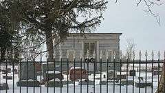
| 15 |
Garrett Community Mausoleum |
|
000000002014-03-25-0000March 25, 2014
(#14000071) |
S. Hamsher St.
41°20′43″N 85°08′38″W / 41.345139°N 85.143889°W / 41.345139; -85.143889 (Garrett Community Mausoleum) |
Garrett |
|
| 16 |
Garrett Historic District |
|
000000001983-05-06-0000May 6, 1983
(#83000121) |
Roughly bounded by Railroad, Britton, Warfield, and Hamsher Sts., and 3rd Ave.
41°20′43″N 85°08′06″W / 41.345278°N 85.135°W / 41.345278; -85.135 (Garrett Historic District) |
Garrett |
|
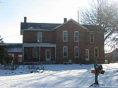
| 17 |
Gump House |
|
000000001983-05-06-0000May 6, 1983
(#83000020) |
State Road 8, northwest of Garrett
41°21′58″N 85°11′23″W / 41.366111°N 85.189722°W / 41.366111; -85.189722 (Gump House) |
Keyser Township |
|
| 18 |
J.H. Haag House |
|
000000001983-05-06-0000May 6, 1983
(#83000019) |
County Road 54
41°19′46″N 85°08′08″W / 41.329583°N 85.135556°W / 41.329583; -85.135556 (J.H. Haag House) |
Garrett |
|
| 19 |
Edward Kelham House |
|
000000001983-05-06-0000May 6, 1983
(#83000018) |
County Road 48, west of Garrett
41°21′07″N 85°11′20″W / 41.351944°N 85.188889°W / 41.351944; -85.188889 (Edward Kelham House) |
Keyser Township |
|
| 20 |
Keyser Township School 8 |
|
000000001983-05-06-0000May 6, 1983
(#83000017) |
E. Quincy St.
41°21′06″N 85°07′03″W / 41.351667°N 85.1175°W / 41.351667; -85.1175 (Keyser Township School 8) |
Garrett |
|
| 21 |
Charles Lehmback Farmstead |
|
000000001983-05-06-0000May 6, 1983
(#83000016) |
County Road 15, east of Garrett
41°20′37″N 85°07′01″W / 41.343611°N 85.116944°W / 41.343611; -85.116944 (Charles Lehmback Farmstead) |
Keyser Township |
|
| 22 |
Mountz House |
|
000000001979-09-11-0000September 11, 1979
(#79000013) |
507 E. Houston St.
41°20′53″N 85°07′49″W / 41.348056°N 85.130278°W / 41.348056; -85.130278 (Mountz House) |
Garrett |
|
| 23 |
Henry Peters House |
|
000000001983-05-06-0000May 6, 1983
(#83000022) |
201 N. 6th St.
41°21′06″N 85°07′11″W / 41.351667°N 85.119722°W / 41.351667; -85.119722 (Henry Peters House) |
Garrett |
|
| 24 |
Rakestraw House |
|
000000001983-05-06-0000May 6, 1983
(#83000024) |
County Road 19, northeast of Garrett
41°22′11″N 85°05′54″W / 41.369722°N 85.098333°W / 41.369722; -85.098333 (Rakestraw House) |
Keyser Township |
|
| 25 |
Henry Shull Farmhouse Inn |
|
000000001983-05-06-0000May 6, 1983
(#83000023) |
County Road 11-A, southeast of Garrett
41°19′36″N 85°05′23″W / 41.326667°N 85.089722°W / 41.326667; -85.089722 (Henry Shull Farmhouse Inn) |
Keyser Township |
|
| 26 |
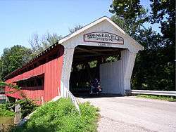
Spencerville Covered Bridge |
|
000000001981-04-02-0000April 2, 1981
(#81000010) |
County Road 68 at Spencerville
41°16′53″N 84°54′53″W / 41.281389°N 84.914722°W / 41.281389; -84.914722 (Spencerville Covered Bridge) |
Spencer Township |
|
| 27 |
Waterloo Community Mausoleum |
|
000000002014-03-25-0000March 25, 2014
(#14000072) |
N. Center St.
41°26′14″N 85°01′23″W / 41.437222°N 85.022917°W / 41.437222; -85.022917 (Waterloo Community Mausoleum) |
Waterloo |
|
| 28 |
John Wilderson House |
|
000000001983-05-06-0000May 6, 1983
(#83000025) |
1349 S. Cowen St.
41°20′01″N 85°08′12″W / 41.333611°N 85.136667°W / 41.333611; -85.136667 (John Wilderson House) |
Garrett |
|
| 29 |
Maria and Franklin Wiltrout Polygonal Barn |
|
000000001993-04-02-0000April 2, 1993
(#93000183) |
0209 County Road 16, northwest of Corunna
41°28′04″N 85°11′02″W / 41.467639°N 85.183889°W / 41.467639; -85.183889 (Maria and Franklin Wiltrout Polygonal Barn) |
Fairfield Township |
|

