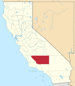
Actis, California
| Actis | |
|---|---|
| Unincorporated community | |
|
Actis  Actis Location in California | |
| Coordinates: 34°57′31″N 118°08′55″W / 34.95861°N 118.14861°WCoordinates: 34°57′31″N 118°08′55″W / 34.95861°N 118.14861°W | |
| Country | United States |
| State | California |
| County | Kern County |
| Elevation[1] | 2,562 ft (781 m) |
Actis (formerly, Highberg, Rummington, and Gloster)[2] is an unincorporated community in Kern County, California.[1] It is located 6.5 miles (10 km) north of Rosamond,[2] at an elevation of 2562 feet (781 m).[1] It is situated between Mojave and Rosamond at Backus Road and California State Route 14.[3]
The Highberg post office opened in 1917, changed its name to Rummington in 1918, and closed for good in 1927.[2]
Climate
| Climate data for Actis | |||||||||||||
|---|---|---|---|---|---|---|---|---|---|---|---|---|---|
| Month | Jan | Feb | Mar | Apr | May | Jun | Jul | Aug | Sep | Oct | Nov | Dec | Year |
| Average high °F (°C) | 57.1 (13.9) |
60.2 (15.7) |
64.6 (18.1) |
73.8 (23.2) |
81.4 (27.4) |
90.5 (32.5) |
98.5 (36.9) |
97.2 (36.2) |
92.3 (33.5) |
79.6 (26.4) |
67.5 (19.7) |
59.9 (15.5) |
76.9 (24.9) |
| Average low °F (°C) | 29.9 (−1.2) |
33.8 (1) |
37.8 (3.2) |
45.7 (7.6) |
52.3 (11.3) |
61.3 (16.3) |
67.8 (19.9) |
65.7 (18.7) |
58.4 (14.7) |
47.4 (8.6) |
35.9 (2.2) |
31.5 (−0.3) |
47.3 (8.5) |
| Average precipitation inches (mm) | 1.1 (28) |
1.3 (33) |
1.2 (30) |
0.4 (10) |
0.1 (3) |
0 (0) |
0 (0) |
0.1 (3) |
0.2 (5) |
0.2 (5) |
0.4 (10) |
1.2 (30) |
6.2 (157) |
| Source: Weatherbase [4] | |||||||||||||
References
- 1 2 3 U.S. Geological Survey Geographic Names Information System: Actis, California
- 1 2 3 Durham, David L. (1998). California's Geographic Names: A Gazetteer of Historic and Modern Names of the State. Clovis, Calif.: Word Dancer Press. p. 991. ISBN 1-884995-14-4.
- ↑ Curtis Darling, Kern County Place Names, second edition (2003), page 1
- ↑ "Weatherbase: Historical Weather for Actis, California". Weatherbase. 2011. Retrieved on November 24, 2011.
This article is issued from Wikipedia - version of the 9/19/2016. The text is available under the Creative Commons Attribution/Share Alike but additional terms may apply for the media files.
