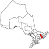
Wollaston, Ontario
| Wollaston | |
|---|---|
| Township (lower-tier) | |
| Township of Wollaston | |
|
Municipal office in Coe Hill | |
 Wollaston | |
| Coordinates: 44°57′22″N 77°50′01″W / 44.95611°N 77.83361°WCoordinates: 44°57′22″N 77°50′01″W / 44.95611°N 77.83361°W[1] | |
| Country |
|
| Province |
|
| County | Hastings |
| Settled | 1860s |
| Incorporated | 1880 |
| Government | |
| • Type | Township |
| • Reeve | Graham Blair |
| • MP | Mike Bossio |
| • MPP | Todd Smith |
| Area[2] | |
| • Land | 220.19 km2 (85.02 sq mi) |
| Population (2011)[2] | |
| • Total | 708 |
| • Density | 3.2/km2 (8/sq mi) |
| Time zone | EST (UTC-5) |
| • Summer (DST) | EDT (UTC-4) |
| Postal Code | K0L 1P0 |
| Area code(s) | 613 and 343 |
| Website |
www |
Wollaston is an incorporated township in Hastings County, Ontario, Canada.[1] The township had a population of 708 in the Canada 2011 Census.
Communities
Coe Hill (44°51′43″N 77°50′11″W / 44.86194°N 77.83639°W) is the main community in Wollaston Township. The local post office serves residents with lock boxes and four rural routes, two of which are for a neighbouring village, Gilmour in Tudor and Cashel Township. Hastings County Road 620 runs through the community, connecting it to Highways 28 to the west and 62 to the east.
Coe Hill has restaurants, a gas station, a Royal Canadian Legion branch, an Liquor Control Board of Ontario outlet, a landscaping business, a school, a post office, a grocery store, a bakery, a fishing supplies store, a doctor's office and a real estate office.
Demographics
| Canada census – Wollaston, Ontario community profile | |||
|---|---|---|---|
| 2011 | 2006 | 2001 | |
| Population: | 708 (-3.0% from 2006) | 730 (7.5% from 2001) | 679 (-5.6% from 1996) |
| Land area: | 220.19 km2 (85.02 sq mi) | 215.22 km2 (83.10 sq mi) | 215.29 km2 (83.12 sq mi) |
| Population density: | 3.2/km2 (8.3/sq mi) | 3.4/km2 (8.8/sq mi) | 3.2/km2 (8.3/sq mi) |
| Median age: | 50.5 (M: 50.5, F: 50.5) | 46.0 (M: 45.5, F: 47.4) | |
| Total private dwellings: | 624 | 629 | 779 |
| Median household income: | $32,010 | $28,386 | |
| References: 2011[3] 2006[4] 2001[5] | |||
Population trend:[6]
- Population in 2011: 708
- Population in 2006: 730
- Population in 2001: 679
- Population in 1996: 719
- Population in 1991: 659
Mother tongue:[4]
- English as first language: 97.9%
- French as first language: 0%
- English and French as first language: 0%
- Other as first language: 2.1%
See also
References
- 1 2 "Wollaston". Geographical Names Data Base. Natural Resources Canada. Retrieved 2016-03-06.
- 1 2 "Wollaston, Ontario (Code 3512054) and Hastings, Ontario (Code 3512) (table)". 2011 Census of Population. Statistics Canada. Retrieved 2012-03-01.
- ↑ "2011 Community Profiles". Canada 2011 Census. Statistics Canada. July 5, 2013. Retrieved 2012-03-01.
- 1 2 "2006 Community Profiles". Canada 2006 Census. Statistics Canada. March 30, 2011. Retrieved 2012-03-01.
- ↑ "2001 Community Profiles". Canada 2001 Census. Statistics Canada. February 17, 2012. Retrieved 2012-03-01.
- ↑ Statistics Canada: 1996, 2001, 2006 census
Other map sources:
- Map 6 (PDF) (Map). 1 : 700,000. Official road map of Ontario. Ministry of Transportation of Ontario. 2014. Retrieved 2016-03-06.
- Restructured municipalities - Ontario map #5 (Map). Restructuring Maps of Ontario. Ontario Ministry of Municipal Affairs and Housing. 2006. Retrieved 2016-03-06.
External links
 |
Faraday | Bancroft |  | |
| North Kawartha | |
Limerick | ||
| ||||
| | ||||
| Havelock-Belmont-Methuen | Marmora and Lake | Tudor and Cashel (Tudor section) |
