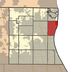
Waukegan Township, Lake County, Illinois
| Waukegan Township | |
|---|---|
| Township | |
 Location in Lake County | |
 Lake County's location in Illinois | |
| Coordinates: 42°22′23″N 87°51′01″W / 42.37306°N 87.85028°WCoordinates: 42°22′23″N 87°51′01″W / 42.37306°N 87.85028°W | |
| Country | United States |
| State | Illinois |
| County | Lake |
| Established | November 6, 1849 |
| Government | |
| • Supervisor | Patricia Jones |
| Area | |
| • Total | 21.4 sq mi (55.3 km2) |
| • Land | 21.0 sq mi (54.5 km2) |
| • Water | 0.3 sq mi (0.8 km2) |
| Elevation | 650 ft (198 m) |
| Population (2010) | |
| • Total | 90,893 |
| • Density | 4,300/sq mi (1,600/km2) |
| Time zone | CST (UTC-6) |
| • Summer (DST) | CDT (UTC-5) |
| GNIS feature ID | 0429903 |
| Website |
www |
Waukegan Township is a township in Lake County, Illinois, USA. As of the 2010 census, its population was 90,893.[1]
Geography
Waukegan Township covers an area of 21.4 square miles (55.3 km2); of this, 0.31 square miles (0.8 km2) or 1.41 percent is water.[1] Lakes in this township include Dead Lake. Sunderland Creek and the Waukegan River run through this township.
Cities and towns
- Beach Park (north quarter)
- North Chicago (south quarter)
- Park City (west quarter)
- Waukegan (partial)
Adjacent townships
- Benton Township (north)
- Shields Township (south)
- Libertyville Township (southwest)
- Warren Township (west)
- Newport Township (northwest)
Cemeteries
The township contains five cemeteries: Am Echod Jewish, North Shore Garden of Memories, Oakwood, Pahlman Family and Saint Marys.
Major highways
Airports and landing strips
- Waukegan Regional Airport
- Saint Therese Medical Center Heliport
- Victory Memorial Hospital Off Heliport
References
- 1 2 "Geographic Identifiers: 2010 Demographic Profile Data (G001): Waukegan township, Lake County, Illinois". U.S. Census Bureau, American Factfinder. Retrieved December 19, 2012.
External links
This article is issued from Wikipedia - version of the 3/2/2016. The text is available under the Creative Commons Attribution/Share Alike but additional terms may apply for the media files.