Wapakoneta, Ohio
| City of Wapakoneta, Ohio | ||
|---|---|---|
| City | ||
|
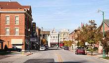
Wapakoneta City Hall | ||
| ||
| Nickname(s): Wapak, Home of the First Man on the Moon, Home of Neil Armstrong, Moon City | ||
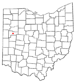
 Location of Wapakoneta, Ohio | ||
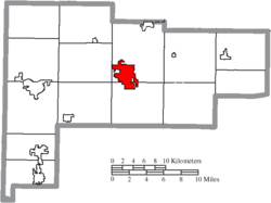
 Location of Wapakoneta in Auglaize County | ||
 City of Wapakoneta, Ohio Location in U.S. | ||
| Coordinates: 40°34′33″N 84°11′34″W / 40.57583°N 84.19278°WCoordinates: 40°34′33″N 84°11′34″W / 40.57583°N 84.19278°W | ||
| Country | United States | |
| State | Ohio | |
| County | Auglaize | |
| Founded | 1782 | |
| Incorporated | March 2, 1849 | |
| Government | ||
| • Mayor | Thomas A. Stinebaugh (R) | |
| Area[1] | ||
| • Total | 6.26 sq mi (16.21 km2) | |
| • Land | 6.21 sq mi (16.08 km2) | |
| • Water | 0.05 sq mi (0.13 km2) | |
| Elevation | 895 ft (272 m) | |
| Population (2010)[2] | ||
| • Total | 9,867 | |
| • Estimate (2012[3]) | 9,824 | |
| • Density | 1,588.9/sq mi (613.5/km2) | |
| Time zone | EST (UTC-5) | |
| • Summer (DST) | EDT (UTC-4) | |
| ZIP codes | 45895 | |
| Area code(s) | 419, 567 | |
| FIPS code | 39-80766[4] | |
| GNIS feature ID | 1070980[5] | |
| Website | http://www.wapakoneta.net | |
Wapakoneta (/ˌwɑːpɑːkəˈnɛtə/ WAH-pah-kə-NET-tə) is a city in and the county seat of Auglaize County,[6] Ohio, United States. The population was 9,867 at the 2010 census. It is the principal city of and is included in the Wapakoneta, Ohio Micropolitan S A, which is included in the Lima-Van Wert-Wapakoneta, Ohio CSA. The community is served by the Wapakoneta City School District.
The city is the birthplace of astronaut Neil Armstrong, the first human to set foot on the moon.
Wapakoneta is a sister city to Lengerich, North Rhine-Westphalia, Germany.
History
Wapakoneta was an important site to the Ottawa Native Americans prior to their leaving Ohio. By 1798, the Shawnee Native Americans had made Wapakoneta their territory and displaced the Ottawa. By 1808, there were reports of more than five hundred Shawnee, Seneca of the Iroquois, and Mingo Native Americans living at Wapakoneta, including Black Hoof. The name Wapakoneta is derived from Shawnee Wa·po’kanite 'Place of White Bones' (wa·pa 'white'+(h)o’kani 'bone'+-ite locative suffix).
The Native Americans of Wapakoneta adopted the agricultural methods that the missionaries from the Society of Friends had introduced to them. The Native Americans worked to prove that they had indeed adopted the life of the white settlers. Wapakoneta was the location of the first sawmill and gristmill in northwest Ohio. In 1810, the United States sent a government agent to help the Native Americans. This did not last since the federal government removed the agent for failing to submit appropriate paperwork.
The Shawnee and Seneca continued to live at Wapakoneta until the United States forced them to leave in 1831, as part of Indian Removal to lands west of the Mississippi River. The Treaty of Wapakoneta and the Treaty of Lewistown resulted in the forced removal of the Shawnees and Senecas to lands west of the Mississippi River.
Euro-American settlers quickly replaced the native population. In 1848, the Ohio legislature created Auglaize County out of parts of Mercer and Allen counties. Early county voters chose Wapakoneta as the county seat in a disputed contest with rival town Saint Marys. For the next 150 years, Auglaize County residents primarily were devoted to agriculture, although several additional industries existed in the city by the late nineteenth century. During the 1880s, an oil and natural gas drilling industry arose. Wapakoneta's 2,765 residents also claimed to produce more butter churns than any other single location in the United States during this same time period.
In 2000, more than nine thousand people called Wapakoneta home. Many residents find employment at General Aluminum, Wapakoneta City Schools, Koneta Rubber Co. and companies outside Wapakoneta proper. It was mentioned in the movie Third Finger, Left Hand as the home town of character Jeff Thompson, who repeatedly got strange looks when he would say where he was from. Wapakoneta has seen many business additions in the last several years, including Walmart, Lowes, and local restaurant chain Happy Daz.
Notable people
- Neil Armstrong, the first man to walk on the moon.
- Charles Brading, pharmacist and politician
- Jennifer Crusie, romance novel writer
- George Russell Davis, Associate Justice of the Arizona Territorial Supreme Court
- Bob Ewing, Major League Baseball player
- Dudley Nichols, Oscar-winning screenwriter
- John T. Smith, wrestler.
As the birthplace of Neil Armstrong, there are several places named after him in Wapakoneta, such as the Neil Armstrong Air and Space Museum, operated by the Ohio Historical Society. The Auglaize County airport is called the Neil Armstrong Airport.
Geography
According to the United States Census Bureau, the city has a total area of 6.26 square miles (16.21 km2), of which 6.21 square miles (16.08 km2) is land and 0.05 square miles (0.13 km2) is water.[1]
Wapakoneta is located on the Auglaize River and includes portions of Duchouquet, Pusheta, and Moulton Townships.
Demographics
| Historical population | |||
|---|---|---|---|
| Census | Pop. | %± | |
| 1850 | 504 | — | |
| 1860 | 900 | 78.6% | |
| 1870 | 2,150 | 138.9% | |
| 1880 | 2,705 | 25.8% | |
| 1890 | 3,616 | 33.7% | |
| 1900 | 3,915 | 8.3% | |
| 1910 | 5,349 | 36.6% | |
| 1920 | 5,295 | −1.0% | |
| 1930 | 5,378 | 1.6% | |
| 1940 | 5,225 | −2.8% | |
| 1950 | 5,797 | 10.9% | |
| 1960 | 6,756 | 16.5% | |
| 1970 | 7,324 | 8.4% | |
| 1980 | 8,402 | 14.7% | |
| 1990 | 9,214 | 9.7% | |
| 2000 | 9,474 | 2.8% | |
| 2010 | 9,867 | 4.1% | |
| Est. 2015 | 9,823 | [7] | −0.4% |
| Sources:[4][8][9][10][11][12][13][14] | |||
2010 census
As of the census[2] of 2010, there were 9,867 people, 4,037 households, and 2,614 families residing in the city. The population density was 1,588.9 inhabitants per square mile (613.5/km2). There were 4,332 housing units at an average density of 697.6 per square mile (269.3/km2). The racial makeup of the city was 97.1% White, 0.4% African American, 0.3% Native American, 0.4% Asian, 0.6% from other races, and 1.2% from two or more races. Hispanic or Latino of any race were 1.6% of the population.
There were 4,037 households of which 32.6% had children under the age of 18 living with them, 46.7% were married couples living together, 12.8% had a female householder with no husband present, 5.3% had a male householder with no wife present, and 35.2% were non-families. 30.5% of all households were made up of individuals and 13.1% had someone living alone who was 65 years of age or older. The average household size was 2.39 and the average family size was 2.95.
The median age in the city was 37 years. 25.2% of residents were under the age of 18; 8.6% were between the ages of 18 and 24; 26% were from 25 to 44; 24.4% were from 45 to 64; and 15.6% were 65 years of age or older. The gender makeup of the city was 47.8% male and 52.2% female.
2000 census
As of the census[4] of 2000, there were 9,474 people, 3,803 households, and 2,540 families residing in the city. The population density was 1,674.7 people per square mile (646.3/km²). There were 4,057 housing units at an average density of 717.2 per square mile (276.8/km²). The racial makeup of the city was 97.96% White, 0.19% African American, 0.26% Native American, 0.39% Asian, 0.05% Pacific Islander, 0.37% from other races, and 0.77% from two or more races. Hispanic or Latino of any race were 0.87% of the population.

There were 3,803 households out of which 33.1% had children under the age of 18 living with them, 51.4% were married couples living together, 11.2% had a female householder with no husband present, and 33.2% were non-families. 28.9% of all households were made up of individuals and 11.9% had someone living alone who was 65 years of age or older. The average household size was 2.43 and the average family size was 2.99.
In the city the population was spread out with 26.2% under the age of 18, 9.7% from 18 to 24, 28.4% from 25 to 44, 20.2% from 45 to 64, and 15.6% who were 65 years of age or older. The median age was 35 years. For every 100 females there were 89.7 males. For every 100 females age 18 and over, there were 85.9 males.
The median income for a household in the city was $38,531, and the median income for a family was $45,456. Males had a median income of $34,523 versus $23,478 for females. The per capita income for the city was $18,976. About 8.4% of families and 8.9% of the population were below the poverty line, including 11.6% of those under age 18 and 9.3% of those age 65 or over.
Sister cities
Wapakoneta has one sister city, as designated by the Sister Cities International:

See also
References
- 1 2 "US Gazetteer files 2010". United States Census Bureau. Retrieved 2013-01-06.
- 1 2 "American FactFinder". United States Census Bureau. Retrieved 2013-01-06.
- ↑ "Population Estimates". United States Census Bureau. Retrieved 2013-06-17.
- 1 2 3 "American FactFinder". United States Census Bureau. Retrieved 2008-01-31.
- ↑ "US Board on Geographic Names". United States Geological Survey. 2007-10-25. Retrieved 2008-01-31.
- ↑ "Find a County". National Association of Counties. Retrieved 2011-06-07.
- ↑ "Annual Estimates of the Resident Population for Incorporated Places: April 1, 2010 to July 1, 2015". Retrieved July 2, 2016.
- ↑ "Population of Civil Divisions Less than Counties" (PDF). Statistics of the Population of the United States at the Tenth Census. U.S. Census Bureau. Retrieved 28 November 2013.
- ↑ "Population of Civil Divisions Less than Counties" (PDF). Statistics of the Population of the United States at the Tenth Census. U.S. Census Bureau. Retrieved 28 November 2013.
- ↑ "Population: Ohio" (PDF). 1910 U.S. Census. U.S. Census Bureau. Retrieved 28 November 2013.
- ↑ "Population: Ohio" (PDF). 1930 US Census. U.S. Census Bureau. Retrieved 28 November 2013.
- ↑ "Number of Inhabitants: Ohio" (PDF). 18th Census of the United States. U.S. Census Bureau. Retrieved 22 November 2013.
- ↑ "Ohio: Population and Housing Unit Counts" (PDF). U.S. Census Bureau. Retrieved 22 November 2013.
- ↑ "Incorporated Places and Minor Civil Divisions Datasets: Subcounty Population Estimates: April 1, 2010 to July 1, 2012". U.S. Census Bureau. Retrieved 25 November 2013.
External links
- City Website
- Wapakoneta Area Economic Development Council
- Wapakoneta Area Chamber of Commerce
- Wapakoneta Daily News


