Rottenegg, Upper Austria
| Rottenegg | |
|---|---|
|
Rottenegg Castle in 1674 | |
 Rottenegg Location in Austria | |
| Coordinates: 48°22′06″N 14°08′06″E / 48.368275°N 14.135025°ECoordinates: 48°22′06″N 14°08′06″E / 48.368275°N 14.135025°E | |
| Country | Austria |
| State | Upper Austria |
| District | Urfahr-Umgebung |
| Municipality | Sankt Gotthard im Mühlkreis |
| Elevation | 473 m (1,552 ft) |
| Time zone | CET (UTC+1) |
| • Summer (DST) | CEST (UTC+2) |
| Postal code | 4112 |
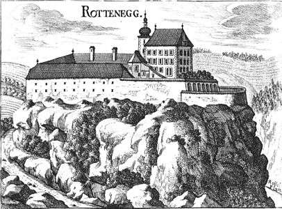
Rottenegg is a village in the municipality of Sankt Gotthard im Mühlkreis, in Upper Austria. It is named after the now-ruined Rottenegg Castle, just east of the village.
Rottenegg is surrounded by hilly country and is a good area for hiking, with excellent views. It once lay on a Via Regia, a medieval trade route.[1] The ruined castle is on a projecting rock promontory where the Kleinen Rodl enters the Großen Rodl river from the north, looking over the confluence. It guarded the old trade route.[2] The village puts on the Rottenegg Cultural Summer Program each year, which includes cabarets, concerts and plays.[1] The village is home to the Mühlviertler Heimatverein Rottenegg, a club that preserves folk dances and songs, and that puts on a play each year.[3] The hall at the leisure center is also used for other events.[4]
References
Citations
Sources
- "Großer Kinderflohmarkt Rottenegg". meinbezirk.at. Siehe Impressum. 07.09.2013. Retrieved 2014-01-01. Check date values in:
|date=(help) - Hammerl, Werner (13 October 2007). "Rottenegg". Retrieved 2014-01-01.
- "Homepage". Mühlviertler Heimatvereines Rottenegg. Retrieved 2014-01-01.
- "St. Gotthard". Oberoesterreich.at. Retrieved 2013-01-01.