Roth, North Dakota
| Roth, North Dakota | |
|---|---|
| Unincorporated community | |
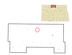 Location of Roth, North Dakota | |
| Coordinates: 48°54′28″N 100°48′10″W / 48.90778°N 100.80278°WCoordinates: 48°54′28″N 100°48′10″W / 48.90778°N 100.80278°W | |
| Country | United States |
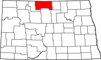
| State | North Dakota |
| County | Bottineau County |
| Area[1] | |
| • Total | .005 sq mi (.0134 km2) |
| • Land | .005 sq mi (.0134 km2) |
| • Water | 0 sq mi (0 km2) |
| Elevation | 1,503 ft (458 m) |
| Time zone | Central (CST) (UTC-6) |
| • Summer (DST) | CDT (UTC-5) |
| ZIP Code | 58783 |
| Area code(s) | 701 |
| FIPS code | 38-68620[2] |
| GNIS feature ID | 1031010[2] |
Roth is an unincorporated community in Bottineau County in the U.S. State of North Dakota. It is located roughly 6 miles (9.7 km) miles to the west of Souris, North Dakota. Roth does not have a post office, but it shares the same zip code of 58783 with Souris.[3]
History
Roth was first founded in 1904 as Faldet (or Faldot) as a station on the Great Northern Railway, and renamed Roth in 1905 after Martin Rothe, a railroad official.[4] It was originally intended to be named Carbury, which is a town roughly 12 miles (19 km) to the east. However, due to a mixup by railroad officials or the Secretary of State, depending on who tells the story, the townsite names were accidentally switched when the wrong signs were posted.[4] The mistake was never corrected.[5][6]
Roth's post office was established May 22, 1907, this time with the name Hewitt. The name was corrected to Roth in 1908 when the new postmaster John W. Reep noticed the mistake. The post office closed August 14, 1964, with mail service merging with Souris, North Dakota.
Geography
Roth is located in the Souris River Valley. The city of Souris is to the east.
Demographics
Roth is part of Scandia Township, which showed a population of 54 as of the 2000 Census.[7] As an unincorporated community, the United States Census Bureau does not track separate population numbers for Roth. However, according to census block data, Roth coincides with block 1091 of census tract 9254, block group 1. This block recorded a combined population of 5 in a total of 3 households during the 2000 Census.[1]
References
- 1 2 "American FactFinder". United States Census Bureau. Retrieved 2008-01-31.
- 1 2 "US Board on Geographic Names". United States Geological Survey. 2007-10-25. Retrieved 2008-01-31.
- ↑ Zip Code Lookup
- 1 2 Wick, Douglas A. North Dakota Place Names. Hedemarken Collectibles. p. 167. ISBN 0-9620968-0-6.
- ↑ "Roth, North Dakota". Geographic Names Information System. United States Geological Survey.
- ↑ "Carbury, North Dakota". Geographic Names Information System. United States Geological Survey.
- ↑ U.S. Census Bureau. Census 2000. "DP-1. Profile of General Demographic Characteristics, Scandia Township". American FactFinder. <http://factfinder.census.gov>. Retrieved 2009-01-31.