| [3] |
Name on the Register[4] |
Image |
Date listed[5] |
Location |
City or town |
Description |
|---|
| 1 |
Joseph Adams House |
|
000000001978-02-17-0000February 17, 1978
(#78002655) |
300 N. Adamswood Rd.
41°03′55″N 111°56′42″W / 41.065278°N 111.945°W / 41.065278; -111.945 (Joseph Adams House) |
Layton |
|
| 2 |
James and Hannah Atkinson House |
|
000000001999-07-15-0000July 15, 1999
(#99000847) |
1510 S. 1100 West
40°52′29″N 111°54′40″W / 40.874722°N 111.911111°W / 40.874722; -111.911111 (James and Hannah Atkinson House) |
Woods Cross |
|
| 3 |
Barnard-Garn-Barber House |
|
000000001997-11-17-0000November 17, 1997
(#97001309) |
1198 N. Main St.
40°55′54″N 111°52′43″W / 40.931667°N 111.878611°W / 40.931667; -111.878611 (Barnard-Garn-Barber House) |
Centerville |
|
| 4 |
John George Moroni Barnes House |
|
000000001982-02-11-0000February 11, 1982
(#82004120) |
42 W. Center St.
41°02′07″N 111°56′20″W / 41.035278°N 111.938889°W / 41.035278; -111.938889 (John George Moroni Barnes House) |
Kaysville |
|
| 5 |
John R. Barnes House |
|
000000001982-07-23-0000July 23, 1982
(#82004121) |
10 S. 100 West
41°02′05″N 111°56′23″W / 41.034722°N 111.939722°W / 41.034722; -111.939722 (John R. Barnes House) |
Kaysville |
|
| 6 |
Henry Blood House |
|
000000001980-04-29-0000April 29, 1980
(#80003897) |
95 S. 300 West
41°02′01″N 111°56′35″W / 41.033611°N 111.943056°W / 41.033611; -111.943056 (Henry Blood House) |
Kaysville |
Home of Henry H. Blood, former Governor of Utah.
|
| 7 |
Bountiful Historic District |
|
000000002005-10-26-0000October 26, 2005
(#05001194) |
Roughly bounded by 200 W., 500 S., 400 E., and 400 N.
40°53′21″N 111°52′42″W / 40.889167°N 111.878333°W / 40.889167; -111.878333 (Bountiful Historic District) |
Bountiful |
|
| 8 |
Bountiful Tabernacle |
|
000000001976-01-01-0000January 1, 1976
(#76001813) |
Main and Center Sts.
40°53′21″N 111°52′43″W / 40.889167°N 111.878611°W / 40.889167; -111.878611 (Bountiful Tabernacle) |
Bountiful |
|
| 9 |
Thomas and Margaret Brandon House |
|
000000001997-11-17-0000November 17, 1997
(#97001310) |
185 E. Center St.
40°55′06″N 111°52′34″W / 40.918333°N 111.876111°W / 40.918333; -111.876111 (Thomas and Margaret Brandon House) |
Centerville |
|
| 10 |
William Capener House |
|
000000001984-01-05-0000January 5, 1984
(#84002172) |
252 N. 400 East
40°55′12″N 111°52′16″W / 40.92°N 111.871111°W / 40.92; -111.871111 (William Capener House) |
Centerville |
|
| 11 |
Clark Lane Historic District |
|
000000001994-10-07-0000October 7, 1994
(#94001208) |
207-399 W. State and 33 N. 200 West
40°58′50″N 111°53′36″W / 40.980556°N 111.893333°W / 40.980556; -111.893333 (Clark Lane Historic District) |
Farmington |
|
| 12 |
Osmyn and Emily Deuel House |
|
000000001997-11-17-0000November 17, 1997
(#97001311) |
271 S. 200 East
40°54′53″N 111°52′31″W / 40.914722°N 111.875278°W / 40.914722; -111.875278 (Osmyn and Emily Deuel House) |
Centerville |
|
| 13 |
John, Harriet, and Eliza Jennett Duncan House |
|
000000001997-11-17-0000November 17, 1997
(#97001312) |
445 N. 400 East
40°55′19″N 111°52′21″W / 40.921944°N 111.8725°W / 40.921944; -111.8725 (John, Harriet, and Eliza Jennett Duncan House) |
Centerville |
|
| 14 |
James and Jane Eldredge House |
|
000000002005-06-10-0000June 10, 2005
(#05000595) |
564 W. 400 North
40°53′40″N 111°53′35″W / 40.894444°N 111.893056°W / 40.894444; -111.893056 (James and Jane Eldredge House) |
West Bountiful |
|
| 15 |
Farmer's Union Building |
|
000000001978-11-30-0000November 30, 1978
(#78002656) |
12 S. Main St.
41°03′38″N 111°57′54″W / 41.060556°N 111.965°W / 41.060556; -111.965 (Farmer's Union Building) |
Layton |
|
| 16 |
Farmington Main Street Historic District |
|
000000002011-10-20-0000October 20, 2011
(#11000756) |
Approximately Main St. from 200 South to 600 North, along 600 North to Park Lane and 100 North from Main St to 100 West
40°58′50″N 111°53′15″W / 40.980556°N 111.8875°W / 40.980556; -111.8875 (Farmington Main Street Historic District) |
Farmington |
|
| 17 |
Farmington Tithing Office |
|
000000001985-03-28-0000March 28, 1985
(#85000686) |
110 N. Main St.
40°58′56″N 111°53′14″W / 40.982361°N 111.887222°W / 40.982361; -111.887222 (Farmington Tithing Office) |
Farmington |
|
| 18 |
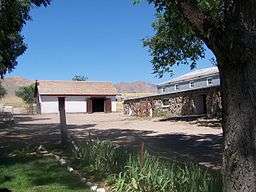
Fielding Garr Ranch |
|
000000001983-01-21-0000January 21, 1983
(#83004402) |
Off State Route 127
40°55′31″N 112°09′59″W / 40.925278°N 112.166389°W / 40.925278; -112.166389 (Fielding Garr Ranch) |
Antelope Island |
|
| 19 |
First National Bank of Layton |
|
000000002006-04-05-0000April 5, 2006
(#06000232) |
50 W. Gentile St.
41°03′38″N 111°57′57″W / 41.060556°N 111.965833°W / 41.060556; -111.965833 (First National Bank of Layton) |
Layton |
|
| 20 |
Joseph N. and Algie Ford House |
|
000000002005-11-18-0000November 18, 2005
(#05001289) |
1394 N. Main St.
40°56′12″N 111°52′39″W / 40.936667°N 111.8775°W / 40.936667; -111.8775 (Joseph N. and Algie Ford House) |
Centerville |
|
| 21 |
Ford-Rigby House |
|
000000001997-11-17-0000November 17, 1997
(#97001313) |
1592 N. Main St.
40°56′27″N 111°52′47″W / 40.940833°N 111.879722°W / 40.940833; -111.879722 (Ford-Rigby House) |
Centerville |
|
| 22 |
James Green House |
|
000000001982-02-11-0000February 11, 1982
(#82004118) |
206 N. 100 East
40°53′30″N 111°52′38″W / 40.891667°N 111.877222°W / 40.891667; -111.877222 (James Green House) |
Bountiful |
|
| 23 |
Hector C. Haight House |
|
000000001985-05-17-0000May 17, 1985
(#85001141) |
208 N. Main St.
40°59′03″N 111°53′11″W / 40.984167°N 111.886389°W / 40.984167; -111.886389 (Hector C. Haight House) |
Farmington |
|
| 24 |
Thomas and Caroline Harris House |
|
000000001998-06-11-0000June 11, 1998
(#98000639) |
275 S. 200 East
40°54′54″N 111°52′30″W / 40.915°N 111.875°W / 40.915; -111.875 (Thomas and Caroline Harris House) |
Centerville |
|
| 25 |
Harris-Tingey House |
|
000000001997-11-17-0000November 17, 1997
(#97001314) |
269 E. Center St.
40°55′03″N 111°52′28″W / 40.9175°N 111.874444°W / 40.9175; -111.874444 (Harris-Tingey House) |
Centerville |
|
| 26 |
Joseph and Ann Hill Cabin |
|
000000002015-12-04-0000December 4, 2015
(#15000130) |
2133 W. 1000 South
41°02′44″N 112°00′22″W / 41.045632°N 112.006086°W / 41.045632; -112.006086 (Joseph and Ann Hill Cabin) |
Layton |
|
| 27 |
Holland-Smith-Brown House |
|
000000001997-11-17-0000November 17, 1997
(#97001315) |
19 S. 200 East
40°55′01″N 111°52′31″W / 40.916944°N 111.875278°W / 40.916944; -111.875278 (Holland-Smith-Brown House) |
Centerville |
|
| 28 |
Kilbourn-Leak House |
|
000000001997-11-17-0000November 17, 1997
(#97001316) |
170 N. 200 East
40°55′10″N 111°52′31″W / 40.919444°N 111.875278°W / 40.919444; -111.875278 (Kilbourn-Leak House) |
Centerville |
|
| 29 |
George Quincy Knowlton House |
|
000000001995-04-17-0000April 17, 1995
(#95000416) |
93 E. 400 North
40°59′14″N 111°53′09″W / 40.987361°N 111.885833°W / 40.987361; -111.885833 (George Quincy Knowlton House) |
Farmington |
|
| 30 |
Lagoon Carousel |
|
000000002012-10-24-0000October 24, 2012
(#12000883) |
375 N. Lagoon Dr.
40°59′05″N 111°53′38″W / 40.984830°N 111.893870°W / 40.984830; -111.893870 (Lagoon Carousel) |
Farmington |
Built in 1913, this hand carved Herschell-Spillman carousel has been at Lagoon Amusement Park since 1918.
|
| 31 |
Lagoon Flying Scooter |
|
000000002012-10-24-0000October 24, 2012
(#12000884) |
375 N. Lagoon Dr.
40°59′13″N 111°53′36″W / 40.987070°N 111.893300°W / 40.987070; -111.893300 (Lagoon Flying Scooter) |
Farmington |
A Bisch-Rocco Amusement Company Flying Scooters ride at Lagoon Amusement Park. Installed in 1941, it is currently known as the Flying Aces.
|
| 32 |
Lagoon Roller Coaster |
|
000000002012-10-24-0000October 24, 2012
(#12000885) |
375 N. Lagoon Dr.
40°59′05″N 111°53′42″W / 40.984861°N 111.895137°W / 40.984861; -111.895137 (Lagoon Roller Coaster) |
Farmington |
The 7th oldest roller coaster in the world, at Lagoon Amusement Park since 1921
|
| 33 |
George W. Layton House |
|
000000001982-07-23-0000July 23, 1982
(#82004122) |
2767 W. Gentile St.
41°03′36″N 112°00′50″W / 41.06°N 112.013889°W / 41.06; -112.013889 (George W. Layton House) |
Layton |
|
| 34 |
John Henry Layton House |
|
000000001982-02-11-0000February 11, 1982
(#82004123) |
683 W. Gentile St.
41°03′36″N 111°58′39″W / 41.06°N 111.9775°W / 41.06; -111.9775 (John Henry Layton House) |
Layton |
|
| 35 |
Mills-Hancock House |
|
000000002007-02-21-0000February 21, 2007
(#07000077) |
571 S. 400 West
40°55′06″N 111°52′52″W / 40.918333°N 111.881111°W / 40.918333; -111.881111 (Mills-Hancock House) |
Centerville |
|
| 36 |
Nathan and Rebecca Cherry and Eliza Ford Porter Farmstead |
|
000000001997-11-17-0000November 17, 1997
(#97001317) |
370 W. 400 South
40°54′48″N 111°53′05″W / 40.913333°N 111.884722°W / 40.913333; -111.884722 (Nathan and Rebecca Cherry and Eliza Ford Porter Farmstead) |
Centerville |
|
| 37 |
Nathan T. and Anna Porter House |
|
000000002004-01-21-0000January 21, 2004
(#03001482) |
224 S. 210 West
40°54′55″N 111°52′55″W / 40.915278°N 111.881944°W / 40.915278; -111.881944 (Nathan T. and Anna Porter House) |
Centerville |
|
| 38 |
Melvin Harley Randall House |
|
000000001980-06-20-0000June 20, 1980
(#80003896) |
390 E. Porter Lane
40°54′46″N 111°52′19″W / 40.912778°N 111.871944°W / 40.912778; -111.871944 (Melvin Harley Randall House) |
Centerville |
|
| 39 |
Rich-Steeper House |
|
000000001997-11-17-0000November 17, 1997
(#97001318) |
415 S. Main St.
40°54′46″N 111°52′42″W / 40.912778°N 111.878333°W / 40.912778; -111.878333 (Rich-Steeper House) |
Centerville |
|
| 40 |
Richards House |
|
000000001977-12-23-0000December 23, 1977
(#77001303) |
386 N. 100 East
40°59′12″N 111°53′02″W / 40.986667°N 111.883889°W / 40.986667; -111.883889 (Richards House) |
Farmington |
|
| 41 |
B.H., Louisa Smith and Cecilia Dibble Roberts House |
|
000000001997-11-17-0000November 17, 1997
(#97001319) |
315 S. 300 East
40°54′51″N 111°52′21″W / 40.914167°N 111.8725°W / 40.914167; -111.8725 (B.H., Louisa Smith and Cecilia Dibble Roberts House) |
Centerville |
Home of B. H. Roberts
|
| 42 |
Thomas J. and Amanda N. Smith House |
|
000000002006-02-02-0000February 2, 2006
(#05001632) |
472 N. Main St.
41°02′35″N 111°56′48″W / 41.043056°N 111.946667°W / 41.043056; -111.946667 (Thomas J. and Amanda N. Smith House) |
Kaysville |
|
| 43 |
Smith-Larsen House |
|
000000001997-11-17-0000November 17, 1997
(#97001320) |
280 E. Center St.
40°54′59″N 111°52′27″W / 40.916389°N 111.874167°W / 40.916389; -111.874167 (Smith-Larsen House) |
Centerville |
|
| 44 |
Smoot Dairy Farmhouse |
|
000000002016-03-22-0000March 22, 2016
(#16000123) |
1697 N. Main St.
40°56′31″N 111°52′49″W / 40.941956°N 111.880220°W / 40.941956; -111.880220 (Smoot Dairy Farmhouse) |
Centerville |
|
| 45 |
Stayner-Steed House |
|
000000001999-08-02-0000August 2, 1999
(#99000846) |
79 S. 100 East
40°58′45″N 111°53′04″W / 40.979167°N 111.884444°W / 40.979167; -111.884444 (Stayner-Steed House) |
Farmington |
|
| 46 |
LeConte Stewart House |
|
000000001996-06-28-0000June 28, 1996
(#96000721) |
172 W. 100 South
41°02′03″N 111°56′28″W / 41.034167°N 111.941111°W / 41.034167; -111.941111 (LeConte Stewart House) |
Kaysville |
|
| 47 |
William Henry and Mary Streeper House |
|
000000001997-11-17-0000November 17, 1997
(#97001321) |
1020 N. Main St.
40°55′46″N 111°52′50″W / 40.929444°N 111.880556°W / 40.929444; -111.880556 (William Henry and Mary Streeper House) |
Centerville |
|
| 48 |
John W., Janet (Nettie), and May Rich Taylor House |
|
000000001997-10-30-0000October 30, 1997
(#97001325) |
49 E. 500 North
40°59′19″N 111°53′11″W / 40.988611°N 111.886389°W / 40.988611; -111.886389 (John W., Janet (Nettie), and May Rich Taylor House) |
Farmington |
|
| 49 |
Thurston-Chase Cabin |
|
000000001997-11-17-0000November 17, 1997
(#97001322) |
975 N. Main St.
40°55′43″N 111°52′45″W / 40.928611°N 111.879167°W / 40.928611; -111.879167 (Thurston-Chase Cabin) |
Centerville |
|
| 50 |
Thomas Tingey House |
|
000000001983-07-28-0000July 28, 1983
(#83004401) |
20 N. 300 East
40°55′03″N 111°52′23″W / 40.9175°N 111.873056°W / 40.9175; -111.873056 (Thomas Tingey House) |
Centerville |
|
| 51 |
VanFleet Hotel |
|
000000001991-12-19-0000December 19, 1991
(#91001819) |
88 E. State St.
40°58′48″N 111°53′05″W / 40.98°N 111.884722°W / 40.98; -111.884722 (VanFleet Hotel) |
Farmington |
|
| 52 |
Franklin and Amelia Walton House |
|
000000001997-11-17-0000November 17, 1997
(#97001323) |
96 W. 280 South
40°54′53″N 111°52′50″W / 40.914722°N 111.880556°W / 40.914722; -111.880556 (Franklin and Amelia Walton House) |
Centerville |
|
| 53 |
John and Sarah Jane Wayman House |
|
000000002015-01-07-0000January 7, 2015
(#14001136) |
240 E. 300 South
40°54′53″N 111°52′27″W / 40.9148°N 111.8741°W / 40.9148; -111.8741 (John and Sarah Jane Wayman House) |
Centerville |
|
| 54 |
West Bountiful Historic District |
|
000000002004-06-18-0000June 18, 2004
(#03000158) |
800 West (Onion St.) from 400 North to roughly 1350 North (both sides)
40°53′51″N 111°54′05″W / 40.8975°N 111.901389°W / 40.8975; -111.901389 (West Bountiful Historic District) |
West Bountiful |
|
| 55 |
Thomas and Elizabeth Mills Whitaker House |
|
000000001996-03-28-0000March 28, 1996
(#96000316) |
168 N. Main St.
40°55′08″N 111°52′43″W / 40.918889°N 111.878611°W / 40.918889; -111.878611 (Thomas and Elizabeth Mills Whitaker House) |
Centerville |
|
| 56 |
James D. Wilcox House |
|
000000001985-11-26-0000November 26, 1985
(#85003051) |
93 E. 100 North
40°58′56″N 111°53′05″W / 40.982222°N 111.884722°W / 40.982222; -111.884722 (James D. Wilcox House) |
Farmington |
|


![]() Media related to National Register of Historic Places in Davis County, Utah at Wikimedia Commons
Media related to National Register of Historic Places in Davis County, Utah at Wikimedia Commons