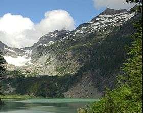
Monte Cristo Peak
| Monte Cristo Peak | |
|---|---|
 Monte Cristo Peak with Kyes Peak to the right from Blanca Lake | |
| Highest point | |
| Elevation | 7,136 ft (2,175 m) NGVD 29[1] |
| Prominence | 576 ft (176 m) [1] |
| Parent peak | Kyes Peak[1] |
| Coordinates | 47°58′17″N 121°20′28″W / 47.9714964°N 121.3412177°WCoordinates: 47°58′17″N 121°20′28″W / 47.9714964°N 121.3412177°W [2] |
| Geography | |
 Monte Cristo Peak | |
| Parent range | Cascade Range |
| Topo map | USGS Blanca Lake |
| Climbing | |
| First ascent | 1923 by James M. Keyes and W. Zerum[3] |
Monte Cristo Peak is a mountain peak in the Henry M. Jackson Wilderness in Washington state. Together with Columbia Peak and Kyes Peak it forms a basin that contains Columbia Glacier and Blanca Lake.[4] The 1918 edition of The Mountaineer called the mountain "a huge pile of red rock."[3]
Monte Cristo is named for the mining boom town of Monte Cristo,[3] which dates from the late 19th and early 20th centuries and which is situated on the mountain's northwestern flank. The town was owned by J. D. Rockefeller for a few years. A railroad and cable tramway was built to move materials.
References
- 1 2 3 "Monte Cristo Peak, Washington". Peakbagger.com. Retrieved 2015-04-10.
- ↑ "Monte Cristo Peak". Geographic Names Information System. United States Geological Survey. Retrieved 2015-04-10.
- 1 2 3 Beckey, Fred W. (2003). Cascade Alpine Guide: climbing and high routes, Vol. 2, Stevens Pass to Rainy Pass (3rd ed.). Mountaineers Books. p. 79. ISBN 978-0-89886-838-8.
- ↑ "Area around Monte Cristo Peak" (map). Acme Mapper. Retrieved 2015-04-10.
External links
- "Monte Cristo Peak". Geographic Names Information System. United States Geological Survey.
- "Monte Cristo Peak". SummitPost.org.
- "Smoot's "Climbing Washington's Mountains" 100 Peaks". Peakbagger.com.
This article is issued from Wikipedia - version of the 1/2/2016. The text is available under the Creative Commons Attribution/Share Alike but additional terms may apply for the media files.