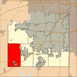
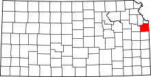
McCamish Township, Johnson County, Kansas
| McCamish Township | |
|---|---|
| Township | |
 Location in Johnson County | |
| Coordinates: 38°48′21″N 95°00′43″W / 38.80578889°N 95.01195833°WCoordinates: 38°48′21″N 95°00′43″W / 38.80578889°N 95.01195833°W | |
| Country | United States |
| State | Kansas |
| County | Johnson |
| Area | |
| • Total | 43.10 sq mi (111.6 km2) |
| • Land | 42.98 sq mi (111.3 km2) |
| • Water | 0.12 sq mi (0.3 km2) |
| Elevation | 909 ft (277 m) |
| Population (2010) | |
| • Total | 878 |
| • Estimate (2011) | 873 |
| • Density | 24.9/sq mi (9.6/km2) |
| Time zone | Central |
| ZIP codes | 66019, 66021, 66030 |
| http://www.jocogov.org/ | |
McCamish Township is one of seven townships in Johnson County, Kansas, USA. As of the 2010 census, its population was 878.
Richard D. McCamish was an early settler who founded the now extinct town of McCamish in 1857.[1]
Adjacent Townships
- Lexington Township North
- Gardner Township Northeast
Cemeteries
Edgerton Cemetery is located in McCamish Township.
Emergency Services
Police
- Johnson County Sheriff
Fire
- Johnson County Rural Fire Department
Medical (EMS)
- Lexington Township EMS, Post 35
Transportation
Major highways
Lakes, Streams & Ponds
- Santa Fe Lake
- Martin Creek
Parks
- Martin Creek Park
Notable Locations
- Johnson County Parks & Recreation
- 199th Street and Interstate 35: Kansas' First Diverging diamond interchange (2013)
- Southern Edge of Sunflower Army Ammunition Plant
- BNSF Intermodal Facility: Largest in the BNSF Railway System
- Edgerton, Kansas: Inside of Township
- Gardner, Kansas: Northwestern Edge lies inside Township
School districts
- Gardner School District 231
References
External links
- "Township of McCamish". Geographic Names Information System. United States Geological Survey. Retrieved 2014-01-04.
This article is issued from Wikipedia - version of the 10/12/2016. The text is available under the Creative Commons Attribution/Share Alike but additional terms may apply for the media files.
