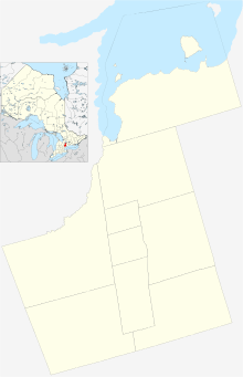
Markham Village, Ontario
| Old Markham Village | |
|---|---|
| Village | |
 Location within York | |
| Coordinates: 43°52′36″N 79°15′37″W / 43.87667°N 79.26028°WCoordinates: 43°52′36″N 79°15′37″W / 43.87667°N 79.26028°W | |
| Country |
|
| Province |
|
| Regional Municipality | York |
| City | Markham |
| Area | |
| • Total | 3.32 km2 (1.28 sq mi) |
| Population (2006) Census Tract Number 5350400.07 / 5350400.08 | |
| • Total | 6,090 |
| • Density | 1,834.34/km2 (4,750.9/sq mi) |
| Time zone | EST (UTC-5) |
| • Summer (DST) | EDT (UTC-4) |
Markham Village (2006 population 6,090)[1][2] (Census Tract No. 5350400.03 and 5350400.12) is a community in the city of Markham. Originally settled in 1825 the village, originally named Reesorville was a founded by Mennonites from Upstate New York and Pennsylvania (see Peter Reesor). Eventually, as Upper Canada started to experience immigration from the British Isles Markham would also experience such growth from Britain. In 1850 the police village is created, but it does not include the villages of Unionville and Thornhill (joins in 1971 when the Town of Markham is created). The village becomes a police village in 1931.
Population
As of 2011, Census tract profile for 0400.07 (CT) currently has a population of 3397 compared to 3418 in 2006 (Census/NHS 2011, Census 2006). This decrease in population may have been due to actors affecting this area including the highly costs of property or simply birth and death rates within the area. To further look, with Markham's current economic expansions in both the public services (Housing, construction, public services, etc.) and finances, expecting to see a population drop from those deciding to move out is not surprising as real estate in Markham is currently estimated around one million for detached homes.
Neighbourhoods
Various neighbourhoods found within Markham Village:
- Old Markham Village - area along Markham Road from Highway 7 to 16th Avenue and home to the historic Markham Main Street area
Markham Village Community Centre
Markham Village Community Centre is located on the southeast corner of Markham Road and Highway 7 and technically in neighbouring Vinegar Hill, Ontario. It was the former site of the Markham Fair. The community centre features a library, community rooms, indoor ice rink (seating 450).[3] and drop off recycling centre.
Veterans Square and Cenotaph
In the southwest corner of Markham Road and Highway 7 is the Markham Cenotaph. The area is used for annual Remembrance Day ceromonies.
Built in 1981, the current memorial is schedule to be re-vamped with a new Veterans Square and Cenotaph which will feature a obelisk-like cenotaph after receiving funding by the federal government in 2015.[4]
Main Street Markham Farmers’ Market
From early May to early October a farmers market is set up along Robinson Street just west of Main Street. The market consists of tables and tents running from 8am to 1pm.[5]
References
- ↑ "Census tract profile for 0400.07 (CT), Toronto (CMA) and Ontario". 2.statcan.ca. 2010-06-01. Retrieved 2011-01-24.
- ↑ "Census tract profile for 0400.08 (CT), Toronto (CMA) and Ontario". 2.statcan.ca. 2010-06-01. Retrieved 2011-01-24.
- ↑ http://www.markham.ca/wps/portal/Markham/RecreationCulture/CommunityCentres/Arenas/
- ↑ http://www.markham.ca/wps/portal/Markham/AboutMarkham/NewsRoom/NewsReleases/cenotaph-renovation/!ut/p/a0/04_Sj9CPykssy0xPLMnMz0vMAfGjzOJN_N2dnX3CLAKNgkwMDDw9XcJM_VwCDX09zPQLsh0VAcc4C2s!/
- ↑ http://www.mainstreetmarkham.com/farmers-market/
 |
Mount Joy, Ontario |  | ||
| Unionville, Ontario Raymerville – Markville East, Ontario |
|
Cornell, Ontario | ||
| ||||
| | ||||
| Milliken, Ontario Armadale, Ontario |