List of Shetland islands
30Jan1973.jpg)
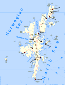
This is a list of Shetland islands in Scotland. The Shetland archipelago is located 100 kilometres (62 mi) north of mainland Scotland and the capital Lerwick is almost equidistant from Bergen in Norway and Aberdeen in Scotland. The Shetland archipelago comprises about 300 islands and skerries, of which 16 are inhabited. In addition to the Shetland Mainland the larger islands are Unst, Yell and Fetlar.
The definition of an island used in this list is that it is land that is surrounded by seawater on a daily basis, but not necessarily at all stages of the tide, excluding human devices such as bridges and causeways.[1] There are four islands joined to the Shetland Mainland by bridges, East Burra, West Burra, Trondra, and Muckle Roe. There is also a bridge from Housay to Bruray.[2] Nowhere in Shetland is more than three miles (5 km) from the sea.[3] Mavis Grind (Old Norse for "gate of the narrow isthmus") is a narrow neck of land little more than 100 metres (328 feet) wide separating St. Magnus Bay and the Atlantic in the west from Sullom Voe and the North Sea in the east.[4]
The geology of Shetland is complex with numerous faults and fold axes. These islands are the northern outpost of the Caledonian orogeny and there are outcrops of Lewisian, Dalradian and Moine metamorphic rocks with similar histories to their equivalents on the Scottish mainland. Similarly, there are also Old Red Sandstone deposits and granite intrusions. The most distinctive feature is the ultrabasic ophiolite, peridotite and gabbro on Unst and Fetlar, which is a remnant of the Iapetus Ocean floor.[5] Much of the island's economy depends on the oil-bearing sediments in the surrounding seas.[6] In the post-glacial epoch, c. 8150 BC, the islands experienced a tsunami up to 20 metres high caused by the Storegga Slides, an immense underwater landslip off the coast of Norway.[7][8]
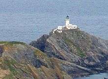
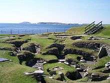
The islands all fall within the Shetland Islands Council local authority. They have been continuously inhabited since Neolithic times and experienced Norse rule for several centuries, the first written records being the Norse sagas.[3][9] The excavations at Jarlshof near the southern end of the Mainland have provided archaeological evidence of life in Shetland since Bronze Age times and the annual Up Helly Aa fire festivals are a living reminder of Shetland's Viking past.[10][11][12] The archipelago is exposed to wind and tide and there are numerous lighthouses as an aid to navigation.[13] A small wind farm on Shetland recently achieved a world record of 58% capacity over the course of a year.[14] The indigenous Shetland ponies are reputed for their strength and hardiness.[9]
Main list


The Scalloway Islands are a small archipelago at the entrance to Weisdale Voe in the South West. The North Isles is the name given to the group including Yell, Unst and Fetlar. There are also numerous islands in Yell Sound between the Mainland and Yell and in St. Magnus Bay to the west, especially near the strait of Swarbacks Minn, but the number and diverse locations of the Shetland islands makes further classification difficult.
Records for the last date of settlement for the smaller uninhabited islands are incomplete, but all of the islands listed here would have been inhabited at some point during the Neolithic, Pictish or Norse periods.
'Ward' appears regularly as the name of the highest point on the island. The derivation of the name is from those high places being used for the lighting of warning beacons.[15]
The total population of the archipelago was 21,988 in 2001[16] and had grown to 23,167 by the time of the 2011 census.[17]
| Island | Location | Area (ha)[18] | Population[17] | Last inhabited[19] | Highest point[20] | Height (m)[21] |
|---|---|---|---|---|---|---|
| Balta | North Isles | 80 | 0 | Norse times or later | Muckle Head | 44 |
| Bigga | Yell Sound | 78 | 0 | 1930s | 34 | |
| Bressay | East of Lerwick | 2805 | 368 | Ward of Bressay | 226 | |
| Brother Isle | Yell Sound | 40 | 0 | 1820s? | 25 | |
| Bruray | Out Skerries | 55 | 24 | Bruray Ward | 53 | |
| East Burra | Scalloway Islands | 515 | 76 | Easter Heog | 81 | |
| Fair Isle | Outlier | 768 | 68 | Ward Hill | 217 | |
| Fetlar | North Isles | 4078 | 61 | Ward Hill | 158 | |
| Foula | Outlier | 1265 | 38 | The Sneug | 418 | |
| Hascosay | Colgrave Sound, Yell | 275 | 0 | 1850s | 30 | |
| Hildasay | Scalloway Islands | 108 | 0 | 1890s | 32 | |
| Housay | Out Skerries | 163 | 50 | North Hill | 53 | |
| Lamba | Yell Sound | 43 | 0 | unknown | 35 | |
| Linga near Muckle Roe | Swarbacks Minn | 70 | 0 | unknown | 69 | |
| Linga | Bluemull Sound, Yell | 45 | 0 | unknown | 26 | |
| Mainland | Mainland | 96879 | 18765 | Ronas Hill | 450 | |
| Mousa | East of Mainland | 180 | 0 | 1841-60 | Mid Field | 55 |
| Muckle Roe | Swarbacks Minn | 1773 | 130 | Mid Ward | 172 | |
| Noss | Bressay | 343 | 0 | 1930s | Noup of Noss | 181 |
| Oxna | Scalloway Islands | 68 | 0 | 1901–1930 | Muckle Ward | 38 |
| Papa | Scalloway Islands | 59 | 0 | 1891–1930 | 32 | |
| Papa Little | Swarbacks Minn | 226 | 0 | 1840s | North Ward | 82 |
| Papa Stour | St Magnus Bay | 828 | 15 | Virda Field | 87 | |
| Samphrey | Yell Sound | 66 | 0 | 1841–1880 | 29 | |
| South Havra | Scalloway Islands | 59 | 0 | 1923 | 42 | |
| Trondra | Scalloway Islands | 275 | 135 | 60 | ||
| Unst | North Isles | 12068 | 632 | Saxa Vord | 284 | |
| Uyea, Northmavine | North Mainland | 45 | 0 | unknown | 70 | |
| Uyea, Unst | North Isles | 205 | 0 | 1931-60 | The Ward | 50 |
| Vaila | Gruting Voe | 327 | 2 | East Ward | 95 | |
| Vementry | Swarbacks Minn | 370 | 0 | 1840s | Muckle Ward | 90 |
| West Burra | Scalloway Islands | 743 | 776 | Hill of Sandwick | 65 | |
| West Linga | Whalsay | 125 | 0 | late 18th century | 52 | |
| Whalsay | Whalsay | 1970 | 1061 | Ward of Clett | 119 | |
| Yell | North Isles | 21211 | 966 | Hill of Arisdale | 210 |
Smaller islets and skerries


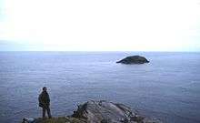
This is a continuing list of uninhabited smaller Shetland islands, tidal islets only separated at higher stages of the tide, and skerries which are only exposed at lower stages of the tide. Many of these islets are called "Holm" from the Old Norse holmr, meaning a "small and rounded islet". "Swarta Skerry" (Old Norse:' svartar sker) - "black skerry" is also a common name, as are "Linga", meaning "heather island", "Taing" (Old Norse: tangi) meaning "tongue" and "Flaesh" (Old Norse: fles) meaning "flat skerry".[22] "Hog" and "calf" are used to indicate a small island, usually adjacent to a larger one.
Surrounding the mainland
- North-east Mainland:[a] Bronga, Flat Stack, Green Isle, Hamera Head, Hellam, Hog Island, Linga near Samphrey, Little Holm, Longa Skerry, Mid Head, Muckle Holm, Muckle Stack, Quilsa Taing, Sandrift Skerries, Scarve Skerry, Skerry of Lunning, Stack of the Skersons, Stany Hog, Swarta Skerry (3), Taing.
- South Nesting Bay:[b] Climnie, Corn Holm, Cunning Holm, Fiska Skerry, Haerie, Holm of Skellister, Inner Voder, Linga Skerries, Litla Billan, Muckla Billan, Muckle Fladdicap, South Holm, Spentlie Holm.
- East Mainland:[c] Aiplin, Aswick Skerries, Brethren, Eswick Holm, Gult Holm, Holm of Califf, Holms of Vatsland, Hoo Stack, Little Holm, North Isle of Gletness, South Holm, South Isle of Gletness, Stacks of Vatsland, Stunger, Tainga Skerry.
- South Mainland:[d] Balla Skerry, Big Kiln, Big Skerry, Black Skerry, Broad Stack, Clocki Stack, Colsay, Deda Skerry, Great Skerry, Hog of the Holm, Hog of the Ness, Holm of Helliness, Holm of Sound, Horse Holm, Lady's Holm, Little Holm, Little Tind, Longa Skerry, Loos Laward, Lyoonigie Skerry, Muckle Hallitie, Ord Skerries, Ripack Stack, Scarfa Skerry, Scarfi Skerry, Scarf Taing, Scottle Holm, Seli Stack, Skerries of Longi-geo, Skerries of Sunngeo, Skerry of Okraquoy, Skersan, Skersund Skerry, Stack of Baronsgeo, Stack of Billyageo, Stack of Okraquoy, Stack of Otter Geo, Starling Rock, Swarta Skerry, The Moul, Wester Skerry, Whale Back.
- St Ninian's Isle: Coar Holm, Fora Stack, High Herbi Clett, Hevda, Hich Holm, Inns Holm, Loose Head, Sand Skerry, Sweyn Holm.
- South West Mainland:[e] Billia Cletts, Black Skerry, Burwick Holm, Cure Holm, Griskerry, Holm of Maywick, Hoove Holm, Housensellar, Kirk Skerry, Little Fogla Stack, Sheep-pund, The Skerry.
- Weisdale Voe:[f] Flotta, Greena, Havra Skerry, Holm of Quoyness, Holms of Hogaland, Hoggs of Hoy, Hoy, Ingra Pund, Junk, North Havra, Scarf Stane, Silver Skerry.
- Walls and Sandness:[g] Aaskerry, Aaskery Taing, Berga Stack, Bousta Skerries, Braga, Broch of West Burrafirth, Brough Skerries, Buid Stacks, Burga Stacks, Burnant Stack, Clett (2), Cley Stacks, Crabba Skerry, Daa Skerry, Erne's Stack (2), Fore Holm, Galta Skerry, Galta Stack, Giltarump, Grava Skerries, Groni Stack, Grossa Stack, Holm of Gruting, Holm of Sefster, Isle of West Burrafirth. Kirk Holm, Lang Stack, Litla Stack, Little Flaes, Long Skerry, Moo Stack, Muckle Flaes, Muman Skerry, Neean Skerry, Riv Skerries, Rusna Stacks, Seli Stack, Skerries of Easter Pail, Skerries of Tunasdaal, Skerries of Watsness, Skerry of Dale, Skerry of Stool, Skerry of the Wick, Snap, Swaaba Stack, Tainga Skerries, The Bak, The Heag, The Peak, Trea Wick, Turl Stack.
- Swarbacks Minn & Olna Firth:[h] Burgastoo, Green Holm, Heathery Holm, Holm of Burrafirth, Inga's Holm, Oggar Holm, Skult.
- Northmavine:[i] Black Skerry, Black Skerry of Ramnageo, Burroo Stacks, Dore Holm, Egilsay, Eina Stack, Gill Stack, Gruna Stack, Holm of Culsetter, Isle of Gunnister, Isle of Nibon, Isle of Niddister, Isle of Westerhouse, Little Ossa, Moo Stack (2), Muckle Ossa, Nista Skerries, Scarf Skerry, Skerry of Eshaness, Isle of Stenness, Stivva, Swart Skerry, Targies, The Bruddans, The Drongs, The Hogg, The Runk.
- North Roe:[j] Buska Stack, Burka Stack, Fugla Ness, Galti Stack (2), Gruna Stack, Hevda Skerries, Inner Booth, Little Gruna Stacks, Longa Skerry, Moo Stack, Munga Skerries, Nista Skerries, Outer Booth, Ship's Stone, Skerries of Fuglaness, Skerry of Skersound, Stack of Sumra, Stack of Weinnia-neep, Stuack, The Cleiver, The Hog, The Roodrans, The Stab, Troll Kona Stack, Valti Stack, Wilma Stack.
- Gruney and the Ramna Stacks: Barlcudda, Fladda, Flae-ass, Gaut Skerries, Hyter, Ofoora, Outer Stack, Scordar, The Club, Turla.
- Yell Sound and Sullom Voe:[k] Bark Stack, Billia Skerry, Fish Holm, Little Roe, Longa Skerry, Lunna Holm, Meokame Skerry, North Holm of Barravoe, Outer Skerry, Pund of Barravoe, Sand Skerry, Setter Holm, Sinna Skerry, Skea Skerry, South Holm of Burravoe, Stack of Stavgeo, The Castle, The Flaess, The Neap, Trolla Stack, Trunka, Ungam, Wether Holm.
a. ^ Lunna Holm to The Keen. b. ^ The Keen to Moul of Eswick. c. ^ Moul of Eswick to Easter Rova Head by Lerwick. d. ^ Easter Rova Head to St Ninian's Isle. e. ^ St Ninian's Isle to Usta Ness. f. ^ Usta Ness to Fora Ness. g. ^ Fora Ness to Face of Neeans. h. ^ Face of Neeans to Roe Sound. i. ^ Roe Sound to The Faither. j. ^ The Faither to Point of Fethaland. k. ^ Point of Fethaland to Lunna Holm.
Surrounding other islands


In the vicinity of:
- Bigga; Sigga Skerry, Uynarey.
- Brother Isle; Stoura Baa, Tinga Skerry.
- Bressay; Flada Cap, Fugla Skerry, Holm of Beosetter, Holm of Cruester, Holm of Gunista, Holm of Mel, Holm Skerry of Beosetter, Inner Score, Loofa Baa, Outer Score, Stoura Clett.
- East Burra; Holm of Hous, Holm of Papil, Peerie Hom of Clett, Scark Skerry, Stacks of Houssness, Taing of Symbister.
- Fair Isle; Breiti Stack, Fogli Stack, Hoiliff, Lang Cole, Oa Stack, Point Saider, Stacks of Skroo, Swabi Cole, The Burrian, The Criv, The Fless, The Keels, The Skerry.
- Fetlar; Braga, Calf of Daaey, Daaey, Outer Brough, Ruir Holm, Scarf Skerry, Stacks of Scambro, Stany Holm, The Flaeshins, The Fludir, Urie Lingey.
- Foula; Arvra Skerry, Blobrick, Da Baas o Stremness, Da Buddle Stane, Da Gloor, Da Rippack Stack, Da Sheepie, Da Skerries o da Rokness, Da Skerry o Hellabrik, Gaada Stack, Hesti Geo, Muntavie Stack.
- Hildasay; Easter Score Holm, Hogg of Linga, Hoe Skerry (east), Hoe Skerry (north), Langa, Linga, Lunga Skerries, North Score Holm, Sanda Little, Sanda Stour, Swarta Skerry, The Nev, The Skerry, The Skult.
- Mousa; Perie Bard.
- Muckle Roe; Burks Skerries, Crog Holm, Lee Skerries, Lothan, Murbie Stacks, Riding Stack, Spindle, Swabi Stack, Tame Holm.
- Noss; Holm of Noss.
- Out Skerries; Billia Skerry, Bound Skerry, Easter Skerry, Filla, Flat Lamba Stack, Grunay, Hevda Skerries, Horn Skerry, Lamba Stack, Little Bound Skerry, Little Skerry, Long Guen, Muckle Skerry, North Benelip, Old Man's Stack, Short Guen, South Benelip, Swaba Stack, Tamma Skerry, The Hogg, Vongs, Wether Holm.
- Oxna; Bullia Skerry, Bulta, Bulta Skerry, Burrian, Cheynies, Hogg of Oxna, Retta Skerries, Spoose Holm, Steggies.
- Papa; Hogg of Papa, Papa Skerry, Skerry of Bag, West Head of Papa.
- Papa Stour; Aesha Stack, Boinna Skerry, Borse Skerry, Brei Holm, Fogla Skerry, Forewick Holm, Galti Stacks, Holm of Melby, Koda Skerry, Lyra Skerry, Maiden Stack, Skerries of Quidaness, Skerry of Lambaness, Sula Stack, Swat Skerry, The Horn, Tiptans Skerry, Wilma Skerry.
- Ve Skerries: Helliogoblo, North Skerry, Ormal, Reaverack, The Clubb.
- South Havra: Little Havra.
- Trondra: Black Skerry, Burland Skerry, Green Holm, Merry Holm, Skervie Skerry, Whaleback Skerry.
- Unst; Baa Skerries, Braava Skerries, Brindacks, Brough Holm, Crickie's Chair, Cudda Stack, Flodda Stack, Haaf Gruney, Hevda Skerry, Hinda Stack, Holm of Heogland, Holm of Skaw, Humla Stack, Huney, Hunts Holm, Inner Flaess, Lang Holm, Leegal Skerry, Little Flugga, Littlewick Stack, Longa Stacks, Muckle Flugga, Neapna Stack, North Croga Skerry, North Holms, Out Stack, Reasings, Round Holm, Rumblings, Ruskock, Sound Gruney, South Croga Skerry, South Holms, Stackingro, Stackins-hocka, Stacks of Poindie, The Buss, The Greing, The Taing, Tipta Skerry, Tonga Stack, Tooa Stack, Tooral Stack, The Trinks o' Clave, The Vere, Urda Stack, Vesta Skerry, Whid Stack, Wilna Stack, Wurs Stack.
- Uyea, Northmavine: Big Nev, Dorra Stack, Little Nev, Out Shuna Stack, Robert Irvine's Skerry, The Burrier.
- Uyea, Unst: Cliva Skerries, Scarf Stack, Wedder Holm.
- Vaila: Burrier Stacks, Gaada Stacks, Gluibuil, Holm of Breibister, Holm of Burrastow, Holm of Scapness, Humla Stack, Gluibuil, Linga, Skerries of Linga, Stack of the Cuillian.
- Vementry: Black Stane, Gruna, Holms of Uyea-sound, Linga, Skewart Holm, Swaba Stacks, Swarbacks Skerry, The Heag.
- West Burra: Atla Holm, Black Stacks, Fugla Stack, Inner Skerry, Muckle Skerry, Red Skerries, Stack of Sandwick, Trondra Skerry, Ukna Skerry, West Skerry.
- West Linga: Beilla Skerry, Bruse Holm, Calf of Linga, Calf of Little Linga, Calf of Score Holm, Hunder Holm, Kettil Holm, Little Linga, Longa Skerry, Marra Flaeshins, Score Holm, Swarta Skerry, The Flaeshans, Wether Holm.
- Whalsay; Flaeshans of Sandwick, Holm of Sandwick, Inner Holm of Skaw, Isbister Holm, Mooa, Nacka Skerry, Nista, Outer Holm of Skaw, Sava Skerry, Skate of Marrister, Trota Stack.
- East Linga; Burlastack of Rumble, Calf of Linga, Flaeshans of Rumble, Grif Skerry, Longa Skerries, Longa Stack, Rumble, Swarta Skerries.
- Yell; Aastack, Bigga, Black Skerry, Brother Isle, Brough, Burravoe Chest, Fish Holm, Gloup Holm, Gold Skerry, Green Holm, Grey Stack, Holm of West Sandwick, Horns of the Roc, Kay Holm, Linga, Muckle Holm, Neapaback Skerries, Orfasay, Outsta Ness, Rug, Skerry Wick, Stacks of Stuis, Sweinna Stack, The Clapper, The Quidin, Whalegeo Stacks, Whilkie Stack.
Tidal islands
St Ninian's Isle is connected to Mainland Shetland by the largest active tombolo in the United Kingdom. Although the 'isle' is greater than 40 hectares in size it fails to meet the definition of an island used in this list as it is only surrounded by water during occasional spring tides and storms.[23]
At spring tides The Huney also has a tombolo that connects it to Unst.
Marilyns
| Peak | Height (m) | Prom. (m) | Col (m) | Grid ref. | Parent | Island |
|---|---|---|---|---|---|---|
| Ronas Hill | 450 | 450 | Sea | HU305835 | none | Mainland |
| The Sneug | 418 | 418 | Sea | HT947395 | none | Foula |
| Royl Field | 293 | 287 | 6 | HU396285 | Ronas Hill | Mainland |
| Saxa Vord | 284 | 284 | Sea | HP631167 | none | Unst |
| Fitful Head | 283 | 270 | 13 | HU346135 | Royl Field | Mainland |
| Scalla Field | 281 | 266 | 15 | HU389572 | Royl Field | Mainland |
| Sandness Hill | 249 | 226 | 23 | HU191557 | Scalla Field | Mainland |
| Ward of Bressay | 226 | 226 | Sea | HU502387 | none | Bressay |
| Ward Hill | 217 | 217 | Sea | HZ208734 | none | Fair Isle |
| Hill of Arisdale | 210 | 210 | Sea | HU495842 | none | Yell |
| Dalescord Hill | 252 | 203 | 49 | HU393684 | Scalla Field | Mainland |
| Valla Field | 216 | 201 | 15 | HP584078 | Saxa Vord | Unst |
| Noss Head | 181 | 181 | Sea | HU553399 | none | Noss |
| The Noup | 248 | 179 | 69 | HT954375 | The Sneug | Foula |
| Scrae Field | 216 | 178 | 38 | HU417361 | Royl Field | Mainland |
| Mid Ward | 172 | 172 | Sea | HU320652 | none | Muckle Roe |
| Ward of Scousburgh | 263 | 166 | 97 | HU388188 | Royl Field | Mainland |
| Vord Hill | 159 | 159 | Sea | HU622935 | none | Fetlar |
| White Grunafirth | 173 | 155 | 18 | HU275807 | Ronas Hill | Mainland |
See also
- List of Orkney islands
- List of Outer Hebrides
- List of islands of Scotland
- North Sea islands
- List of islands called Linga
- Geology of Scotland
- Geography of Shetland
- Shetland population
References and footnotes
- General references
- Haswell-Smith, Hamish. (2004) The Scottish Islands. Edinburgh. Canongate. ISBN 1-84195-454-3
- General Register Office for Scotland (28 November 2003) Scotland's Census 2001 – Occasional Paper No 10: Statistics for Inhabited Islands. Retrieved 26 February 2012.
- Ordnance Survey 1:25,000 Maps Get-a-map. ordnancesurvey.co.uk Retrieved 15 January 2008.
- Schei, Liv Kjørsvik (2006) The Shetland Isles. Grantown-on-Spey. Colin Baxter Photography. ISBN 978-1-84107-330-9
- Specific references and notes
- ↑ Various other definitions are used in the Scottish context. For example the General Register Office for Scotland define an island as 'a mass of land surrounded by water, separate from the Scottish mainland' but although they include islands linked by bridges etc. this is not clear from this definition. Haswell-Smith (2004) uses 'an Island is a piece of land or group of pieces of land which is entirely surrounded by water at Lowest Astronomical Tide and to which there is no permanent means of dry access'. This is widely agreed to be unhelpful as it consciously excludes bridged islands.
- ↑ Haswell-Smith (2004) page 460.
- 1 2 "Walk in Scotland: Orkney and Shetland" Visit Scotland. Retrieved 15 July 2007.
- ↑ "Mavis Grind" Gazetteer for Scotland. Retrieved 28 July 2007.
- ↑ Gillen, Con (2003) Geology and landscapes of Scotland. Harpenden. Terra. Pages 90-1.
- ↑ Keay, J. & Keay, J. (1994) Collins Encyclopaedia of Scotland. London. HarperCollins.
- ↑ "Study Sees North Sea Tsunami Risk" Speigel Online. Retrieved 28 July 2007.
- ↑ Bondevik, Stein; Dawson, Sue; Dawson, Alastair; Lohne, Øystein (5 August 2003). "Record-breaking Height for 8000-Year-Old Tsunami in the North Atlantic" (PDF). EOS, Transactions of the American Geophysical Union. 84 (31): 289, 293. Bibcode:2003EOSTr..84..289B. doi:10.1029/2003EO310001. Retrieved 15 January 2007.
- 1 2 "A History of Shetland" Visit Shetland. Retrieved 25 July 2007.
- ↑ Haswell-Smith (2004) p. 437
- ↑ Schei (2006) pp. 198-99
- ↑ "Up Helly Aa 1998" up-helly-aa.org.uk. Retrieved 11 August 2007.
- ↑ "Lighthouse Library" Northern Lighthouse Board. Retrieved 9 May 2012.
- ↑ "Burradale Wind Farm Shetland Islands" REUK.co.uk. Retrieved April 2007. This record is claimed by Burradale windfarm located just a few miles outside Lerwick and operated by Shetland Aerogenerators Ltd. Since opening in 2000 with three Vestas V47 660 kW turbines, this wind farm has had an average capacity factor of 52% and, according to this report, in 2005 averaged a world record 57.9%.
- ↑ "Orkney Placenames - natural features" Orkneyjar.com. Retrieved 15 July 2007.
- ↑ General Register Office for Scotland (28 November 2003) Scotland's Census 2001 – Occasional Paper No 10: Statistics for Inhabited Islands. Retrieved 26 February 2012.
- 1 2 National Records of Scotland (15 August 2013) (pdf) Statistical Bulletin: 2011 Census: First Results on Population and Household Estimates for Scotland - Release 1C (Part Two). "Appendix 2: Population and households on Scotland’s inhabited islands". Retrieved 17 August 2013.
- ↑ Haswell-Smith (2004) save those indicated with an asterisk, which are estimates based on Ordnance Survey maps and General Register Office for Scotland (2003) statistics.
- ↑ For uninhabited islands indicates the last known date of permanent, year round settlement. Information is from Haswell-Smith (2004) save those indicated with a separate footnote.
- ↑ Haswell-Smith (2004) and Ordnance Survey maps.
- ↑ Ordnance Survey maps. Note that the maps mark the height above sea level of an elevated place on most islands, but in a small number of cases, this may not be the highest point.
- ↑ Waugh, Doreen J., Orkney Place-names in Omand, Donald (ed.) (2003) The Orkney Book. Edinburgh, Birlinn. Page 119.
- ↑ "St Ninian's Isle" Shetlopedia. Retrieved 3 March 2008.
