La Bocayna
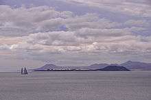
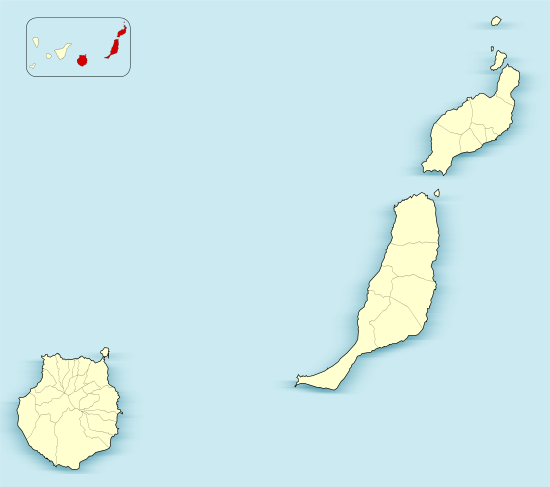
La Bocayna or La Bocaina (Spanish: Estrecho de la Bocaina) is the name given to the sea strait that separates Lanzarote from Fuerteventura in the Canary Islands.The small island of Lobos is situated on the southern side of the strait, close to Fuerteventura.[1][2]
In the 19th century, the strait was known as a safe anchorage with a sandy bottom, which shelved gradually towards Lanzarote with depths of up to five fathoms. The shore around Lobos was less hospitable, being ‘foul and rocky’. A steady trade wind could be found in the strait, although it was blocked by the hills of Lanzarote, becalming ships that were in their lee, tacking towards Lobos was needed to regain the wind.[3]
Large breakers were observed by one ship’s captain, produced by a heavy westerly swell. Waves up to 18 metres (60 ft) high were seen breaking on the northern point of Lobos, the sound of the waves could be heard up to six or seven leagues away.[3]
Lighthouses
The strait is marked by a number of lighthouses including Punta Martiño on Lobos, Pechiguera at the south western end of Lanzarote, and Tostón on the north western side of Fuerteventura.[4]
Ferry
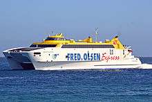
A high speed ferry service runs across the strait, using the aptly named catamaran, Bocayna Express, the crossing time is 20 minutes. The Fred. Olsen Express line has operated the service since 2003 between Playa Blanca in Lanzarote and Corralejo in Fuerteventura.[5]
Open water swimming
The Travesia La Bocaina is an annual open water swimming endurance event that crosses the strait. Depending on the speed of the swimmers it can take between five and eight hours to complete the swim from Playa Blanca to Corralejo, over a distance of 15km.[6]
References
- ↑ La Bocayna can be found at GEOnet Names Server, at this link, by opening the Advanced Search box, entering " -386561 " in the "Unique Feature Id" form, and clicking on "Search Database".
- ↑ Google (7 January 2015). "Bocayna" (Map). Google Maps. Google. Retrieved 7 January 2015.
- 1 2 John Purdy (1825). Memoir, Descriptive and Explanatory: To Accompany the New Chart of the Atlantic Ocean and Comprising Instructions, General and Particular, for the Navigation of that Sea. R.H. Laurie. pp. 213–214.
- ↑ "Museum of Traditional Fishing". Museums. artesaniaymuseosdefuerteventura.org. Retrieved 10 January 2015.
- ↑ John May; William Mayes (1 May 2004). Ferries: Southern Europe. Overview Press Ltd. p. 65. ISBN 978-0-9547206-0-5.
- ↑ "Travesia La Bocaina". Swim Crossing. b15active.com. Retrieved 11 January 2015.
External links
![]() Media related to La Bocayna at Wikimedia Commons
Media related to La Bocayna at Wikimedia Commons
Coordinates: 28°48′N 13°48′W / 28.8°N 13.8°W