Lobos Island
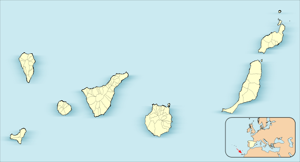
 Map of Fuerteventura showing Lobos | |
 Lobos | |
| Geography | |
|---|---|
| Archipelago | Canary Islands |
| Area | 4.679 km2 (1.807 sq mi) |
| Highest elevation | 127 m (417 ft) |
| Administration | |
| Autonomous Community | Canary Islands |
| Province | Las Palmas |
| Municipality | La Oliva |
| Demographics | |
| Population | 0 (2013) |

Lobos (Spanish: Isla de Lobos,[1] pronounced: [ˈizla ðe ˈloβos]) is a small island of the Canary Islands (Spain) located just 2 kilometres (1 mile) north of the island of Fuerteventura. Politically it belongs to the municipality of La Oliva on the island of Fuerteventura. It has an area of 4.68 square kilometres (1.8 sq mi). It has been a nature reserve (Parque Natural del Islote de Lobos) since 1982.[2][3]
The island is accessible to tourists via a short ferry ride from Corralejo, in the north of Fuerteventura. It has day facilities and weekend homes of local fishermen. At the northeastern end of the island is the Punta Martiño Lighthouse, the lighthouse keeper and his family were the last permanent inhabitants of Lobos, until the light was automated in the 1960s.

In 1405, Lobos Island served as resupply base for Jean de Béthencourt's conquest of Fuerteventura.
Origin of name
Lobos Island (Wolves Island) was named for the large number of sea wolves, also called monk seals, that once lived there. The monk seals were the island's only inhabitants when it was discovered by the Spanish conquerors of the Canaries archipelago in the fifteenth century, but with the arrival of man, these animals were hunted on a massive scale by sailors and fishermen who saw them as a source of food, fat and skin. As a result of this hunting, the species eventually became extinct on the island and its presence now is only occasional.
Geography
Lobos Island, like the rest of the Canary Islands, is a volcanic island. Its age is estimated between 6,000 and 8,000 years. The highest point is on the island's volcanic caldera, Montaña La Caldera, 127 metres (417 feet) above sea level. The island includes a small lake, but the low rainfall creates an arid landscape.
Fauna and flora
Despite being a desert and a volcanic landscape, Lobos Island has a large number of natural habitats. There are over 130 plant species, including the siempreviva - endemic island-, the Sea Uvilla, or White Caleton which is very attractive because of its shape and color.
Likewise, birds are an important feature of the island: it has a great variety of seabirds that usually nest on cliffs and rocks. Among these species are the shearwater Cinderella, little shearwater and the herring gull. Also in residence are the storm petrel, Bulwer's petrel and yellow-legged gull. In addition to birds a great diversity of fish can be spotted in its waters. Of these abound old fish (Canarian fish), barracuda, hammerhead shark, bream and striped fish.
Because of its great ecological diversity the site has been designated as a protected zone, the Parque Natural del Islote de Lobos. It has also been declared a special protection area (SPA) for birds.
History
Recent archaeological findings have concluded that Ancient Rome established a (possibly seasonal) settlement in the island, related with the obtention of purple dye.[4]
In 1405 Lobos Island served as resupply base for Jean de Béthencourt´s conquest of Fuerteventura. Until 1968 the only inhabitants of the island were the lighthouse keeper and his family, who had the responsibility for operating the Faro de Lobos lighthouse located at Punta Martiño at the northern tip of the island, a prominent local landmark (his name was Antoñito. A school in the town of Corralejo was named after him). The island was one of the first natural areas of the Canary Islands to be designated as a natural park in 1982. Later the island was also designated an area of special protection for birds, and many marine species of migratory birds inhabit the island.
Tourism
The island is a popular location for day trips for tourists visiting from Fuerteventura who have an interest in flora, fauna and geology.[5] Regular boat services ferry passengers from Corralejo harbour during daylight hours. To protect the natural landscape from human impact, access is limited to restricted areas and to a series of walking trails, marked by directional signs to protect the conservation areas. The paths take visitors from the boat jetty through a varied landscape, including to the lighthouse at Punto Martino and to the top of the caldera. There is a small, sheltered sea lagoon, Playa de la Concha, with a sandy beach for bathing.
Visitors can ask for authorisation from Fuerteventura local government's environment office to camp on the island, for a maximum of three nights, in one permitted location known as "El carpintero" (the carpenter's).
Gallery
 Lobos Island's small lagoon, Playa de la Concha
 Lobos Island's Playa de la Concha, looking to Punta Saladero
 Lobos Island interior
 Lobos Island interior detail
 Lobos Island typical soil
- Lobos Island buildings

References
- ↑ Literally translating as "Wolves Island", the name refers to the Mediterranean monk seal, which was known locally as lobo marinero ("sea wolf", compare sea-"lion"). These animals are now extinct in the Canaries.
- ↑ Protected Natural Areas
- ↑ Boletín Oficial de Canarias, pages 9715 and 9851-2
- ↑ In Spanish: ¿Llegaron los romanos a las Islas Canarias? (El Diario Montañés)
- ↑ Noel Rochford (2007). Landscapes of Fuerteventura, A Countryside Guide, 4th edition. Landscapes of Fuerteventura, A Countryside Guide. Sunflower Books.
- R. Pott, J. Hüppe, W. Wildpret de la Torre, Die Kanarischen Inseln. Natur- und Kulturlandschaften, Ulmer Eugen Verlag, 2003, ISBN 9783800132843
- Viajes a vela en las Islas Canarias, España ~ turismo vela: Isla de Lobos. Accessed on October 3, 2010
- Isla de Lobos. Islas Canarias. Fuerteventura. Accessed on October 3, 2010
External links
 Media related to Isla de Lobos (Spain) at Wikimedia Commons
Coordinates: 28°44′53″N 13°49′19″W / 28.748°N 13.822°W
