Jericho, Oxford
| Jericho | |
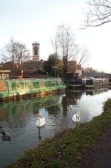
 Jericho and the tower of St Barnabas Church seen from the Oxford Canal |
|
 Jericho |
|
| OS grid reference | SP504069 |
|---|---|
| Civil parish | unparished |
| District | Oxford |
| Shire county | Oxfordshire |
| Region | South East |
| Country | England |
| Sovereign state | United Kingdom |
| Post town | Oxford |
| Postcode district | OX2 |
| Dialling code | 01865 |
| Police | Thames Valley |
| Fire | Oxfordshire |
| Ambulance | South Central |
| EU Parliament | South East England |
| UK Parliament | Oxford West and Abingdon |
| Website | Oxford City Council |
|
|
Coordinates: 51°45′32″N 1°16′05″W / 51.759°N 1.268°W
Jericho is an historic suburb of the English city of Oxford.[1] It consists of the streets bounded by the Oxford Canal, Worcester College, Walton Street and Walton Well Road. Located outside the old city wall, it was originally a place for travellers to rest if they had reached the city after the gates had closed. The name Jericho may have been adopted to signify this 'remote place' outside the wall.[2]
History
This was originally an industrial area which grew up because of its proximity to the Oxford Canal, which arrived in 1790. The Eagle Ironworks (now redeveloped into apartments), wharves and the Oxford University Press were based there and its residential streets are mostly 'two-up, two-down' Victorian workers' houses. With back streets of 19th century terraced housing and many restaurants, it has become a popular area for student and London commuter accommodation.
Many reports from the 1870s suggest that early homes in Jericho were built with very poor drainage. Low-lying land and lack of basic drainage in these homes would result in flooding. Flooding, open sewers, and overcrowding resulted in deaths from diseases such as typhoid and dysentery, with five out of eleven typhoid deaths in 1873 originating from Jericho.[3]
In the 1950s, Jericho was briefly a red light area, and in the early 1960s there were plans to demolish it and replace it with light industrial units and new housing. However, many people objected and campaigned to save this historic area, rallied by local city councillor Olive Gibbs and the Jericho Residents Association. As a result, the plans were changed. Those houses beyond repair were demolished, but many others were upgraded in the late 1960s and early 1970s with the help of council grants. This encouraged many young professionals and families to move in; and subsequently Jericho became one of Oxford's most sought-after areas. Large council and social housing developments were built in the 1970s and 1980s.
Community
Jericho retains a strong community spirit. The Jericho Community Association runs the Jericho Community Centre[4] in Canal Street, maintains the community website, Jericho Online,[5] publishes the local newspaper the Jericho Echo[6] and organizes the annual Jericho Street Fair which is held in mid-June each year, around the feast day of the patron saint Barnabas (11 June). It is also the focus for other community activities and has also been very active in campaigning for responsible development of the canal-side land behind St Barnabas Church, on a part of which it plans to build a new Community Centre. It is served by a primary school, St Barnabas Primary School, a large primary school where over 50% speak English as a second language.
Appropriately for its biblical name, Jericho is also known for its iconic places of worship. The Church of England parish church is the Anglo-Catholic St Barnabas Church,[7] next to the Oxford Canal. St Sepulchre's Cemetery lies off Walton Street, which has no associated church and has lost its chapel. The Albert Street Chapel [8] (Reformed Baptist) is also in the neighbourhood. The Oxford Synagogue (one of the few in England with more than one denomination of Judaism worshipping in the same house) and the Oxford Jewish Centre [9] are in Jericho.
Castlemill Boatyard is a 160-year-old wharf on the canal in Jericho, previously owned by British Waterways and now closed. British Waterways sold the site to a company that subsequently went into administration. The land has yet to be marketed by the administrators. Since the closure of the yard, Jericho Community Boatyard Ltd has been set up to restore services for Oxford boaters and protect the future of Castle Mill Boatyard.
The local cinema has had a number of incarnations. It started in 1913 as the North Oxford Kinema.[10][11] In 1925, it was renamed The Scala. Then in 1970 it was split in two and became Studios 1 and 2, one of which was well known for showing softcore pornography. In 1977, the cinema revived again after being taken over by the London company Contemporary Entertainments and acquired its current name, the Phoenix, showing first-run and art house films.
Jericho in fiction

Thomas Hardy's novel Jude the Obscure has a scene set in St Barnabas Church, and it is possible that the suburb named 'Beersheba' in the novel is based on Jericho.[12] As an homage to Hardy, in 1996, one of Jericho's pubs was renamed Jude the Obscure.
The first episode of the long running ITV drama series Inspector Morse, starring British actor John Thaw, called "The Dead of Jericho", was partially filmed in the streets of Jericho, notably Combe Road (which is 'Canal Reach' in the drama). It also featured the exterior of the Bookbinders Arms public house on the corner of Victor Street. The spin-off show Lewis also has stories based around the same area.
Philip Pullman set parts of his novels Northern Lights and Lyra's Oxford in Jericho. In the books, Jericho is home to the water-dwelling "Gyptians". He has been a vocal advocate of the residential boaters' fight to save the Castlemill Boatyard.[13]
In The Whore's Asylum by Katy Darby (Penguin Group, 2012), the "home for indigent whores" is in Victor Street and the young doctor attending their special medical needs lives in Canal Street. Jericho in 1887 is described (probably inaccurately) as "haunted by drunkards, thieves,and the lowest sort of brazen female as ever lifted her petticoats".
See also
- Art Jericho, a contemporary art gallery
- Jericho Press
- Great Clarendon Street
- Juxon Street
Gallery
-

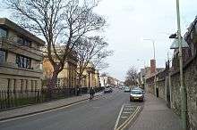
Looking north down Walton Street from the southeast corner of Jericho. Oxford University Press is on the left
-

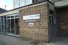
Jericho Health Centre on Walton Street.
-
Jericho Street Fair Stalls.
-
Morris dancers in Cardigan Street.
-
Music outside the Bookbinders pub in Canal Street.
-
Jubilee Street Party, 2012, in Cardigan Street.
References
- ↑ Curl, 1977, pages 149-162
- ↑ Stalker, Peter. (Jericho Online)
- ↑ Kennedy, 1997, page not cited
- ↑ Jericho Community Centre
- ↑ Jericho Online
- ↑ Jericho Echo
- ↑ St Barnabas Church Website
- ↑ The Albert Street Chapel website
- ↑ Oxford Synagogue
- ↑ Hibbert, Christopher, ed. (1988). "Cinemas". The Encyclopaedia of Oxford. Macmillan. pp. 88–89. ISBN 0-333-39917-X.
- ↑ White, Debbie (January 24, 2013). "Jericho cinema to mark centenary". The Oxford Times. p. 29.
- ↑ Jericho Online
- ↑ Portmeadow.org
Sources and further reading
- Chance, Eleanor; Colvin, Christina; Cooper, Janet; Day, C.J.; Hassall, T.G.; Selwyn, Nesta (1979). Crossley, Alan; Elrington, C.R., eds. Victoria County History: A History of the County of Oxford, Volume 4.
- Curl, James Stevens (1977). The Erosion of Oxford. Oxford Illustrated Press Ltd. pp. 149–162. ISBN 0-902280-40-6.
- Kennedy, Julie (1997). The Changing Faces Of Jericho, Book One. Witney: Robert Boyd. ISBN 1-899536-14-0.
- Sherwood, Jennifer; Pevsner, Nikolaus (1974). The Buildings of England: Oxfordshire. Harmondsworth: Penguin Books. pp. 289–291. ISBN 0-14-071045-0.
