Grant Township, Franklin County, Iowa
| Grant Township | |
|---|---|
| Township | |
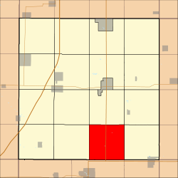 Location in Franklin County | |
| Coordinates: 42°36′01″N 93°12′11″W / 42.60028°N 93.20306°WCoordinates: 42°36′01″N 93°12′11″W / 42.60028°N 93.20306°W | |
| Country | United States |
| State | Iowa |
| County | Franklin |
| Area | |
| • Total | 35.83 sq mi (92.8 km2) |
| • Land | 35.83 sq mi (92.8 km2) |
| • Water | 0 sq mi (0 km2) 0% |
| Elevation | 1,201 ft (366 m) |
| Population (2010)[1] | |
| • Total | 331 |
| • Density | 9.2/sq mi (3.6/km2) |
| Time zone | CST (UTC-6) |
| • Summer (DST) | CDT (UTC-5) |
| ZIP codes | 50041, 50126, 50441, 50601, 50633 |
| GNIS feature ID | 0467937[2] |
Grant Township is one of sixteen townships in Franklin County, Iowa, United States. As of the 2010 census, its population was 331 and it contained 154 housing units.[1]
History
Grant Township was created in 1870.[3]
Geography
As of the 2010 census, Grant Township covered an area of 35.83 square miles (92.8 km2), all land.[1]
Cities, towns, villages
Cemeteries
The township contains Pleasant Hill Cemetery[4] and Saint Peters Evangelical Cemetery.[5]
Transportation
School districts
- Agwsr Community School District
- Hampton-Dumont Community School District
- Iowa Falls Community School District
Political districts
- Iowa's 4th congressional district
- State House District 54
- State Senate District 27
References
- "TIGER/Line Shapefiles". United States Census Bureau.
- 1 2 3 "2010 Census Gazetteer". United States Census Bureau. Retrieved 2014-02-21.
- ↑ "Grant Township, Franklin County, Iowa". Geographic Names Information System. United States Geological Survey. Retrieved 2014-02-21.
- ↑ Stuart, I. L. (1914). History of Franklin County, Iowa: A Record of Settlement, Organization, Progress and Achievement, Volume 1. S. J. Clarke Publishing Company. p. 312.
- ↑ "Pleasant Hill Cemetery". Geographic Names Information System. United States Geological Survey. Retrieved 2014-02-21.
- ↑ "Saint Peters Evangelical Cemetery". Geographic Names Information System. United States Geological Survey. Retrieved 2014-02-21.
External links
 |
Hamilton Township | Reeve Township | Geneva Township | |
| Lee Township | |
Osceola Township | ||
| ||||
| | ||||
| Hardin Township, Hardin County | Etna Township, Hardin County |
Municipalities and communities of Franklin County, Iowa, United States | ||
|---|---|---|
| Cities | ||
| Townships | ||
| CDPs | ||
| Footnotes | ‡This populated place also has portions in an adjacent county or counties | |
This article is issued from Wikipedia - version of the 11/2/2016. The text is available under the Creative Commons Attribution/Share Alike but additional terms may apply for the media files.