Fajã Mata Sete
| Fajã Mata Sete | |
| Debris field (Fajã) | |
| Country | Portugal |
|---|---|
| Autonomous region | Azores |
| Group | Central |
| Island | São Jorge |
| Municipality | Velas |
| Civil parish | Rosais |
| Coordinates | 38°45′16″N 28°18′24″W / 38.75444°N 28.30667°WCoordinates: 38°45′16″N 28°18′24″W / 38.75444°N 28.30667°W |
| Biomes | Temperate, Mediterranean |
| Geology | Alkali basalt, Tephra, Trachyte, Trachybasalt |
| Orogeny | Volcanism |
| Period | Holocene |
| For public | Public |
| Visitation | Accessible by foot, yet restricted during periods of inclement weather |
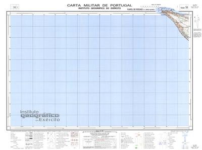
| Geographic detail from Portuguese Army map[1] | |
The Fajã Mata Sete is a permanent debris field, built from the collapsing cliffs on the northern coast of the civil parish of Rosais, in the municipality of Velas, island of São Jorge, in the Portuguese archipelago of the Azores.
History
The fajã has never had a permanent population, the area had several small homes and support buildings to support seasonal visitors. Although a human presence was never constant, the fajãs' great fertility and microclimate, allowed constant cultivation of vineyards, potato, corn, fruit and taro, divided in small plots. Owners of these plots would descend the cliff-face between the months of March and April, to cultivate the land, and returned in September for the harvest. For efficiency, wine was pressed in the fajã using a rudimentary system of stone presses.
In this fajã is a cave, locally called "Furna", which was used as a shelter by visitors descending to the base. It is relatively large, accommodating between 7 or 8 people, many of whom over-nighted in the space. Ferns were laid on the ground to act as bedding, for many fisherman who transited the area or stayed the night.
Formed during the 1 January 1980 earthquake, with the passage of time, the debris field was successively eroded away. By 2012, the actual fajã had disappeared. Due to the faults in the geology, the access to the fajã was restricted, due to its geological instability, resulting in the closure of the lighthouse and restricted access to the area around it.
Geology
Linked by several trails with the plateau of Rosais, it primarily provides access to the area around the Lighthouse of Ponta dos Rosais. The fajã is visible from the edge of the northern area of the Rosais clifftop, and dotted by a few homes interspersed within the thick, local vegetation.
In the bay that formed from the fajã, alongside the Ponta dos Rosais, is a large, geological stack called the Torrão de Açúcar (Tower of Sugar). Its name is derived from the stacks composition, which includes a basalt base surmounted by a softer, red deposits of consolidated pyroclasts.
Biology
The more frequent visitors to the fajã are the nesting families of Shearwaters, gulls and terns, that scale the cliffs of the region.
References
- ↑ Map nr. 14 Farol de Rosais (S. Jorge, Açores) 1:25,000, Instituto Geográfico do Exército, retrieved 1 December 2015