Ewingville, New Jersey
| Ewingville, New Jersey | |
|---|---|
| Unincorporated community | |
|
The main intersection in Ewingville as it appeared in 2016 | |
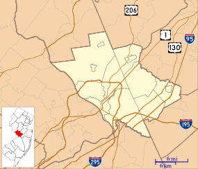
 Ewingville, New Jersey  Ewingville, New Jersey  Ewingville, New Jersey Location of Ewingville in Mercer County Inset: Location of county within the state of New Jersey | |
| Coordinates: 40°16′37″N 74°46′51″W / 40.27694°N 74.78083°WCoordinates: 40°16′37″N 74°46′51″W / 40.27694°N 74.78083°W | |
| Country |
|
| State |
|
| County | Mercer |
| Township | Ewing |
| Elevation[1] | 138 ft (42 m) |
| GNIS feature ID | 876251[1] |
Ewingville is a section of Ewing Township in Mercer County, New Jersey, United States.[2] Located at the intersection of Ewingville Road/Upper Ferry Road and Pennington Road, it is one of the oldest settlements in Ewing Township and dates back to the 18th century. The community was known as Cross Keys before adopting its current name in 1836, two years after the incorporation of Ewing Township in 1834.[3][4]
References
- 1 2 "Ewingville". Geographic Names Information System. United States Geological Survey.
- ↑ Locality Search, State of New Jersey. Accessed January 7, 2015.
- ↑ Jo Ann Tesauro (2002). Images of America: Ewing Township. Arcadia Publishing. p. 8. ISBN 0-7385-1040-8.
Cross Keys/Ewingville was a village with its main intersection at today's Pennington, Ewingville and Upper Ferry Roads. This bustling town was named after William Green's Cross Keys Inn, located on the northeast corner of the intersection in the 1700s.
- ↑ Jo Ann Tesauro (2002). Images of America: Ewing Township. Arcadia Publishing. p. 64. ISBN 0-7385-1040-8.
In the 1700s and part of 1800s, this village was called Cross Keys, as was the hotel at its main intersection. In 1836, after the incorporation of Ewing Township in 1834, the village became known as Ewingville.
This article is issued from Wikipedia - version of the 6/8/2016. The text is available under the Creative Commons Attribution/Share Alike but additional terms may apply for the media files.
_in_the_Ewingville_section_of_Ewing%2C_New_Jersey.jpg)
