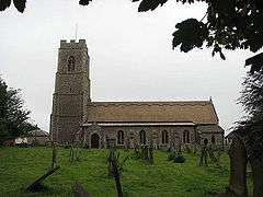
Coltishall
| Coltishall | |
 St John the Baptist, Coltishall |
|
 Coltishall |
|
| Area | 7.27 km2 (2.81 sq mi) |
|---|---|
| Population | 1,503 (2011)[1] |
| – density | 207/km2 (540/sq mi) |
| OS grid reference | TG271197 |
| Civil parish | Coltishall |
| District | Broadland |
| Shire county | Norfolk |
| Region | East |
| Country | England |
| Sovereign state | United Kingdom |
| Post town | NORWICH |
| Postcode district | NR12 |
| Police | Norfolk |
| Fire | Norfolk |
| Ambulance | East of England |
| EU Parliament | East of England |
Coordinates: 52°43′41″N 1°21′43″E / 52.7281°N 1.36189°E
Coltishall is a village (population 2001 - 1,405[2]) on the River Bure, west of Wroxham, in the English county of Norfolk,[3] within the Norfolk Broads. The population at the 2011 Census had increased to 1,503.
History
Coltishall was a place of note even when the Domesday Book was compiled. For 250 years it was a centre of the malting industry. Many Norfolk wherries (trading ships) were built here.
Between 1779 and 1912, it was possible to navigate the River Bure all the way to Aylsham, but now the limit of navigation for powered craft is just south of Coltishall.[4]
The nearby RAF Coltishall played an important role during World War II, and afterwards, but was finally closed in December 2006. The site is now home to HMP Bure.
Horstead watermill on the Coltishall-Horstead river border was one of the most photographed mills in the county until it burned down in 1963.
Notable residents
- John Alen, Archbishop of Dublin, was born in Coltishall in 1476.
- John Alan, Lord Chancellor of Ireland, cousin and namesake of Archbishop Alen, was born in Coltishall about 1500.
Climate
Climate in this area has mild differences between highs and lows, and there is adequate rainfall year round. The Köppen climate classification subtype for this climate is "Cfb". (Marine West Coast Climate/Oceanic climate).[5]
| Climate data for Coltishall, United Kingdom | |||||||||||||
|---|---|---|---|---|---|---|---|---|---|---|---|---|---|
| Month | Jan | Feb | Mar | Apr | May | Jun | Jul | Aug | Sep | Oct | Nov | Dec | Year |
| Average high °C (°F) | 7 (45) |
8 (46) |
10 (50) |
13 (55) |
16 (61) |
19 (66) |
21 (70) |
22 (72) |
19 (66) |
15 (59) |
10 (50) |
7 (44) |
14 (57) |
| Average low °C (°F) | 1 (34) |
1 (34) |
2 (36) |
3 (37) |
6 (43) |
9 (48) |
11 (52) |
11 (52) |
9 (48) |
5 (41) |
2 (36) |
1 (34) |
5 (41) |
| Average precipitation mm (inches) | 48 (1.9) |
43 (1.7) |
43 (1.7) |
43 (1.7) |
41 (1.6) |
61 (2.4) |
53 (2.1) |
61 (2.4) |
64 (2.5) |
69 (2.7) |
74 (2.9) |
66 (2.6) |
665 (26.2) |
| Source: Weatherbase [6] | |||||||||||||
References
- ↑ "Civil Parish population 2011". Neighbourhood Statistics. Office for National Statistics. Retrieved 2 August 2016.
- ↑ Office for National Statistics & Norfolk County Council, 2001. "Census population and household counts for unparished urban areas and all parishes."
- ↑ Ordnance Survey (2005). OS Explorer Map OL40 – The Broads. ISBN 0-319-23769-9.
- ↑ The Canals of Eastern England, (1977), John Boyres and Ronald Russell, David and Charles, ISBN 978-0-7153-7415-3
- ↑ Climate Summary for closest city on record
- ↑ "Weatherbase.com". Weatherbase. 2013. Retrieved on June 4, 2013.
External links
| Wikimedia Commons has media related to Coltishall. |