Col du Grapillon
| Col du Grapillon | |
|---|---|
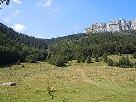
|
View of the east side of the Col du Grapillon | |
| Elevation | 1,509 m (4,951 ft) |
| Location | Savoie, France |
| Range | Chartreuse Mountains |
| Coordinates | 45°27′46″N 5°50′30″E / 45.46278°N 5.84167°ECoordinates: 45°27′46″N 5°50′30″E / 45.46278°N 5.84167°E |
 Col du Grapillon Location of Col du Grapillon | |
The Col du Grapillon (or col de Grapillon) is a mountain pass located 1,509 metres (4,951 ft) above sea level in the Chartreuse Mountains between La Cochette (1,618 metres (5,308 ft)) to the south, and Mont Outheran (1,673 metres (5,489 ft)) to the north[1]
Access
The pass is available only to hikers. It connects Le Désert d'Entremont (Entremont-le-Vieux district) to Saint-Thibaud-de-Couz, and it's the southern access path of the Mont Outheran and northern access path of La Cochette.
References
- ↑ "Fiche (n°2615) de: Col de Grapillon". refuges.info. Retrieved March 6, 2016.
This article is issued from Wikipedia - version of the 3/7/2016. The text is available under the Creative Commons Attribution/Share Alike but additional terms may apply for the media files.