Chullpa Ch'utu
| Chullpa Ch'utu | |
|---|---|
 Chullpa Ch'utu Location in Bolivia | |
| Highest point | |
| Elevation | 3,748 m (12,297 ft) [1] |
| Coordinates | 17°33′19″S 65°34′49″W / 17.55528°S 65.58028°WCoordinates: 17°33′19″S 65°34′49″W / 17.55528°S 65.58028°W |
| Geography | |
| Location |
Bolivia, Cochabamba Department |
| Parent range | Andes |
Chullpa Ch'utu (Quechua chullpa stone tomb, burial tower, ch'utu cone,[2] "chullpa cone", also spelled Chullpa Chutu) is a 3,748-metre-high (12,297 ft) mountain in the Bolivian Andes. It is located in the Cochabamba Department, Arani Province, Vacas Municipality, north of Vacas. The Jatun Mayu ("big river"), a tributary of Parqu Qucha, flows along its western slope.[1][3]
References
Capital: Cochabamba | ||
| Provinces | 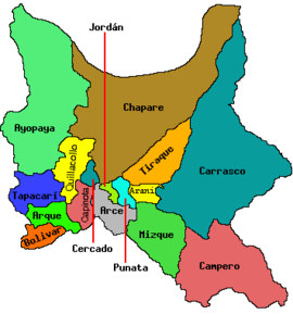 | |
| Municipalities (and seats) |
| |
This article is issued from Wikipedia - version of the 5/5/2016. The text is available under the Creative Commons Attribution/Share Alike but additional terms may apply for the media files.