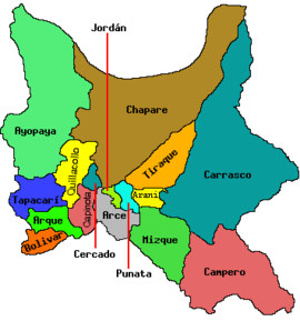
Tacopaya Municipality
| Tacopaya Municipality | |
|---|---|
| Municipality | |
 Tacopaya Municipality Location within Bolivia | |
| Coordinates: BO 17°49′S 66°39′W / 17.817°S 66.650°W | |
| Country |
|
| Department | Cochabamba Department |
| Province | Arque Province |
| Cantons | 2 |
| Seat | Tacopaya |
| Government | |
| • Mayor | Ramon Quispe Mamani (2007) |
| • President | Bacilo Ugarte Medrano (2007) |
| Area | |
| • Total | 218 sq mi (565 km2) |
| Elevation | 13,000 ft (4,000 m) |
| Population (2001) | |
| • Total | 11,658 |
| Time zone | -4 (UTC-4) |
Tacopaya Municipality is the second municipal section of the Arque Province in the Cochabamba Department in Bolivia. Its seat is Tacopaya. At the time of census 2001 the municipality had 11,658 inhabitants.[1]
Geography
Some of the highest mountains of the municipality are listed below:[2][3]
- Chullpa Ch'utu
- Inka Pukara
- Janq'u Jaqhi
- Kuntur Sayana
- Kuntur Wachana
- Mik'ayani
- Millu Wiqu
- Murmuntani
- Pichaqani
- Pukara
- P'ujru P'ujruni
- Silla Q'asa
- Uma P'ujru
- Wila Ch'utu
- Yaritani
Cantons
The municipality is divided into two cantons. They are (their seats in parentheses):
- Tacopaya Canton - (Tacopaya)
- Ventilla Canton - (Ventilla)
Languages
The languages spoken in the Tacopaya Municipality are mainly Quechua and Spanish.[4]
| Language | Inhabitants |
|---|---|
| Quechua | 10,766 |
| Aymara | 123 |
| Guaraní | 3 |
| Another native | 132 |
| Spanish | 3,309 |
| Foreign | 9 |
| Only native | 7,552 |
| Native and Spanish | 3,236 |
| Only Spanish | 74 |
References
- ↑ Instituto Nacional de Estadística Bolivia (INE) 2001 (Spanish)
- ↑ Bolivia 1:100,000 Tarata 3635, Map prepared and published by the Defense Mapping Agency, Hydrographic/Topographic Center, Bethesda, MD
- ↑ "Tacopaya". INE, Bolivia. Retrieved March 30, 2016.
- ↑ obd.descentralizacion.gov.bo / Observatorio Bolivia Democrático (Spanish)
Coordinates: 17°49′00″S 66°39′00″W / 17.8167°S 66.65°W
This article is issued from Wikipedia - version of the 3/30/2016. The text is available under the Creative Commons Attribution/Share Alike but additional terms may apply for the media files.
