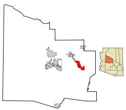
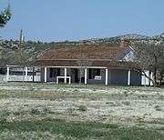
Camp Verde (Yavapai: ʼMatthi:wa; Western Apache: Gambúdih[3]) is a town in Yavapai County, Arizona, United States. According to the 2010 census, the population of the city is 10,873.[1]
The town hosts an annual corn festival in July, sponsored and organized by Hauser and Hauser Farms. Other annual festivals include Fort Verde Days (October); the Pecan, Wine and Antiques Festival (February); and the Crawdad Festival (June).
Geography
The 42.6 sq mi (110 km2) town is intersected by I-17, extending 8 miles (13 km) to the West and 10 miles (16 km) to the East of the interstate. Three freeway exits provide local access: Exits 285, 287, and 289. The Town's Historic Downtown is approximately 1-mile (1.6 km) from I-17 and contains a grocery store, physician facilities, shopping, dining, historical museum, Fort Verde State Historic Park, chamber of commerce/visitor center and town offices. Camp Verde is located at 34°34′0″N 111°51′22″W / 34.56667°N 111.85611°W / 34.56667; -111.85611 (34.566713, -111.856194).[4]
According to the United States Census Bureau, the town has a total area of 42.6 square miles (110 km2), of which, 42.6 square miles (110 km2) of it is land and 0.02% is water. It is in the Verde River valley. To the southwest lie the Black Hills mountain range. Camp Verde is surrounded by Prescott National Forest. The Mogollon Rim is just north of the town and forms the southwestern edge of the large, geologically ancient Colorado Plateau.
Demographics
| Historical population |
| Census | Pop. | | %± |
| 1980 | 3,824 | | — |
| 1990 | 6,243 | | 63.3% |
| 2000 | 9,451 | | 51.4% |
| 2010 | 10,873 | | 15.0% |
| Est. 2015 | 11,155 | [5] | 2.6% |
U.S. Decennial Census[6]
2014 Estimate[2] |
As of the census[7] of 2000, there were 9,451 people, 2,611 households, and 2,538 families residing in the town. The population density was 222.0 people per square mile (85.7/km²). There were 3,969 housing units at an average density of 93.2 per square mile (36.0/km²). The racial makeup of the town was 85.05% White, 0.35% Black or African American, 7.31% Native American, 0.22% Asian, 0.14% Pacific Islander, 4.70% from other races, and 2.23% from two or more races. 10.94% of the population were Hispanic or Latino of any race.
There were 2,611 households out of which 27.4% had children under the age of 18 living with them, 55.9% were married couples living together, 9.8% had a female householder with no husband present, and 29.7% were non-families. 24.3% of all households were made up of individuals and 11.8% had someone living alone who was 65 years of age or older. The average household size was 2.52 and the average family size was 2.97.
In the town the population was spread out with 24.0% under the age of 18, 7.2% from 18 to 24, 23.0% from 25 to 44, 25.3% from 45 to 64, and 20.5% who were 65 years of age or older. The median age was 42 years. For every 100 females there were 101.5 males. For every 100 females age 18 and over, there were 100.2 males.
The median income for a household in the town was $31,868, and the median income for a family was $37,049. Males had a median income of $30,104 versus $20,306 for females. The per capita income for the town was $15,072. About 9.5% of families and 14.0% of the population were below the poverty line, including 21.2% of those under age 18 and 6.1% of those age 65 or over.
Tourism
Tourist attractions include Montezuma Castle National Monument, Fort Verde State Historic Park, and Out of Africa Wildlife Park. The Cliff Castle Casino, operated by the Yavapai-Apache Nation Indian tribe, is an important gambling destination for north and central Arizona. Montezuma Castle National Monument is located in the town, just off I-17 exit 289. Fort Verde State Historic Park is located in Camp Verde’s Historic Downtown approximately 1-mile (1.6 km) from all three Camp Verde exits.
Education
Camp Verde Unified School District serves the community.
Camp Verde in popular culture
The Marvel Comics superhero characters James and John Proudstar are from a reservation in Camp Verde.
The 1977 horror movie, Kingdom of the Spiders, was filmed in Camp Verde.
In the 2011 film Paul, Simon Pegg and Nick Frost plan to visit Camp Verde as a UFO hot spot along with Rachel, Nevada, Area 51, Apache Junction, AZ and Roswell, New Mexico.
In Cable #7, Camp Verde is a bunker headquarters of the X-Force.
Historic Places and properties in Camp Verde
Historic properties and structures of Camp Verde
(NRHP = National Register of Historic Places)[8]
(CVHS=Verde Camp Verde Historical Society-listed)[9] |
|---|
| This "0" Mile General Crook Trail Marker is located in the place where in 1871 General George Crook established a military supply trail which connected Forts Whipple, Verde and Apache. The marker is located close to the Fort Verde Administration Building at 125 E. Hollamon St. The marker and its contents are the work of an employee of the Bureau of Land Management. It is located in the Fort Verde District which is listed in the National Register of Historic Places, reference #71000120. |
| The Old Camp Verde Bell is located on the grounds of the historic 1916 George Hance House. The Bell is located at 229 Coppinger Street. It is located in the Fort Verde District, which was added to the National Register of historic Places in 1971, reference #71000120. |
| The main Administration Building of Fort Verde was built in 1871 and is located at 125 E. Hollamon St. It contained the main offices from which the decisions as to the operations of the fort were made. It now houses the Visitor Center of the Fort Verde Museum and contains exhibits, period artifacts from military life, and history on the Indian Scouts and Indian Wars era. It is listed in the National Register of Historic Places, reference #71000120. |
| Inside the Commanding officers office in the Administration Building of Fort Verde. The structure was built in 1871. |
| Display of uniforms once used by the men who served in Fort Verde. The display is in the old Administration Building.
The building is listed in the National Register of Historic Places, reference #71000120. |
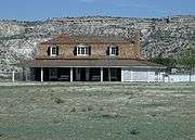
| The historic Commanding Officer Quarters in Fort Verde was built in 1871 and is in the grounds of the Fort Verde Museum located at 125 E. Hollamon St. |
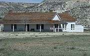
| The historic Bachelor Officers’ Quarters in Fort Verde was built in 1871. |
| The historic Doctor’s & Surgeons Quarters in Fort Verde was built in 1871. |
| The Camp Verde Boler's Bar was built in 1934 and is located at 325 S. Main Street. When the building first opened it housed the Camp Verde Cafe. The building is currently occupied by the Verde Brewing Company.(CVHS). |
| The Rock Jail was built in 1933 and is located at 44 Hollamon St.. In 1933, during the Great Depression, federal money started making its way to Yavapai County. One of President Roosevelt’s first major relief efforts under the Civil Works Administration was a new jail for Camp Verde (CVHS). |
| This Camp Verde Bath House was built c. 1919. It is located near 301 Woods Street. It is currently used as a public restroom (CVHS). |
| Part of the 1880s original structure of the Wingfields Mercantile Store. |
| 1911 Building at the Wingfield Sutler District. This building was added to the original 1860s structure. The structure is located on the grounds which has the distinction of being the oldest, continuously operating business in Yavapai County and the first stop on the historic pony express between Camp Verde and Payson, Arizona. It is located at 564 S. Main Street. (CVHS). |
| 1916 Building at the Wingfield Sutler District. This building was added to the original 1860's structure. It is located at 564 S. Main Street. (CVHS). |
| The Wingfield, Hank and Myrtle, Homestead, a.k.a." Crooked "H" Ranch House", was built in 1917 and is located at 806 E. Quaterhorse Ln.. It was listed in the National Register of Historic Places in 1999, reference #99000857. |
| The Don Bell House was built in 1917 and is located at 2530 Anupaya Ln.. It was listed in the National Register of Historic Places in 2004, reference #04000513 |
| The Clear Creek Church was built in 1898 and is located on Clear Creek Road 3.5 mi. SE of Camp Verde. The builders placed in the cornerstone of the building a bible and a $5 gold piece (which was chiseled away in the 1920s). It was Camp Verde’s only church until 1913, when it was transformed into the city’s one-room schoolhouse. In 1946, the church was abandoned. Today Clear Creek Church is looked after by the Camp Verde Historical Society. It was listed in the National Register of Historic Places on August 6, 1975, reference #75000362. [10] |
| The George Hance House was built in 1916 and is located at 229 Coppinger Street. George Hance was a veteran of the American Civil War who served as Camp Verdes first postmaster. For almost 30 years, George Hance served as the unincorporated community's unofficial mayor. Hance was also a Justice of the Peace, notary public and cattleman. The house is now a museum and is owned by the Camp Verde Historical Society. It is located in the Fort Verde District, which was added to the National Register of Historic Places in 1971, reference #71000120. [11] |
|
Montezuma Castle
(NRHP = National Register of Historic Places)[8] |
|---|
| Entrance sign of the Montezuma Castle National Monument which is located near Camp Verde, Arizona. The sign and its contents are the work of an employee of the Bureau of Land Management. Montezuma Castle National Monument is listed in the National Register of Historic Places, reference #66000082. |
| The Montezuma Castle is a historic cliff dwelling located in Montezuma Castle National Monument. The dwelling was built and used by the Pre-Columbian Sinagua people. It was occupied from approximately 1100–1425 AD, and occupation peaked around 1300 AD. Early European settlers believed that the builders were of the Aztec tribe and named the dwellings after Montezuma II, the Aztec emperor of Mexico. |
| Close up view of the Montezuma Castle. |
| The Cliff and cave dwellings of the Sinagua people next to the Montezuma Castle, located in Montezuma Castle National Monument. |
| Display which shows how the Pre-Columbian Sinagua people lived in Montezuma Castle. The display and its contents are the work of an employee of the Bureau of Land Management. |
|
Montezuma Well
(NRHP = National Register of Historic Places)[8] |
|---|
| Montezuma Well is a detached unit of Montezuma Castle National Monument located near Rimrock and Camp Verde, Arizona. The Montezuma Well is a natural limestone sinkhole. It is listed in the National Register of Historic Places, reference #66000082. |
| Cliff dwellings of the Sinagua people in the area known as Montezuma Well. Montezuma Well is a detached unit of Montezuma Castle National Monument. |
| Close up view of the Cliff dwellings of the Sinagua people. |
| Pit House ruins of Sinagua people, which dates back to 1050 AD, in the area known as Montezuma Well. The two largest holes in the dirt floor held the timber which supported the roof. The holes around the edge reveal the outline of the structure. |
| Hiker posing in the Ruins of a Sinagua house, which dates back to 1050 AD. |
| Different view of the Ruins of a Sinagua house. |
|
References
External links
