Botoșani County
| Botoșani County Județul Botoșani | ||
|---|---|---|
| County | ||
 | ||
| ||
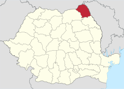 Location of Botoșani County in Romania | ||
| Coordinates: 47°50′N 26°49′E / 47.84°N 26.82°ECoordinates: 47°50′N 26°49′E / 47.84°N 26.82°E | ||
| Country |
| |
| Development region1 | Nord-Est | |
| Historic region | Moldavia | |
| Capital city (Reședință de județ) | Botoșani | |
| Government | ||
| • Type | County Board | |
| • President of the County Board | Mihai Țâbuleac (PD-L) | |
| • Prefect2 | Adrian Constantinescu | |
| Area | ||
| • Total | 4,986 km2 (1,925 sq mi) | |
| Area rank | 29th in Romania | |
| Population (2011) | ||
| • Total | 412,626 | |
| • Rank | 22nd in Romania | |
| • Density | 83/km2 (210/sq mi) | |
| Time zone | EET (UTC+2) | |
| • Summer (DST) | EEST (UTC+3) | |
| Postal Code | 71wxyz3 | |
| Area code(s) | +40 x314 | |
| Car Plates | BT5 | |
| GDP | US$ 2.06 billion (2008) | |
| GDP/capita | US$ 4,536 (2008) | |
| Website |
County Board County Prefecture | |
|
1The developing regions of Romania have no administrative role. They were formed just to attract funds from the European Union 2 as of 2007, the Prefect is not a politician, but a public functionary. He (or she) is not allowed to be a member of a political party, and is banned to have any political activity in the first six months after the resignation (or exclusion) from the public functionary corps 3w, x, y, and z are digits that indicate the city, the street, part of the street, or even the building of the address 4x is a digit indicating the operator: 2 for the former national operator, Romtelecom, and 3 for the other ground telephone networks 5used on both the plates of the vehicles that operate only in the county limits (like utility vehicles, ATVs, etc.), and the ones used outside the county | ||
Botoșani (Romanian pronunciation: [botoˈʃanʲ]) is a county (județ) of Romania, in Moldavia (few villages in Bukovina), with the capital city at Botoșani.
Demographics
As of October 31, 2011, it had a population of 412,626 and the population density was 83/km2. [1]
- Romanians – 94.1%
- Romani – 1%
- Ukrainians – 0.2%
- Lipovans – 0.1%
- Other ethnicities – 0.1%
- Unknown ethnicity – 4.6%
| Year | County population [2] |
|---|---|
| 1948 | 385,236 |
| 1956 | 428,050 |
| 1966 | 452,406 |
| 1977 | 451,217 |
| 1992 | 458,904 |
| 2002 | 452,834 |
| 2011 | 412,626 |
Geography
- it is situated between Siret and Prut, in the north-east part of the county, Ukraine in the north and Moldova in the east. At the west and south it has borders with the Suceava County and Iași County.
- it has a total area of 4,986 km2 (2.1% of the Romanian territory).
- the relief is a high plain, between the valleys of the Siret River, the Prut River and its affluent the Jijia River.
- temperate climate, influenced by the eastern air masses of the continent.
Neighbours
- Republic of Moldova in the East – Edineț Raion.
- Suceava County in the West.
- Ukraine in the North – Chernivtsi Oblast.
- Iași County in the South.
Economy
This is a predominantly agricultural county.
The predominant industries in the county are:
- Textile industry
- Food industry
- Electrical components industry
- Glass and porcelain industry
At Stânca-Costești there is one of the greatest hydroelectric power plants in Romania.
Politics
The Botoșani County Council, elected at the 2016 local government elections, is made up of 33 counselors, with the following party composition:[3]
| Party | Seats | Current County Council | ||||||||||||||||||
|---|---|---|---|---|---|---|---|---|---|---|---|---|---|---|---|---|---|---|---|---|
| Social Democratic Party | 18 | |||||||||||||||||||
| National Liberal Party | 15 | |||||||||||||||||||
Administrative divisions
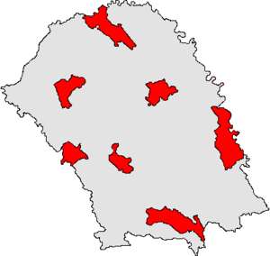
Botoșani County has 2 municipalities, 5 towns and 71 communes
- Municipalities
- Towns
- Communes
- Adășeni
- Albești
- Avrămeni
- Bălușeni
- Blândești
- Brăești
- Broscăuți
- Călărași
- Cândești
- Concești
- Copălău
- Cordăreni
- Corlăteni
- Corni
- Coșula
- Coțușca
- Cristești
- Cristinești
- Curtești
- Dersca
- Dângeni
- Dimăcheni
- Dobârceni
- Drăgușeni
- Durnești
- Frumușica
- George Enescu
- Gorbănești
- Havârna
- Hănești
- Hilișeu-Horia
- Hlipiceni
- Hudești
- Ibănești
- Leorda
- Lozna
- Lunca
- Manoleasa
- Mihai Eminescu
- Mihăileni
- Mihălășeni
- Mileanca
- Mitoc
- Nicșeni
- Păltiniș
- Pomârla
- Prăjeni
- Rădăuți-Prut
- Răchiți
- Răuseni
- Ripiceni
- Roma
- Românești
- Santa Mare
- Stăuceni
- Suharău
- Sulița
- Șendriceni
- Știubieni
- Todireni
- Trușești
- Tudora
- Ungureni
- Unțeni
- Văculești
- Viișoara
- Vârfu Câmpului
- Vlădeni
- Vlăsinești
- Vorniceni
- Vorona
People
Natives of the county include:
See also
References
| Wikimedia Commons has media related to Botoșani County. |
- ↑ Tab8. Populația stabilă după etnie – județe, municipii, orașe, comune
- ↑ Tab1. Populația la recensămintele din anii 1948, 1956, 1966, 1977, 1992, 2002 și 2011 – categorii de localități și județe
- ↑ "Mandate de CJ pe judete si competitori" (in Romanian). Biroul Electoral Central. 10 June 2016. Retrieved 16 June 2016.
External links
This article is issued from Wikipedia - version of the 7/10/2016. The text is available under the Creative Commons Attribution/Share Alike but additional terms may apply for the media files.
