Borgo, Haute-Corse
| Borgo | ||
|---|---|---|
|
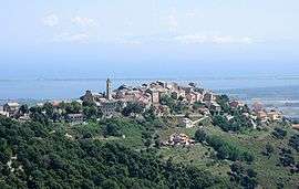
The village of Borgo overlooking the plain and part of the lake of Biguglia, and the lagoon of Marana | ||
| ||
 Borgo | ||
|
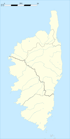
Location within Corsica region  Borgo | ||
| Coordinates: 42°33′17″N 9°25′41″E / 42.5547°N 9.4281°ECoordinates: 42°33′17″N 9°25′41″E / 42.5547°N 9.4281°E | ||
| Country | France | |
| Region | Corsica | |
| Department | Haute-Corse | |
| Arrondissement | Bastia | |
| Canton | Borgo | |
| Government | ||
| • Mayor | Anne-Marie Natali | |
| Area1 | 37.78 km2 (14.59 sq mi) | |
| Population (2008)2 | 7,456 | |
| • Density | 200/km2 (510/sq mi) | |
| Time zone | CET (UTC+1) | |
| • Summer (DST) | CEST (UTC+2) | |
| INSEE/Postal code | 2B042 / 20290 | |
| Elevation |
0–1,117 m (0–3,665 ft) (avg. 320 m or 1,050 ft) | |
|
1 French Land Register data, which excludes lakes, ponds, glaciers > 1 km² (0.386 sq mi or 247 acres) and river estuaries. 2 Population without double counting: residents of multiple communes (e.g., students and military personnel) only counted once. | ||
Borgo (Corsican: U Borgu) is a commune in the Haute-Corse department of France on the island of Corsica.
The Bastia-Poretta Airport is located in Borgo.[1] It was the site of the 1768 Battle of Borgo during the French Conquest of Corsica when a French force was defeated by Corsican troops.
Population
| Historical population | ||
|---|---|---|
| Year | Pop. | ±% |
| 1800 | 431 | — |
| 1806 | 459 | +6.5% |
| 1821 | 430 | −6.3% |
| 1831 | 589 | +37.0% |
| 1836 | 627 | +6.5% |
| 1841 | 687 | +9.6% |
| 1846 | 675 | −1.7% |
| 1851 | 677 | +0.3% |
| 1856 | 690 | +1.9% |
| 1861 | 761 | +10.3% |
| 1866 | 717 | −5.8% |
| 1872 | 787 | +9.8% |
| 1876 | 717 | −8.9% |
| 1881 | 723 | +0.8% |
| 1886 | 803 | +11.1% |
| 1891 | 849 | +5.7% |
| 1896 | 903 | +6.4% |
| 1901 | 959 | +6.2% |
| 1906 | 1,203 | +25.4% |
| 1911 | 1,023 | −15.0% |
| 1921 | 746 | −27.1% |
| 1926 | 714 | −4.3% |
| 1931 | 789 | +10.5% |
| 1936 | 806 | +2.2% |
| 1946 | 725 | −10.0% |
| 1954 | 913 | +25.9% |
| 1962 | 726 | −20.5% |
| 1968 | 1,600 | +120.4% |
| 1975 | 2,650 | +65.6% |
| 1982 | 3,413 | +28.8% |
| 1990 | 3,773 | +10.5% |
| 1999 | 5,002 | +32.6% |
| 2008 | 7,542 | +50.8% |
Sights
See also
References
- ↑ [https://www.sia.aviation-civile.gouv.fr/aip/enligne/FRANCE/AIRAC-2016-11-10/html/eAIP/FR-AD-2.LFKB -fr-FR.html LFKB – BASTIA PORETTA]. AIP from French Service d'information aéronautique, effective 10 November 2016.
| Wikimedia Commons has media related to Borgo. |
This article is issued from Wikipedia - version of the 4/10/2016. The text is available under the Creative Commons Attribution/Share Alike but additional terms may apply for the media files.

.svg.png)