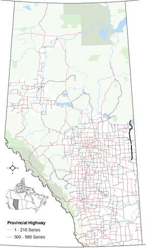
Alberta Highway 897
| ||||
|---|---|---|---|---|
 | ||||
| Route information | ||||
| Maintained by Alberta Transportation | ||||
| Length: |
209 km (130 mi) Two sections: 186 km (116 mi) and 23 km (14 mi) | |||
| Major junctions | ||||
| South end: |
| |||
|
| ||||
| North end: | Township Road 652 west of Cold Lake Provincial Park | |||
| Location | ||||
| Specialized and rural municipalities: | Wainwright M.D. No. 61, Vermilion River County, St. Paul County No. 19, Bonnyville M.D. No. 87 | |||
| Major cities: | Cold Lake | |||
| Villages: | Paradise Valley, Kitscoty, Marwayne | |||
| Highway system | ||||
|
Provincial highways in Alberta
| ||||
Alberta Provincial Highway No. 897[1] is a highway in the province of Alberta, Canada. It runs south-north in two sections, from Highway 14 north of Edgerton to Highway 55 south of Cold Lake, then from Kingsway at the west CFB Cold Lake limits to where Township Road 651 would be, west of Cold Lake Provincial Park. The south section runs between Highway 17 and Highway 41, the north section offers a route to resorts and vacation spots north of Cold Lake.
Km by km description
Starting from the south end of Highway 897.
South section
North section
| County | km | Intersecting road | Notes | Coordinates |
|---|---|---|---|---|
| Municipal District of Bonnyville No. 87 | 201 | Kingsway | West CFB Cold Lake limits North of Beaver River East to Medley End Kingsway west concurrency |
54°25′32″N 110°19′59″W / 54.42556°N 110.33306°W |
| 204 | West to La Corey East to Cold Lake |
54°27′24″N 110°20′1″W / 54.45667°N 110.33361°W | ||
| 224 | End | North to Marie Lake North-east to Cold Lake Provincial Park |
54°37′5″N 110°14′21″W / 54.61806°N 110.23917°W |
References
- ↑ Provincial Highways Designation Order, Alberta Transportation, p. 38
This article is issued from Wikipedia - version of the 10/28/2016. The text is available under the Creative Commons Attribution/Share Alike but additional terms may apply for the media files.
