Yvoir
| Yvoir | |
|---|---|
| Municipality | |
 | |
 Yvoir Location in Belgium | |
|
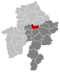
Location of Yvoir in Namur province  | |
| Coordinates: 50°20′N 04°53′E / 50.333°N 4.883°ECoordinates: 50°20′N 04°53′E / 50.333°N 4.883°E | |
| Country | Belgium |
| Community | French Community |
| Region | Wallonia |
| Province | Namur |
| Arrondissement | Dinant |
| Government | |
| • Mayor | Ovide Monin |
| • Governing party/ies | LB 2006 |
| Area | |
| • Total | 56.84 km2 (21.95 sq mi) |
| Population (1 January 2016)[1] | |
| • Total | 9,126 |
| • Density | 160/km2 (420/sq mi) |
| Postal codes | 5530 |
| Area codes | 082 |
| Website | www.yvoir.be |
Yvoir (French pronunciation: [i.vwaʁ]) is a Walloon municipality located in the Belgian province of Namur. On 1 January 2006 the municipality had 8,450 inhabitants. The total area is 56.84 km², making it a population density of 149 inhabitants per km².
The municipality consists of the villages Dorinne, Durnal, Evrehailles, Godinne, Houx, Mont, Purnode, Spontin and Yvoir.
Sport
Yvoir was the host city of the 1975 UCI Road World Championships
See also
References
- ↑ Population per municipality as of 1 January 2016 (XLS; 397 KB)
External links
-
 Media related to Yvoir at Wikimedia Commons
 - Official website (in French)
 |
Profondeville | Assesse |  | |
| Anhée | |
Ciney | ||
| ||||
| | ||||
| Dinant |
This article is issued from Wikipedia - version of the 12/1/2016. The text is available under the Creative Commons Attribution/Share Alike but additional terms may apply for the media files.
