Vysoká (Carpathian mountain)
| Vysoká | |
|---|---|
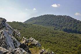 Vysoká as seen from Taricové skaly | |
| Highest point | |
| Elevation | 754 m (2,474 ft) |
| Coordinates | 48°25′4.69″N 17°13′13.84″E / 48.4179694°N 17.2205111°ECoordinates: 48°25′4.69″N 17°13′13.84″E / 48.4179694°N 17.2205111°E |
| Geography | |
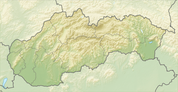 Vysoká Location in Slovakia | |
| Location | Malé Karpaty (Little Carpathians) |
| Climbing | |
| Easiest route | from Zochova chata |
Vysoká is the second-highest mountain in the Little Carpathians mountains, part of the Carpathians mountain range, located above the village Kuchyňa in Slovakia. The mountain is part of Nature Reserve Vysoká protected area. The 754-meter (2,474 ft) AMSL high peak offers views of the surrounding Little Carpathians' relief, Tribeč mountains, Považský Inovec and Podunajská pahorkatina. On a fine day, it offers views of extended parts of landscape with even the Austrian Alps being clearly visible.[1]
Description
The mountain offers numerous gorges, streams, meadows and rocky faces. The surrounding woods feature several small caves. In the past, limestone was mined underneath the mountain and transported to a nearby factory. The woods are rich in fauna, notably the mouflon.
The mountain is located within the Vysoká nature reserve (Slovak: Prírodná rezervácia Vysoká) a protected area with the highest, fifth degree of protection. The nature reserve was established in 1988 with the area of 80,53 ha within the administrative areas of the villages Kuchyňa and Rohožník. The nature reserve is part of the Little Carpathians Protected Landscape Area.
Approach
Usual points of departure for a one-day trip are Zochova chata and Kuchyňa. There are many popular tourism locations nearby (observation tower Veľká homoľa, Červený Kameň Castle, Štúr's way and others).
See also
| Wikimedia Commons has media related to Vysoká (Malé Karpaty). |
References
- ↑ "Vysoka in the Little Carpathians". PodujatiaSlovensko.sk. Retrieved 28 April 2012.
Further reading
- Vladimír Adamec, Nora Jedličková: Slovensko. Turistický lexikon. Šport, slovenské telovýchovné vydavateľstvo, Bratislava 1991, ISBN 80-7096-152-X