Unorganized South Nipissing District
| Unorganized South Nipissing District | |
|---|---|
| Unorganized area | |
| Nipissing, Unorganized, South Part | |
|
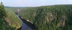
The Barron Canyon in Algonquin Park | |
 Unorganized South Nipissing | |
| Coordinates: 45°50′N 78°25′W / 45.833°N 78.417°WCoordinates: 45°50′N 78°25′W / 45.833°N 78.417°W | |
| Country |
|
| Province |
|
| District | Nipissing |
| Government | |
| • Federal riding | Nipissing—Timiskaming |
| • Prov. riding | Nipissing, Renfrew—Nipissing—Pembroke |
| Area[1] | |
| • Land | 6,710.88 km2 (2,591.09 sq mi) |
| Population (2011)[1] | |
| • Total | 80 |
| • Density | 0.01/km2 (0.03/sq mi) |
| Time zone | EST (UTC-5) |
| • Summer (DST) | EDT (UTC-4) |
| Area code(s) | 705 |
Unorganized South Nipissing District is an unorganized area in north-central Ontario, in the District of Nipissing. It is almost entirely within and includes most of Algonquin Provincial Park.
Communities
- Acanthus
- Achray
- Brent
- Canoe Lake
- Coristine
- Daventry
- Government Park
- Kilrush
- Kiosk
- Lake Traverse
- Mink Lake
- Odenback
- Radiant
- Stuart
Demographics
| Canada census – Nipissing, Unorganized, South Part community profile | |||
|---|---|---|---|
| 2011 | 2006 | 2001 | |
| Population: | 80 (% from 2006) | 67 (19.6% from 2001) | 51 (-33.8% from 1996) |
| Land area: | 6,710.88 km2 (2,591.09 sq mi) | 6,704.78 km2 (2,588.73 sq mi) | 6,704.68 km2 (2,588.69 sq mi) |
| Population density: | 0.0/km2 (0/sq mi) | 0.0/km2 (0/sq mi) | 0.0/km2 (0/sq mi) |
| Median age: | 46.8 (M: 48.6, F: 44.5) | ||
| Total private dwellings: | 138 | 99 | 69 |
| Median household income: | |||
| References: 2011[2] 2006[3] 2001[4] | |||
Population trend:[5]
- Population in 2011: 80
- Population in 2006: 67
- Population in 2001: 51
- Population in 1996: 636 (or 77 when adjusted to 2001 boundaries)
- Population in 1991: 628
See also
References
- 1 2 "Nipissing, Unorganized, South Part census profile". 2011 Census of Population. Statistics Canada. Retrieved 2012-02-10.
- ↑ "2011 Community Profiles". Canada 2011 Census. Statistics Canada. July 5, 2013. Retrieved 2012-02-10.
- ↑ "2006 Community Profiles". Canada 2006 Census. Statistics Canada. March 30, 2011. Retrieved 2012-02-10.
- ↑ "2001 Community Profiles". Canada 2001 Census. Statistics Canada. February 17, 2012. Retrieved 2012-02-10.
- ↑ Statistics Canada: 1996, 2001, 2006 census
This article is issued from Wikipedia - version of the 6/17/2015. The text is available under the Creative Commons Attribution/Share Alike but additional terms may apply for the media files.


