United States and Mexican Boundary Survey

The United States and Mexican Boundary Survey (1848-1855) determined the border between the United States and Mexico as defined in the Treaty of Guadalupe Hidalgo, which had ended the Mexican-American War. The results of the survey were published in the three volumes entitled Report on the United States and Mexican boundary survey, made under the direction of the secretary of the Interior by William H. Emory (1857-1859).
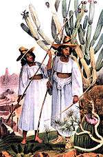
In addition to its documentation of the new boundary, the survey report was notable for its natural history content, including paleontology, botany, ichthyology, ornithology, and mammalogy. Twenty-five hand-colored lithographic plates of birds were included in the volume Zoology of the Boundary, edited by Spencer Fullerton Baird. These illustrations were prepared by J.T. Bowen and Company of Philadelphia, the same firm that had produced the octavo edition of Audubon's Birds of America. Numerous illustrations of plants, reptiles, and amphibians were included, colored in some editions. The hand-colored lithographs of scenery and ethnography are important historical records.
As a result of the boundary survey and subsequent treaties, the U.S. and Mexico established the International Boundary and Water Commission (IBWC) in 1889 to maintain the border, allocate river waters between the two nations, and provide for flood control and water sanitation. Once viewed as a model of international cooperation, in recent decades the IBWC has been heavily criticized as an institutional anachronism.[1]
See also
References
- ↑ Robert J. McCarthy, Executive Authority, Adaptive Treaty Interpretation, and the International Boundary and Water Commission, U.S.-Mexico, 14-2 U. Denv. Water L. Rev. 197(Spring 2011) (also available for free download at http://papers.ssrn.com/sol3/papers.cfm?abstract_id=1839903).
- Ann Shelby Blum (1993). Picturing Nature: American Nineteenth-Century Zoological Illustration. Princeton, New Jersey: Princeton University Press, 403 pages. ISBN 0-691-08578-1.
- Sacheverell Sitwell, Handasyde Buchanan, James Fisher (1990). Fine Bird Books, 1700-1900. Grove/Atlantic. ISBN 0-87113-285-0
- Robert Taft (1953). Artists and Illustrators of the Old West 1850-1900. New York: Scribner's. ISBN 0-517-10079-7.
- United States Department of the Interior (1857-59). Report on the United States and Mexican Boundary Survey, made under the direction of the Secretary of the Interior by William H. Emory Washington, D.C.: C. Wendell, printer. Three volumes, bound in two.
- Herman J. Viola (1987). Exploring the West. Washington, D.C.: Smithsonian Books. 256 pages. ISBN 0-8109-0889-1.
- Edward S. Wallace (1955). The Great Reconnaissance--Soldiers, Artists and Scientists on the Frontier 1848-1861. Boston, MA: Little, Brown and Company. 288 pages.
| Wikimedia Commons has media related to United States and Mexican Boundary Survey. |