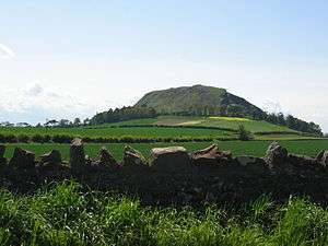
Traprain Law
Coordinates: 55°57′47″N 2°40′21″W / 55.96306°N 2.67250°W
Traprain Law is a hill about 221m (724 feet) in elevation, located 6 km (3.7 mi) east of Haddington in East Lothian, Scotland. It is the site of an oppidum or hill fort, which covered at its maximum extent about 16 ha (40 acres) and must have been a veritable town. Whether it was a seasonal meeting place or permanent settlement is a matter of speculation.
The hill was already a place of burial by around 1500 BC, and showed evidence of occupation and signs of ramparts after 1000 BC. The ramparts were rebuilt and re-aligned many times in the following centuries. Excavations have shown it was occupied in the Late Iron Age from about AD 40 through the last quarter of the 2nd century (about the time that the Antonine Wall was manned). Following the Roman withdrawal to the line of Hadrian's Wall it was occupied from about 220 almost uninterruptedly until about 400 when an impressive new rampart was built, then within a few decades the site was abandoned.
In the 1st century the Romans recorded the Votadini as a British tribe in the area, and Traprain Law is generally thought to have been one of their major settlements; named "Curia" by Ptolomy.[1] They emerged as a kingdom under the Brythonic version of their name Gododdin and Traprain Law is thought to have been their capital before moving to Din Eidyn (Edinburgh Castle).
Name history
This hill was only known as Traprain Law from the late 18th century, taking its name from a local hamlet. This is etymologically a Cumbric name cognate with Welsh tref 'farm' and either pren 'tree' or bryn 'hill'.[2]
Before that, it is found on old maps as Dunpendyrlaw.[3] Locally, and particularly amongst fishermen who use it as a landmark, it is still referred to as Dunpelder. This name seems also to be etymologically Cumbric, cognate with Welsh din 'fort' and pelydr 'spear shafts', thus meaning 'fort of the spear shafts'.[4]
Archaeology
A team led by Curle and Cree began the first excavations in 1914 and continued them until 1923, finding layers of fragmentary stone and timber houses under the turf.
Traprain Treasure
In 1919, they recovered a hoard of Silver plate. Consisting of over 53 pounds of sliced-up Roman era silver, the discovery was made in a pit within the boundary of the settlement earlier uncovered. Four Gallic coins were discovered with the hoard; one of the emperor Valens, three of Arcadius and one of Honorius, which dates the find to some point in the fifth century AD. The quality of some of the items suggests that they may have come from as far afield as Rome, Ravenna, or possibly Antioch or Constantinople.[5][6]
Most objects had been crushed and hacked to pieces, and only some were left intact. A great deal of the find was table silver, but there was also early Christian items and remnants from a Roman officer's uniform.
It had originally been thought that the objects had been brought back from a raid abroad, as the objects had been split up ready for division. Later finds such as at Mildenhall, Suffolk showed that silverware of this nature was certainly in use in Roman Britain. A further suggestion is that it had been brought back on a raid by the Votadini across Hadrian's Wall. Furthermore, it has also been suggested that the silver was in payment for mercenary service to protect weaker tribes from the inroads of the Scots, Picts, and Angles, the Silver being split up as bullion due to lack of adequate coinage.
Further excavations were made in 1939 by Cruden and in 1947 by Bersu.
The collection was restored where appropriate and sent to the National Museum of Antiquities in Edinburgh and now is in the care of the Royal Museum of Scotland.
The Roman Traprain Law Treasure
|
Folklore
In legend, Traprain Law was the cliff from which Thenaw, the mother of St Mungo, was thrown when her father, King Lot or Leudonus, discovered she was pregnant by Owain mab Urien. Saved by divine providence, she was transported by boat to Saint Serf's community in Culross, where she gave birth to Kentigern, later also known as Mungo.
Geodesy
Up to 1891 Traprain Law was the origin (meridian) of the 6 inch and 1:2500 Ordnance Survey maps of East Lothian. After that year the East Lothian maps were drawn according to the meridian of The Buck in Aberdeenshire. [7]
See also
References
- ↑ http://www.romanmap.com/htm/nomina/Curia.htm
- ↑ Bethany Fox, 'The P-Celtic Place-Names of North-East England and South-East Scotland', The Heroic Age, 10 (2007), http://www.heroicage.org/issues/10/fox.html (appendix at http://www.heroicage.org/issues/10/fox-appendix.html).
- ↑ Scots Place Names. Retrieved 23 April 2008, from: http://www.scotsplacenames.com
- ↑ Bethany Fox, 'The P-Celtic Place-Names of North-East England and South-East Scotland', The Heroic Age, 10 (2007), http://www.heroicage.org/issues/10/fox.html (appendix at http://www.heroicage.org/issues/10/fox-appendix.html).
- ↑ HMSO Information Sheet 7/1980, The Treasure of Traprain. Joanna Close-Brooks, 1980.
- ↑ "Votadini and Traprain Law." - Caledonians, Picts and Romans. Education Scotland. Web. 27 Oct. 2015.
- ↑ https://www.charlesclosesociety.org/files/153Meridians.pdf
- Ian Armit, Scotland's Hidden History Tempus (in association with Historic Scotland) 1998, ISBN 0-7486-6067-4
- R.W. Feachem, "The Fortifications on Traprain Law," Proceedings of the Society of Antiquaries of Scotland, 89 (1955-6), 284-9.
- Richard Feachem, Guide to Prehistoric Scotland London: Batsford, 1977 ISBN 0-7134-3264-0
- Stuart Piggott, Scotland Before History Edinburgh: University Press, 1982 ISBN 0-85224-348-0
Photo gallery
Further reading
- Weitzmann, Kurt, ed., Age of spirituality: late antique and early Christian art, third to seventh century, no. 389, 1979, Metropolitan Museum of Art, New York, ISBN 9780870991790
External links
- "Great Sites: Trapain Law", Ian Armit, British Archaeology, February 2001
- http://www.roman-britain.org/places/traprain_law.htm


