Three Anchor Bay
| Three Anchor Bay Drieankerbaai | |
|---|---|
|
DRC church in Three Anchor Bay | |
 Three Anchor Bay  Three Anchor Bay  Three Anchor Bay
| |
|
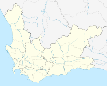
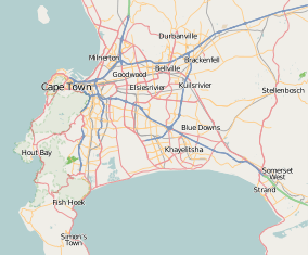
Location within Cape Town  Three Anchor Bay | |
| Coordinates: 33°54′30″S 18°23′45″E / 33.90833°S 18.39583°ECoordinates: 33°54′30″S 18°23′45″E / 33.90833°S 18.39583°E | |
| Country | South Africa |
| Province | Western Cape |
| Municipality | City of Cape Town |
| Main Place | Cape Town |
| Area[1] | |
| • Total | 0.29 km2 (0.11 sq mi) |
| Population (2011)[1] | |
| • Total | 2,225 |
| • Density | 7,700/km2 (20,000/sq mi) |
| Racial makeup (2011)[1] | |
| • Black African | 14.9% |
| • Coloured | 8.9% |
| • Indian/Asian | 3.5% |
| • White | 67.8% |
| • Other | 5.0% |
| First languages (2011)[1] | |
| • English | 67.9% |
| • Afrikaans | 16.4% |
| • Xhosa | 4.3% |
| • Zulu | 1.0% |
| • Other | 10.4% |
| Postal code (street) | 8005 |
Three Anchor Bay is a suburb of Cape Town in the Western Cape province of South Africa.
Small anchorage in Table Bay. The name, first encountered in 1661, possibly refers to anchors securing chains stretched as defence across the bay. The form Drieankerbaai is preferred for official purposes.[2]
References
- 1 2 3 4 "Sub Place Three Anchor Bay". Census 2011.
- ↑ Raper, Peter E. (1987). Dictionary of Southern African Place Names. Internet Archive. p. 433. Retrieved 28 August 2013.
This article is issued from Wikipedia - version of the 10/2/2016. The text is available under the Creative Commons Attribution/Share Alike but additional terms may apply for the media files.

.svg.png)