Thornton, Mississippi
| Thornton, Mississippi | |
|---|---|
| Unincorporated community | |
 Thornton, Mississippi  Thornton, Mississippi | |
| Coordinates: 33°04′45″N 90°19′21″W / 33.07917°N 90.32250°WCoordinates: 33°04′45″N 90°19′21″W / 33.07917°N 90.32250°W | |
| Country | United States |
| State | Mississippi |
| County | Holmes |
| Elevation | 115 ft (35 m) |
| Time zone | Central (CST) (UTC-6) |
| • Summer (DST) | CDT (UTC-5) |
| ZIP code | 39146 |
| Area code(s) | 662 |
| GNIS feature ID | [1] |
Thornton is an unincorporated community located in Holmes County, Mississippi near the Yazoo River. U.S. Highway 49E runs through the community, which is approximately 7 miles (11 km) north of Eden and approximately 10 miles (16 km) south of Tchula.
References
Municipalities and communities of Holmes County, Mississippi, United States | ||
|---|---|---|
| Cities | 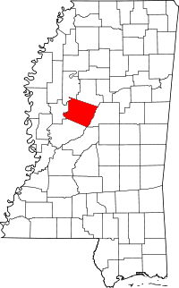 | |
| Towns | ||
| Unincorporated communities | ||
This article is issued from Wikipedia - version of the 7/30/2016. The text is available under the Creative Commons Attribution/Share Alike but additional terms may apply for the media files.