San Carlos de Bariloche Airport
| San Carlos de Bariloche Airport Aeropuerto de San Carlos de Bariloche | |||||||||||
|---|---|---|---|---|---|---|---|---|---|---|---|
|
| |||||||||||
| IATA: BRC – ICAO: SAZS | |||||||||||
| Summary | |||||||||||
| Operator | Aeropuertos Argentina 2000 S.A. | ||||||||||
| Serves | San Carlos de Bariloche | ||||||||||
| Location | Ruta Nacional Nº 237 s/n | ||||||||||
| Elevation AMSL | 2,776 ft / 846 m | ||||||||||
| Coordinates | 41°09′04″S 71°09′27″W / 41.15111°S 71.15750°WCoordinates: 41°09′04″S 71°09′27″W / 41.15111°S 71.15750°W | ||||||||||
| Map | |||||||||||
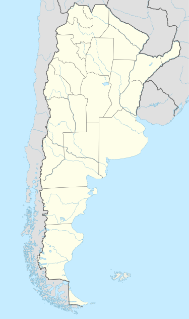
 BRC Location in Argentina | |||||||||||
| Runways | |||||||||||
| |||||||||||
| Statistics (2015) | |||||||||||
| |||||||||||
San Carlos de Bariloche Airport (Spanish: Aeropuerto de San Carlos de Bariloche) (IATA: BRC, ICAO: SAZS), also known as Teniente Luis Candelaria Airport,[6] is an international airport serving the city of San Carlos de Bariloche, Río Negro, Argentina. The airport covers an area of 1,810 hectares (4,500 acres; 7.0 sq mi) and has a 12,000-square-metre (130,000 sq ft) terminal; it is located 13 kilometres (8.1 mi) out of the city.[3]
Airlines and destinations
Accidents and incidents
Accidents involving fatalities
- 13 May 1957: A LADE Vickers VC.1 Viking, registration T-3, flew into mountainous terrain, 30 kilometres (19 mi) out of San Carlos de Bariloche. All 16 occupants of the aircraft perished in the accident.[7]
- 16 March 1975: A LADE Fokker F27-400M, tail number TC-72, struck a mountain, 35 kilometres (22 mi) west of the city, while on approach to the airport inbound from El Palomar. There were 52 fatalities.[8]
- 21 November 1977: An Austral Líneas Aéreas BAC 1-11, registration LV-JGY, that was operating a domestic non-scheduled Buenos Aires–Bariloche as Flight 9, made a premature descent and crashed into mountainous terrain on final approach to the airport, 21 kilometres (13 mi) east of the city, killing 46 of 79 occupants on board.[9]
Non-fatal hull-losses
- 16 August 1989: A LADE Fokker F28-1000C, tail number TC-51, failed to get airborne and overran the runway, being stopped by a dike.[10]
Statistics
| Passengers | Change from previous year | Aircraft operations | Change from previous year | Cargo (metric tons) | Change from previous year | |
|---|---|---|---|---|---|---|
| 2005 | 648,569 | | 8,730 | | 589 | |
| 2006 | 676,197 | | 8,273 | | 717 | |
| 2007 | 724,010 | | 7,830 | | 660 | |
| 2008 | 701,244 | | 7,667 | | 432 | |
| 2009 | 748,400 | | 8,782 | | 269 | |
| 2010 | 831,792 | | 9,477 | | 274 | |
| Source: Airports Council International. World Airport Traffic Statistics (Years 2005-2010) | ||||||
See also
References
- ↑
- ↑ "SAZS/San Carlos de Bariloche International Airport Fact Sheet" (PDF) (in Spanish). Retrieved 23 March 2012.
- 1 2 "Aeropuerto de San Carlos de Bariloche" [San Carlos de Bariloche Airport]. Organismo Regulador del Sistema Nacional de Aeropuertos (ORSNA) (in Spanish). Archived from the original on 23 March 2012.
- ↑ Airport information for SAZS at World Aero Data. Data current as of October 2006.
- ↑ "Aumento del 4.4 por ciento en el tráfico de pasajeros en 2013" [4.4 per cent increase in passenger traffic for 2013] (Press release) (in Spanish). Aeropuertos Argentina 2000. 14 January 2014. Archived from the original on 2 April 2014.
- ↑ Lieutenant Luis Candelaria International Airport, at Aeropuertos.net (accessed 2015-04-26)
- ↑ Accident description for T-3 at the Aviation Safety Network. Retrieved on 23 March 2012.
- ↑ Accident description for TC-72 at the Aviation Safety Network. Retrieved on 23 March 2012.
- ↑ Accident description for LV-JGY at the Aviation Safety Network. Retrieved on 23 March 2012.
- ↑ Accident description for TC-51 at the Aviation Safety Network. Retrieved on 23 March 2012.
External links
| Wikimedia Commons has media related to Aeropuerto Internacional Teniente Luis Candelaria. |
- Airport's details, at Aeropuertos Argentina 2000 S.A. (accessed 2015-04-26)
- Airport information for Bariloche Airport at Great Circle Mapper. Source: DAFIF (effective October 2006).
- Current weather for SAZS at NOAA/NWS
- Accident history for BRC at Aviation Safety Network
This article is issued from Wikipedia - version of the 12/4/2016. The text is available under the Creative Commons Attribution/Share Alike but additional terms may apply for the media files.