Suni K'ira
| Suni K'ira | |
|---|---|
 Suni K'ira Location in Bolivia | |
| Highest point | |
| Elevation | 5,899 m (19,354 ft) [1] |
| Coordinates | 22°00′34″S 67°13′08″W / 22.00944°S 67.21889°WCoordinates: 22°00′34″S 67°13′08″W / 22.00944°S 67.21889°W |
| Geography | |
| Location |
Bolivia Potosí Department |
| Parent range | Andes |
Suni K'ira (Quechua suni long, k'ira prop, support,[2] hispanicized spellings Sonequera, Soniquera, Suniquera, Suniquira) is a 5,899-metre-high (19,354 ft) volcano[3] in Bolivia. It is located in the Potosí Department, Nor Lípez Province, Colcha "K" Municipality, and in the Sud Lípez Province, San Pablo de Lípez Municipality. It lies north of the Uturunku volcano.[4]
References
- ↑ Bolivian IGM map 1:250,000 Cerro Zapaleri SF 19-12
- ↑ Diccionario Quechua - Español - Quechua, Academía Mayor de la Lengua Quechua, Gobierno Regional Cusco, Cusco 2005 (Quechua-Spanish dictionary) (5-vowel system)
- ↑ A. C. Fernández, P. K. Hörmann, S. Kussmaul, J. Meave, H. Pichler, T. Subieta, First petrologic data on young volcanic rocks of SW-Bolivia, Springer-Verlag, 1973
- ↑ "San Pablo de Lípez". Retrieved January 22, 2016. (unnamed)
Capital: Potosí | ||
| Provinces | 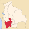 | |
| Municipalities (and seats) |
| |
This article is issued from Wikipedia - version of the 4/29/2016. The text is available under the Creative Commons Attribution/Share Alike but additional terms may apply for the media files.