Steventon Island
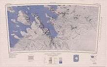
Topographic map sheet Boyd Glacier 1:250,000
Steventon Island (77°15′S 148°15′W / 77.250°S 148.250°WCoordinates: 77°15′S 148°15′W / 77.250°S 148.250°W) is a broad ice-covered island about 39 km (24 mi) long off of Antarctica, lying west of Court Ridge in the Sulzberger Ice Shelf. It was mapped from surveys by the United States Geological Survey (USGS) and U.S. Navy air photos (1959–65), and named by the Advisory Committee on Antarctic Names (US-ACAN) for Richard F. Steventon, USN, Petty Officer in charge of Eights Station, 1963.
![]() This article incorporates public domain material from the United States Geological Survey document "Steventon Island" (content from the Geographic Names Information System).
This article incorporates public domain material from the United States Geological Survey document "Steventon Island" (content from the Geographic Names Information System).
This article is issued from Wikipedia - version of the 7/19/2016. The text is available under the Creative Commons Attribution/Share Alike but additional terms may apply for the media files.