Srednja Kanomlja
| Srednja Kanomlja | |
|---|---|
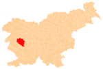
 Srednja Kanomlja Location in Slovenia | |
| Coordinates: 46°1′24.86″N 13°59′21.24″E / 46.0235722°N 13.9892333°ECoordinates: 46°1′24.86″N 13°59′21.24″E / 46.0235722°N 13.9892333°E | |
| Country |
|
| Traditional region | Littoral |
| Statistical region | Gorizia |
| Municipality | Idrija |
| Area | |
| • Total | 7.54 km2 (2.91 sq mi) |
| Elevation | 379.5 m (1,245.1 ft) |
| Population (2002) | |
| • Total | 280 |
| [1] | |
Srednja Kanomlja (pronounced [ˈsɾeːdnja kaˈnoːmlja]; literally, 'middle Kanomlja'; cf. Spodnja Kanomlja 'lower Kanomlja') is a dispersed settlement in the Kanomljica Valley (along Kanomljica Creek, a small tributary of the Idrijca River named after Kanomlja) west of Spodnja Idrija in the Municipality of Idrija, Slovenia.[2] The village formerly included the hamlet of Kanomeljsko Razpotje (literally, 'Kanomlja crossroads'),[3] now Razpotje.
References
- ↑ Statistical Office of the Republic of Slovenia
- ↑ Idrija municipal site
- ↑ Savnik, Roman, ed. 1968. Krajevni leksikon Slovenije, vol. 1. Ljubljana: Državna založba Slovenije. p. 79.
External links
| Settlements | Administrative centre: Idrija
|  |
|---|---|---|
| Landmarks |
| |
| Notable people | ||
This article is issued from Wikipedia - version of the 3/21/2016. The text is available under the Creative Commons Attribution/Share Alike but additional terms may apply for the media files.