Sobral Peninsula
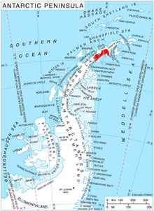
Location of Nordenskjöld Coast.
Sobral Peninsula (64°30′S 59°40′W / 64.500°S 59.667°WCoordinates: 64°30′S 59°40′W / 64.500°S 59.667°W) is a high and mainly ice-covered peninsula projecting from Nordenskjöld Coast in northern Graham Land, Antarctica. The feature is 11 nautical miles (20 km) long and 5 nautical miles (9 km) wide and projects southward between Larsen Inlet to the east and Mundraga Bay to the west. The name was applied by United Kingdom Antarctic Place-Names Committee (UK-APC) (1963) and derives from Cape Sobral at the south end of this peninsula.
References
![]() This article incorporates public domain material from the United States Geological Survey document "Sobral Peninsula" (content from the Geographic Names Information System).
This article incorporates public domain material from the United States Geological Survey document "Sobral Peninsula" (content from the Geographic Names Information System).
This article is issued from Wikipedia - version of the 11/21/2015. The text is available under the Creative Commons Attribution/Share Alike but additional terms may apply for the media files.