Redheugh Bridge
| Redheugh Bridge | |
|---|---|
 Redheugh Bridge, photographed from the north side at Newcastle from the Metro Radio Arena | |
| Carries |
Motor vehicle A189 road Pedestrians |
| Crosses | River Tyne |
| Locale | Newcastle/Gateshead, England |
| Characteristics | |
| Total length | 897m |
| Width | 15.8m |
| History | |
| Opened | 18 May 1983 |
The Redheugh Bridge /ˈrɛdjʊf/ is a road bridge spanning the River Tyne west of Newcastle upon Tyne centre on the North Bank and Gateshead centre on the South Bank, in North East England. It currently carries the A189 road.
The first crossing
In 1860 builder Richard Cail proposed a rail and road bridge at Redheugh with the rail deck below the road level – the reverse of the High Level Bridge. The North Eastern Railway showed little interest so Cail decided to press ahead with a road bridge.
The first Redheugh Bridge was opened on 1 May 1871 engineered by Thomas Bouch who was also the designer of the ill-fated first Tay Bridge in Scotland (see Tay Bridge disaster).
It was a slender construction supported by three piers. The road deck was 30 metres above river level with a footpath at either side. Construction was hindered by delays in the delivery of materials, due to poor access roads, and the scarcity of skilled labour. By as early as 1885 serious structural faults began to emerge and inspections concluded that repairs would cost more than a new bridge, and so it was replaced.
The second crossing
.jpg)
Replacement commenced in 1897 with the new bridge being built by Sir William Arrol & Co. around the old structure. Once again process was hindered by delays in materials and an inadequate work force. By 1900 the main girders and spans were in place and, ingeniously, hydraulic jacks were used to inch along the newly built superstructure until it rested on the previously constructed piers. The remains of the old structure were removed and the bridge was opened in August 1901. However, by the 1960s serious design flaws once again became apparent. Speed restrictions of 10 miles per hour (16 km/h) and weight restrictions of between 8 and 10 tonnes hindered the traffic flow and engineers stated that, if it remained in use for much longer, the approaches and superstructure would need to be rebuilt. It was seen as more economical to build a new crossing.
The present crossing

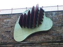
Work to replace the second crossing began in 1980.[1] Of the original crossing, only the south abutment now remains (adorned by a modern sculpture designed by Richard Deacon). The third bridge is much different from its two predecessors. It is a pre-stressed concrete structure with a central span of 160 metres and two side spans of 100 metres (including the approaches, it is a total of 897 metres long and 15.8 metres wide). It can carry abnormal loads of up to 400 tonnes,[2] and has a life expectancy of 120 years. It was constructed by Edmund Nuttall Ltd to a design by Mott, Hay and Anderson's young engineer, Alan Yiu Lun Wan.
The two supporting concrete piers were fluted to create an impression of lightness and were designed to withstand the impact from a vessel of ten thousand tonnes travelling at a speed of five knots, although this is highly unlikely as large ships rarely came this far up the Tyne and the shipping lane has now effectively been blocked by the Gateshead Millennium Bridge. Due to the exposed location, strong winds can cause problems for high-sided vehicles. Early in the bridge's life, a double decker bus was nearly blown over the side[3] but luckily came to rest leaning against the parapet railings.
The bridge was opened on 18 May 1983 by the Princess of Wales.[4] The total cost amounted to £15,350,000.[5]
References
- ↑ http://structurae.net/structures/redheugh-bridge
- ↑ http://www.bbc.co.uk/history/domesday/dblock/GB-424000-561000/page/5
- ↑ http://www.twmuseums.org.uk/discovery/buildingbridges/the-redheugh-bridge/
- ↑ http://www.bbc.co.uk/history/domesday/dblock/GB-424000-561000/page/5
- ↑ http://structurae.net/structures/redheugh-bridge
External links
- Redheugh Bridge at Structurae
- Gateshead Council article on the Richard Deacon sculpture
- 2/22/1902;Reconstruction of the Redheugh Bridge, Newcastle.on.Tyne.
See also
| Next road crossing upstream | River Tyne | Next road crossing downstream |
| Scotswood Bridge | Redheugh Bridge Grid reference: NZ243631 |
High Level Bridge (road and rail) |
| Next rail crossing upstream | River Tyne | Next rail crossing downstream |
| Scotswood Railway Bridge (disused rail, now carries water and gas mains) |
Redheugh Bridge Grid reference: NZ243631 |
King Edward VII Bridge |
Coordinates: 54°57′43″N 1°37′08″W / 54.962°N 1.619°W