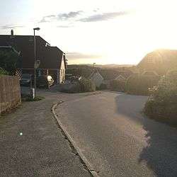
Randesund
| District Randesund | ||
|---|---|---|
| District | ||
| ||
 | ||
| Country | Norway | |
| City | Kristiansand | |
| Borough | Oddernes | |
| Population (2014) | ||
| • Total | 2,000 | |
| Time zone | CET (UTC+1) | |
| • Summer (DST) | CEST (UTC+2) | |
| ISO 3166 code | NO-030112 | |
| Website | kristiansand.kommune.no | |
| Randesund herred | |
|---|---|
| Former Municipality | |
|
Swimming in Randesund | |
| Coordinates: 58°07′59″N 08°07′04″E / 58.13306°N 8.11778°ECoordinates: 58°07′59″N 08°07′04″E / 58.13306°N 8.11778°E | |
| Country | Norway |
| County | Vest-Agder |
| District | Sørlandet |
| Municipality ID | NO-1011 |
| Adm. Center | Randesund |
| Split from | Oddernes in 1893 |
| Merged into | Kristiansand in 1965 |
Randesund is a former municipality in Vest-Agder county in Norway. Randesund is currently a borough of Kristiansand, located between Kvåsefjorden in Høvåg and the Topdalsfjord in Oddernes. Several small islands are situated alongside the cost of Randesund, among them Dvergsøya, Randøya and Herøya, all popular tourists destinations.
Name
The municipality (originally the parish) is named after the island, Randøen (now known as Randøya). The first part of the name is rand (Old Norse: rǫnd) which means "boundary" or "edge" and the last part of the name is sund which means "strait". The name was previously spelled Randøsund.[1][2]
History
The municipality was established on 31 December 1893 when it was split off from the municipality of Oddernes to form a separate municipality. At that time, Randesund had a population of 1,133. On 1 January 1965, Randesund was incorporated into the neighboring municipality of Kristiansand along with neighboring Tveit and Oddernes. Prior to the merger, Randesund had a population of 1,672.[3]
Politic
The 10 largest politics parties in Randesund in 2015:
| Kristiansand city council votes from Randesund 2015[4] | |
| Conservative Party | 25% (252 votes) |
| Christian Democratic Party | 21,7% (218 votes) |
| Labour Party | 19,8% (199 votes) |
| Progress Party | 9,4% (95 votes) |
| The Democrats | 6,1% (61 votes) |
| Liberal Party | 4,3% (43 votes) |
| Green Party | 4% (40 votes) |
| Pensioners' | 3,3% (33 votes) |
| The Christians | 2,2% (22 votes) |
| Socialist Left Party | 1,6% (16 votes) |
| Others | 2,9% (29 votes) |
| Total | 1008 votes |
Transportation
The main road to Tømmerstø is Norwegian County Road 3, which goes from Rona in Søm, to Drange. It goes through Tømmerstø. Norwegian County Road 9 goes from Dvergsnes, to Tangen both in Randesund. Norwegian County Road 4 goes from Bjørnestad to Kongshavn in Randesund. Norwegian County Road 14 goes from Frikstad to Stangenes. Norwegian County Road 401 goes from Randesund to Høvåg and Lillesand in Aust-Agder.
| Line | Destination [5] |
|---|---|
| 08 | Randesund - Rona |
| 17 | Tømmerstø - Hellemyr |
| 17 | Tømmerstø-Frikstad - Hellemyr |
| 17 | Tømmerstø - Kvadraturen |
| N17 | Tømmerstø - Kvadraturen |
| 18 | Tømmerstø Odderhei-Holte - Hellemyr |
| 18 | Dvergsnes - Hellemyr |
| 18 | Tømmerstø Odderhei-Holte - Kvadraturen |
| A18 | Tømmerstø Odderhei-Holte - Eg-Sykehuset |
| 139 | Høvåg-Lillesand - Kristiansand |
| 234 | Randesund - Kringsjå |
Neighborhoods
- Bjørkestøl
- Butangen
- Drange
- Drangeskauen
- Dvergsnes
- Eftevåg
- Fidje
- Frikstad
- Hestehagen
- Holte
- Kirkevik
- Kongshavn
- Kvarnes
- Lykkedrag
- Odderhei
- Rabbersvik
- Skaupemyr
- Sommerro
- Stangenes
- Tømmerstø
- Tømmeråsen
- Vadvik
- Vrånes
Photos
- Skippergada
 Rabbesvik
 Fidjeåsen
 Holte
Holte Holte
Holte Norwegian County Road 3
 Fidjekilen
 Odderhei Terrasse
 Odderhei
References
- ↑ Rygh, Oluf (1912). Norske gaardnavne: Lister og Mandals amt (in Norwegian) (9 ed.). Kristiania, Norge: W. C. Fabritius & sønners bogtrikkeri. pp. 20 & 26.
- ↑ "Randesund" (in Norwegian). Store norske leksikon. Retrieved 2009-11-12.
- ↑ Jukvam, Dag (1999). "Historisk oversikt over endringer i kommune- og fylkesinndelingen" (PDF) (in Norwegian). Statistisk sentralbyrå.
- ↑ "VG - Valgnatt" (in Norwegian). vg.no. Retrieved 14 September 2015.
- ↑ "AKT".
External links
 Kristiansand travel guide from Wikivoyage
- Weather information for Randesund (Norwegian)
