Planura Hut
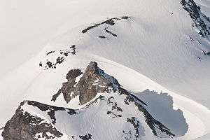
The Planura Hut with the Hüfi Glacier in background
The Planura Hut (German: Planurahütte) is a mountain hut of the Swiss Alpine Club, located on the border between the cantons of Uri and Glarus, between Amsteg and Linthal. It lies at a height of 2,947 metres above sea level, on the watershed between the Hüfi Glacier and the Sandfirn.
The Planura Hut is used for the ascents of the Tödi, Schärhorn, Clariden, Düssi, Chammliberg and Gemsfairenstock.
References
- Swisstopo topographic maps
External links
![]() Media related to Planurahütte at Wikimedia Commons
Media related to Planurahütte at Wikimedia Commons
Coordinates: 46°49′12″N 8°52′49″E / 46.82000°N 8.88028°E
This article is issued from Wikipedia - version of the 7/18/2013. The text is available under the Creative Commons Attribution/Share Alike but additional terms may apply for the media files.