Pirwani (Bolivia)
This article is about the mountain in the Potosí Department, Bolivia. For other uses, see Pirwani (disambiguation).
| Pirwani | |
|---|---|
 Pirwani Location in Bolivia | |
| Highest point | |
| Elevation | 4,840 m (15,880 ft) [1] |
| Coordinates | 19°29′06″S 66°27′13″W / 19.48500°S 66.45361°WCoordinates: 19°29′06″S 66°27′13″W / 19.48500°S 66.45361°W |
| Geography | |
| Location |
Bolivia, Potosí Department |
| Parent range | Andes |
Pirwani (Aymara pirwa, piwra granary,[2][3] -ni a suffix to indicate ownership, "the one with a granary", hispanicized spelling Pirhuani) is a mountain in the Andes of Bolivia, about 4,840 metres (15,879 ft) high. It is situated in the Potosí Department, Antonio Quijarro Province, in the east of the Uyuni Municipality. Janq'u Qullu lies south-west of the mountains Warachi Qullu and Janq'u Qullu. It is situated east of the Chillawa River (Chillahua) which flows to the south.[1][4]
References
- 1 2 BIGM map 1:50,000 6335-IV Laguna Wara Wara
- ↑ Ministerio de Educación, Dirección National de Educación Bilingue Intercultural, Yatiqirinaka Aru Pirwa, Lima, 2005 (Aymara-Spanish dictionary)
- ↑ Radio San Gabriel, "Instituto Radiofonico de Promoción Aymara" (IRPA) 1993, Republicado por Instituto de las Lenguas y Literaturas Andinas-Amazónicas (ILLLA-A) 2011, Transcripción del Vocabulario de la Lengua Aymara, P. Ludovico Bertonio 1612 (Spanish-Aymara-Aymara-Spanish dictionary)
- ↑ "Uyuni". INE, Bolivia. Retrieved October 17, 2014. (unnamed)
Capital: Potosí | ||
| Provinces | 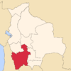 | |
| Municipalities (and seats) |
| |
This article is issued from Wikipedia - version of the 12/6/2015. The text is available under the Creative Commons Attribution/Share Alike but additional terms may apply for the media files.