Pegasus Bay

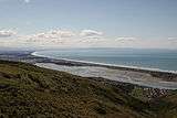
Pegasus Bay, earlier known as Cook's Mistake, is a bay on the east coast of the South Island of New Zealand.
Location

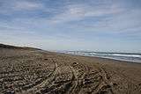
The bay has a sandy beach and runs from Banks Peninsula to the Waipara River mouth. The city of Christchurch is at the southern end of the bay.
Other than dolphins including the endemic, endangered Hector's Dolphins that regularly live or visit into the waters, whales such as southern right and humpback are known to migrate into the gulf.[1][2]
Rivers
Rivers flowing into Pegasus Bay, from north to south, are:
- Waipara River
- Ashley River
- Waimakariri River
- Avon River and Heathcote River via the Avon Heathcote Estuary
Naming

The Pegasus was the name of the sailing ship which surveyed part of the South Island in 1809. The first mate of the brig Pegasus, William Stewart, gave Pegasus Bay its name.[3] The captain of the ship, Captain Samuel Chase (not to be confused with his contemporary, Captain Samuel Rodman Chace),[4] lays claim to correcting James Cook's charts by determining that "Banks Island" was in fact a peninsula. As late as 1843, the bay was referred to as Cook's Mistake.[5]
The MV Pegasus Bay was also the final name of a container ship that operated with a variety of owners from 1978 to 2002.[6] It was made into a Triang model ship under another name, MV City of Durban.[7]
References
- ↑ Clement D.. 2009. Assessment of Potential Effects on Marine Mammals of Proposed Capital Dredging of Approach Channel to Lyttelton Port of Christchurch and Offshore Disposal of Spoil. Cawthron Report. No. 1705. retrieved on November 5. 2014
- ↑ Description of the Environment. Retrieved on November 5. 2014
- ↑ "Christchurch Chronology 1809 - Heritage". Christchurch City Libraries. 2013-06-12. Retrieved 2015-09-29.
- ↑ Entwisle, Peter (2005). Taka: a vignette life of William Tucker 1784-1817. Port Daniel Press. p. 49. ISBN 0-473-10098-3. Retrieved 2010-08-19.
- ↑ Hight, James; Straubel, C. R. (1957). A History of Canterbury : to 1854. I. Christchurch: Whitcombe and Tombs Ltd. p. 35.
- ↑ "ACT 8". Bluestarline.org. 2002-10-19. Retrieved 2015-09-29.
- ↑ "P 623 MV City of Durban (Ellerman Lines)". Tri-ang Minic Ships. Retrieved 2015-09-29.
Coordinates: 43°20′S 173°00′E / 43.333°S 173.000°E