Ostrander Lake (Michigan)
For the Lake in Yellowstone National Park: Ostrander Lake
| Ostrander Lake | |
|---|---|
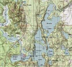 A topographic map of the Corner-Straits Chain area showing Ostrander Lake | |
| Location | Alger, Schoolcraft, and Delta counties |
| Coordinates | 46°10′00″N 86°36′46″W / 46.16667°N 86.61278°WCoordinates: 46°10′00″N 86°36′46″W / 46.16667°N 86.61278°W |
| Basin countries | United States |
| Surface area | 54.2 acres (21.9 ha)[1] |
| Shore length1 | about 1.4 miles (2.3 km)[1] |
| Surface elevation | 761 ft (232 m)[2] |
| 1 Shore length is not a well-defined measure. | |

Ostrander Lake
Ostrander Lake is a 54.2-acre (21.9 ha) lake that is located near the tri-county corner of Delta County, Michigan, Alger and Schoolcraft countries in the Hiawatha National Forest.[1] The chain consists of Skeels Lake, Corner Lake, Deep Lake, and Straits Lake. Other nearby lakes include Hugaboom Lake, Blue Lake, Ironjaw Lake, the Corner-Straits Chain of lakes, Toms Lake and Round Lake.
See also
References
- 1 2 3 "OSTRANDER_LAKE_LYMAN_LAKE.PDF" (PDF). U.S.D.A. Forest Service and the Michigan DNR. Retrieved 2008-12-07.
- ↑ U.S. Geological Survey Geographic Names Information System: Ostrander Lake (Michigan)
This article is issued from Wikipedia - version of the 7/24/2016. The text is available under the Creative Commons Attribution/Share Alike but additional terms may apply for the media files.