Nxai Pan National Park
| Nxai Pan National Park | |
|---|---|
|
IUCN category II (national park) | |
|
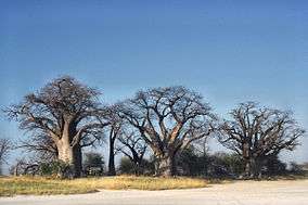
Baines Baobabs, Nxai Pan National Park, Botswana | |
| Location | Botswana |
| Coordinates | 20°02′30″S 24°46′08″E / 20.0416666667°S 24.7688888889°ECoordinates: 20°02′30″S 24°46′08″E / 20.0416666667°S 24.7688888889°E |
| Area | 2578 km² |
| Established | 1992 |
Nxai Pan National Park is a national park in north-eastern Botswana, consisting of Nxai Pan, which is one of the Makgadikgadi Pan salt flats. Nxai Pan National Park lies just north of the Maun-Nata main road and adjoins the Makgadikgadi Pans National Park on its northern border. The pan itself is a fossil lakebed about 40 square km in size.[1]
Notes
This park is considered for inclusion in the 5 Nation Kavango - Zambezi Transfrontier Conservation Area.
References
- ↑ "Botswana Travel Guide to Nxai Pan". Siyabona Africa. Retrieved 19 September 2014.
External links
| Wikimedia Commons has media related to Nxai Pan National Park. |
This article is issued from Wikipedia - version of the 12/28/2015. The text is available under the Creative Commons Attribution/Share Alike but additional terms may apply for the media files.
