Norton Parish, New Brunswick
| Norton | |
|---|---|
| Parish | |
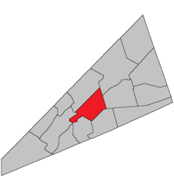 Location within Kings County, New Brunswick. | |
| Coordinates: 45°50′N 64°35′W / 45.84°N 64.59°W | |
| Country |
|
| Province |
|
| County | Queens County |
| Established | 1795 |
| Area[1] | |
| • Land | 144.62 km2 (55.84 sq mi) |
| Population (2011)[1] | |
| • Total | 1,296 |
| • Density | 9.0/km2 (23/sq mi) |
| • Pop 2006-2011 |
|
| • Dwellings | 502 |
| Time zone | AST (UTC-4) |
| • Summer (DST) | ADT (UTC-3) |
Norton is a Canadian parish in Kings County, New Brunswick.
History
Norton Parish was created in 1795 from Sussex Parish and Kingston Parish: possibly named for Norton, near Taunton, in southern Massachusetts, which was the original home of many of the first settlers to this area.
Delineation
Norton Parish is defined in the Territorial Division Act[2] as being bounded:
- East by Sussex and Studholm Parishes; north by Kingston and Springfield Parishes; south by the Kennebecasis River and the centre of the old Westmorland Road,[lower-alpha 1] and west by Kingston Parish and the lower line of lot number fourteen, granted to John Fritch, prolonged southeasterly.
Communities
Parish population total does not include incorporated municipalities (in bold):
|
|
Bodies of water & Islands
This is a list of rivers, lakes, streams, creeks, marshes and Islands that are at least partially in this parish
- None
Demographics
PopulationPopulation trend[4]
|
LanguageMother tongue language (2006)[5]
|
Access Routes
Highways and numbered routes that run through the parish, including external routes that start or finish at the parish limits:[6]
|
|
See also
Footnotes
References
- 1 2 2011 Statistics Canada Census Profile: Norton Parish, New Brunswick
- ↑ "Territorial Division Act (R.S.N.B. 1973, c. T-3)". Government of New Brunswick website. Retrieved 24 August 2016.
- ↑ "No. 447" (PDF). 2015 Designated Highway Maps. Government of New Brunswick. Retrieved 24 August 2016.
- ↑ Statistics Canada: 2001, 2006 census
- ↑ Profile: Norton Parish, New Brunswick
- ↑ Atlantic Canada Back Road Atlas ISBN 978-1-55368-618-7
 |
Springfield Parish | Studholm Parish | | |
| Kingston Parish | |
Sussex Parish | ||
| ||||
| | ||||
| Hampton Parish | Upham Parish |
| Subdivisions | |
|---|---|
| Cities | |
| Counties | |
| |
Coordinates: 45°36′26″N 65°42′53″W / 45.607193°N 65.714808°W