Non Din Daeng District
| Non Din Daeng โนนดินแดง | |
|---|---|
| Amphoe | |
|
Prasat Nong Hong | |
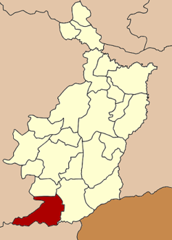 Amphoe location in Buriram Province | |
| Coordinates: 14°18′57″N 102°44′37″E / 14.31583°N 102.74361°ECoordinates: 14°18′57″N 102°44′37″E / 14.31583°N 102.74361°E | |
| Country | Thailand |
| Province | Buriram |
| Seat | Non Din Daeng |
| Area | |
| • Total | 448.0 km2 (173.0 sq mi) |
| Population (2005) | |
| • Total | 26,073 |
| • Density | 58.2/km2 (151/sq mi) |
| Time zone | ICT (UTC+7) |
| Postal code | 31260 |
| Geocode | 3120 |

Non Din Daeng (Thai: โนนดินแดง, pronounced [nōːn dīn dɛ̄ːŋ]) is the southwesternmost district (amphoe) of Buriram Province, northeastern Thailand.
Geography
Neighboring districts are (from the north clockwise) Pakham, Lahan Sai of Buriram Province, Ta Phraya, Watthana Nakhon of Sa Kaeo Province and Soeng Sang of Nakhon Ratchasima Province.
The Sankamphaeng Range mountainous area is in the southern section of this district.
History
The minor district (king amphoe) Non Din Daeng was created on 31 May 1993, when three tambon were split off from Lahan Sai district.[1] It was upgraded to a full district on December 5, 1996.[2]
Administration
The district is divided into three sub-districts (tambon), which are further subdivided into 45 villages (muban). Non Din Daeng is a township (thesaban tambon) which covers parts of tambon Non Din Daeng and Sompoi. There are also three tambon administrative organizations (TAO).
| No. | Name | Thai name | Villages | Pop. | |
|---|---|---|---|---|---|
| 1. | Non Din Daeng | โนนดินแดง | 25 | 11,991 | |
| 2. | Som Poi | ส้มป่อย | 7 | 4,393 | |
| 3. | Lam Nang Rong | ลำนางรอง | 13 | 9,689 |
References
- ↑ ประกาศกระทรวงมหาดไทย เรื่อง แบ่งเขตท้องที่อำเภอละหานทราย จังหวัดบุรีรัมย์ ตั้งเป็นกิ่งอำเภอโนนดินแดง (PDF). Royal Gazette (in Thai). 110 (74 ง): 20. June 8, 1993.
- ↑ พระราชกฤษฎีกาตั้งอำเภอเหนือคลอง อำเภอนายายอาม อำเภอท่าตะเกียบ อำเภอขุนตาล อำเภอแม่ฟ้าหลวง อำเภอแม่ลาว อำเภอรัษฎา อำเภอพุทธมณฑล อำเภอวังน้ำเขียว อำเภอเจาะไอร้อง อำเภอชำนิ อำเภอโนนดินแดง อำเภอปางมะผ้า อำเภอสนธิ อำเภอหนองม่วง อำเภอเบญจลักษ์ อำเภอโพนนาแก้ว อำเภอบุ่งคล้า อำเภอดอนมดแดง และอำเภอลืออำนาจ พ.ศ. ๒๕๓๙ (PDF). Royal Gazette (in Thai). 113 (62 ก): 5–8. November 20, 1996.