Nina Urqu
| Nina Urqu | |
|---|---|
 Nina Urqu Location in Bolivia | |
| Highest point | |
| Elevation | 4,742 m (15,558 ft) [1] |
| Coordinates | 21°53′18″S 66°34′27″W / 21.88833°S 66.57417°WCoordinates: 21°53′18″S 66°34′27″W / 21.88833°S 66.57417°W |
| Geography | |
| Location | Bolivia, Potosí Department, Sud Lípez Province |
| Parent range | Andes |
Nina Urqu (Quechua nina fire, urqu mountain,[2] "fire mountain", also spelled Nina Orkho) is a 4,742-metre (15,558 ft) high mountain in the Andes of Bolivia. It is situated in the Potosí Department, Sud Lípez Province, in the north of the Esmoruco Municipality, south-west of Guadalupe. Nina Urqu lies south-east of the mountains P'aqu Urqu, Waqrayuq and Muruq'u.[1][3]
References
- 1 2 BIGM map 1:50,000 San Pablo de Lípez 6228-I
- ↑ Teofilo Laime Ajacopa, Diccionario Bilingüe Iskay simipi yuyayk'ancha, La Paz, 2007 (Quechua-Spanish dictionary)
- ↑ "San Antonio de Esmoruco". ine.gob.bo. Retrieved September 6, 2014. (unnamed)
Capital: Potosí | ||
| Provinces | 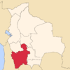 | |
| Municipalities (and seats) |
| |
This article is issued from Wikipedia - version of the 12/6/2015. The text is available under the Creative Commons Attribution/Share Alike but additional terms may apply for the media files.