Nagashima, Kagoshima
| Nagashima 長島町 | ||
|---|---|---|
| Town | ||
| ||
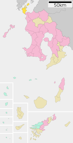
 Location of Nagashima in Kagoshima Prefecture | ||
 Nagashima Location in Japan | ||
| Coordinates: 32°9′43″N 130°9′15″E / 32.16194°N 130.15417°ECoordinates: 32°9′43″N 130°9′15″E / 32.16194°N 130.15417°E | ||
| Country | Japan | |
| Region | Kyushu | |
| Prefecture | Kagoshima Prefecture | |
| District | Izumi | |
| Area | ||
| • Total | 116.13 km2 (44.84 sq mi) | |
| Population (2003) | ||
| • Total | 12,173 | |
| • Density | 100/km2 (270/sq mi) | |
| Time zone | Japan Standard Time (UTC+9) | |
| Website |
www | |
Nagashima (長島町 Nagashima-chō) is a town located in Izumi District, Kagoshima Prefecture, Japan.
Demography
On March 20, 2006 the town of Azuma, from Izumi District, was merged into Nagashima.
As of this merger (but with 2003 population statistics), the town has an estimated population of 12,173 and a density of 105 persons per km². The total area is 116.13 km².
Geography
Nagashima is a small island located just south of Amakusa and connected to mainland Kyūshū via the Kuronoseto bridge. It is primarily a farming and fishing community.
Economy
Nagashima's chief exports are satsumaimo (sweet potatoes), shōchū, and buri (yellowtail). Some of Kagoshima's most well known shōchū is distilled in Nagashima. Such brands include Shimabijin (Beautiful Islander), Shimaotome (Island maiden), Shimamusume (Island Daughter), and DanDan ("thank you" in Kagoshima dialect).
Attractions
- Gyōnindake (traveler's mountain) offers a spectacular view of Amakusa and some of the smaller islands around Nagashima.
- Hotel Nagashima has an Onsen center as well as fine dining.
- A Jōmon era tomb which celebrates an annual festival
Transportation
Nagashima is accessible by car (via the Kuronoseto bride from Izumi District) or by Ferry from Amakusa or Kumamoto.
External links
 Media related to Nagashima, Kagoshima at Wikimedia Commons
- Nagashima official website (Japanese)