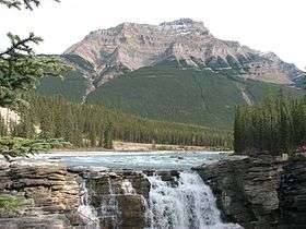
Mount Kerkeslin
| Mount Kerkeslin | |
|---|---|
 Mount Kerkeslin seen from Athabasca Falls | |
| Highest point | |
| Elevation | 2,956 m (9,698 ft) |
| Prominence | 730 m (2,400 ft) |
| Coordinates | 52°38′56″N 117°49′36″W / 52.64889°N 117.82665°WCoordinates: 52°38′56″N 117°49′36″W / 52.64889°N 117.82665°W [1] |
| Geography | |
 Mount Kerkeslin Mount Kerkeslin in Alberta | |
| Location | Alberta |
| Parent range | Maligne Range |
| Topo map | NTS 83C/13 |
Mount Kerkeslin is a peak in the Canadian Rockies in Alberta, Canada. It is the highest peak of the Maligne Range.
It is located in the nsouth parts of the Maligne Range, east of the Icefields Parkway and is visible from the Athabasca Falls lookout.
The peak reaches an altitude of 2,956 m (9,698 ft).[2]
See also
References
- ↑ Bivuac. "Mount Kerkeslin". Retrieved 2010-01-09.
- ↑ Peak Finder. "Mount Kerkeslin". Retrieved 2010-01-09.
This article is issued from Wikipedia - version of the 6/30/2016. The text is available under the Creative Commons Attribution/Share Alike but additional terms may apply for the media files.